

- Forecast
- Maps
- Live
- Weather State
- Spot Information
Boners Surf Forecast
/ CAL – San Luis Obispo (23 breaks) / California (404 breaks) /
Surf Forecasts
Boners surfForecast / CAL – San Luis Obispo / USA
Forecast update in hr min s Forecast update imminent
Boners surf forecast is for near shore open water. Breaking waves will often be smaller at less exposed spots.
Today's Boners sea temperature is
11.4° C
(Which is 1.8°C colder than average for this time of year)How big are the waves at Boners today?
The current surf forecast for Boners at 10PM is: 1.1m 11s primary swell from a West-northwest direction and 0.8m 15s secondary swell from a South-southwest direction (forecast issued at 04:00pm May 07). The wind direction is predicted to be cross-shore.
| Time (PDT) & Date | Wave Height | Wave Period |
|---|---|---|
| Morning (07 May) | - | - |
| Afternoon (07 May) | 3ft (0.9m) | 18s |
| Evening (07 May) | 3.5ft (1.1m) | 11s |
Table - waves today at Boners. (Swell directed towards the surf break)
Updates in hr min s Forecast update imminent
Wednesday 07 | Thursday 08 | Friday 09 | Saturday 10 | Sunday 11 | Monday 12 | Tuesday 13 | Wednesday 14 | |||||||||||||||||||||||||||||||||||||||||||||||||||||
| 2 PM | 5 PM | 8 PM | 11 PM | 2 AM | 5 AM | 8 AM | 11 AM | 2 PM | 5 PM | 8 PM | 11 PM | 2 AM | 5 AM | 8 AM | 11 AM | 2 PM | 5 PM | 8 PM | 11 PM | 2 AM | 5 AM | 8 AM | 11 AM | 2 PM | 5 PM | 8 PM | 11 PM | 2 AM | 5 AM | 8 AM | 11 AM | 2 PM | 5 PM | 8 PM | 11 PM | 2 AM | 5 AM | 8 AM | 11 AM | 2 PM | 5 PM | 8 PM | 11 PM | 2 AM | 5 AM | 8 AM | 11 AM | 2 PM | 5 PM | 8 PM | 11 PM | 2 AM | 5 AM | 8 AM | 11 AM | 2 PM | 5 PM | 8 PM | 11 PM | |
Rating (10 max) | ||||||||||||||||||||||||||||||||||||||||||||||||||||||||||||
Swell Height Map |  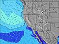  |    |    |  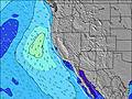 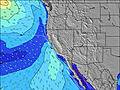 |  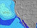 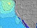 |  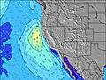 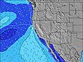 |  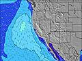 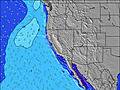 |  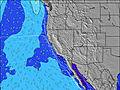 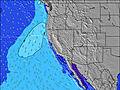 | ||||||||||||||||||||||||||||||||||||||||||||||||||||
| Wave Height (m) & direction (?) | ||||||||||||||||||||||||||||||||||||||||||||||||||||||||||||
| Period(s) (?) | 18 | 18 | 12 | 11 | 11 | 13 | 13 | 13 | 13 | 12 | 12 | 12 | 16 | 15 | 12 | 15 | 15 | 19 | 19 | 7 | 7 | 7 | 18 | 18 | 18 | 7 | 7 | 8 | 8 | 8 | 8 | 8 | 7 | 8 | 7 | 7 | 7 | 7 | 7 | 18 | 6 | 6 | 6 | 6 | 16 | 7 | 8 | 9 | 9 | 10 | 9 | 9 | 9 | 9 | 9 | 9 | 9 | 9 | 9 | 8 |
Wave (?)Graph | ||||||||||||||||||||||||||||||||||||||||||||||||||||||||||||
| Energy (?) | 491 | 448 | 324 | 222 | 222 | 178 | 484 | 351 | 504 | 808 | 517 | 299 | 280 | 252 | 215 | 223 | 215 | 273 | 369 | 251 | 303 | 266 | 307 | 399 | 304 | 286 | 397 | 774 | 780 | 819 | 857 | 300 | 559 | 874 | 701 | 384 | 582 | 355 | 314 | 154 | 283 | 266 | 178 | 193 | 177 | 315 | 353 | 358 | 710 | 1175 | 1117 | 1279 | 528 | 475 | 794 | 378 | 490 | 531 | 469 | 519 |
Wind (km/h) | ||||||||||||||||||||||||||||||||||||||||||||||||||||||||||||
| Wind State (?) onshore cross-onshore cross-shore cross-offshore offshore glassy | cross- on | cross- on | cross | cross | glass | glass | glass | cross- on | cross- on | cross- on | cross | glass | glass | cross- off | cross- off | cross | cross | cross | cross | cross- off | cross- off | cross- off | cross- off | cross | cross | cross | cross | cross | cross- off | cross- off | cross- off | cross | cross | cross | cross | cross | cross- off | cross- off | cross- off | cross | cross | cross | cross | cross | cross- off | cross- off | glass | cross | cross | cross | cross | cross- off | cross- off | cross- off | cross | cross | cross | cross | cross | cross |
High Tide / height (m) | 8:23PM 1.43 | 8:33AM 1.11 | 8:44PM 1.49 | 9:23AM 1.08 | 9:05PM 1.55 | 10:10AM 1.06 | 9:26PM 1.60 | 10:55AM 1.05 | 9:49PM 1.64 | 11:41AM 1.03 | 10:15PM 1.66 | 12:29PM 1.01 | 10:44PM 1.65 | 1:20PM 0.99 | ||||||||||||||||||||||||||||||||||||||||||||||
Low Tide / height (m) | 1:49PM 0.20 | 2:47AM 0.29 | 2:19PM 0.32 | 3:24AM 0.16 | 2:45PM 0.44 | 3:59AM 0.04 | 3:09PM 0.55 | 4:33AM -0.05 | 3:33PM 0.64 | 5:07AM -0.12 | 3:57PM 0.73 | 5:43AM -0.15 | 4:23PM 0.79 | 6:22AM -0.16 | 4:50PM 0.84 | |||||||||||||||||||||||||||||||||||||||||||||
Wednesday 07 | Thursday 08 | Friday 09 | Saturday 10 | Sunday 11 | Monday 12 | Tuesday 13 | Wednesday 14 | |||||||||||||||||||||||||||||||||||||||||||||||||||||
| Sunrise | - | - | - | - | - | - | 6:05 | - | - | - | - | - | - | - | 6:05 | - | - | - | - | - | - | - | 6:03 | - | - | - | - | - | - | - | 6:03 | - | - | - | - | - | - | - | 6:01 | - | - | - | - | - | - | - | 6:01 | - | - | - | - | - | - | - | 6:00 | - | - | - | - | - |
| Sunset | - | 7:54 | - | - | - | - | - | - | - | 7:55 | - | - | - | - | - | - | - | 7:57 | - | - | - | - | - | - | - | 7:58 | - | - | - | - | - | - | - | 7:59 | - | - | - | - | - | - | - | 7:59 | - | - | - | - | - | - | - | - | 8:00 | - | - | - | - | - | - | - | 8:00 | - |
Rain (mm) | - | - | - | - | - | - | - | - | - | - | - | - | - | - | - | - | - | - | - | - | - | - | - | - | - | - | - | - | - | - | - | - | - | - | - | - | - | - | - | - | - | - | - | - | - | - | - | - | - | - | - | - | - | - | - | - | - | - | - | - |
| Temp. °C | 16 | 17 | 13 | 13 | 13 | 13 | 16 | 19 | 20 | 20 | 16 | 16 | 16 | 17 | 20 | 24 | 26 | 24 | 21 | 20 | 18 | 19 | 21 | 24 | 24 | 23 | 19 | 16 | 16 | 15 | 16 | 19 | 19 | 17 | 13 | 10 | 10 | 9 | 11 | 14 | 15 | 14 | 12 | 11 | 10 | 9 | 11 | 14 | 15 | 15 | 12 | 12 | 11 | 10 | 12 | 15 | 15 | 14 | 12 | 12 |
| Feels °C (?) | 15 | 16 | 11 | 12 | 12 | 12 | 16 | 18 | 18 | 17 | 15 | 16 | 15 | 15 | 18 | 22 | 22 | 20 | 18 | 18 | 15 | 16 | 18 | 21 | 21 | 19 | 16 | 13 | 13 | 11 | 13 | 15 | 14 | 10 | 7 | 5 | 6 | 6 | 8 | 9 | 9 | 8 | 7 | 8 | 6 | 7 | 10 | 11 | 11 | 10 | 7 | 9 | 8 | 7 | 10 | 12 | 10 | 9 | 7 | 9 |
- Map Icons:
 Break
Break Live Wave Height (m)
 Live Wind Speed (km/h)
 Surf Rating (10 Max)
 Ocean Swells (m)
- Wind Speed (km/h)
FREE! Surf-Forecast.com widget for your website
The surf report / weather widget below is available to embed on third party websites free of charge and provides a summary of our Boners surf forecast. Simply grab the html code snippet that we provide and paste it into your own site. You can choose your preferred language and metric/imperial units for the surf forecast feed to suit users of your site. Click here to get the code.


 Nearest