

- Forecast
- Maps
- Live
- Weather State
- Spot Information

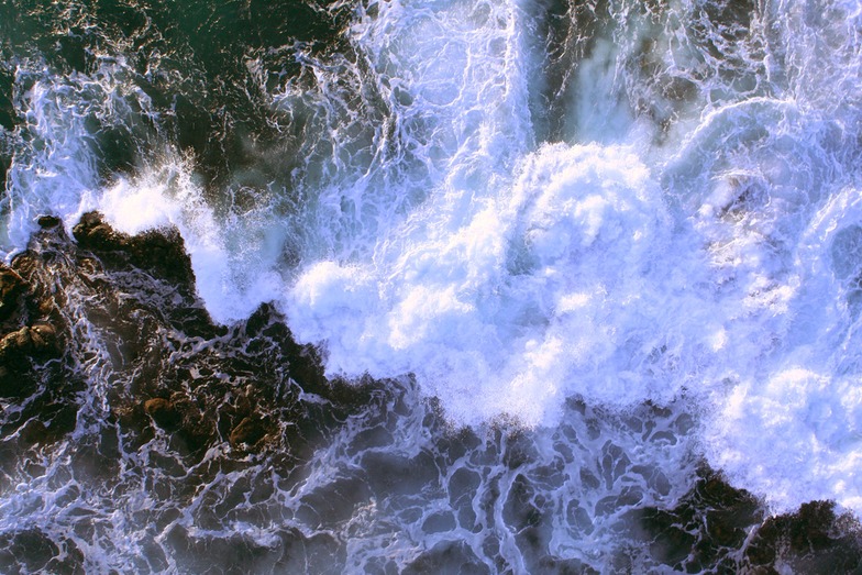
Hookipa surfForecast / HAW – Maui / USA
How big are the waves at Hookipa today?
The current surf forecast for Hookipa at 11AM is: 2.2m 8s primary swell from a East-northeast direction and 0.4m 11s secondary swell from a Northwest direction, 0.1m 18s secondary swell from a Northwest direction (forecast issued at 07:00am April 12). The wind direction is predicted to be cross-shore.
| Time (HST) & Date | Wave Height | Wave Period |
|---|---|---|
| Morning (12 Apr) | 7ft (2.2m) | 8s |
| Afternoon (12 Apr) | 7ft (2.2m) | 8s |
| Evening (12 Apr) | 7ft (2.2m) | 8s |
Table - waves today at Hookipa. (Swell directed towards the surf break)
Saturday 12 | Sunday 13 | Monday 14 | Tuesday 15 | Wednesday 16 | Thursday 17 | Friday 18 | Saturday 19 | |||||||||||||||||||||||||||||||||||||||||||||||||||||
| 5 AM | 8 AM | 11 AM | 2 PM | 5 PM | 8 PM | 11 PM | 2 AM | 5 AM | 8 AM | 11 AM | 2 PM | 5 PM | 8 PM | 11 PM | 2 AM | 5 AM | 8 AM | 11 AM | 2 PM | 5 PM | 8 PM | 11 PM | 2 AM | 5 AM | 8 AM | 11 AM | 2 PM | 5 PM | 8 PM | 11 PM | 2 AM | 5 AM | 8 AM | 11 AM | 2 PM | 5 PM | 8 PM | 11 PM | 2 AM | 5 AM | 8 AM | 11 AM | 2 PM | 5 PM | 8 PM | 11 PM | 2 AM | 5 AM | 8 AM | 11 AM | 2 PM | 5 PM | 8 PM | 11 PM | 2 AM | 5 AM | 8 AM | 11 AM | 2 PM | |
Rating (10 max) | ||||||||||||||||||||||||||||||||||||||||||||||||||||||||||||
Swell Height Map |    |    |    |  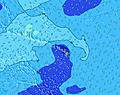 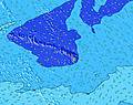 |  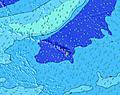 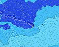 |  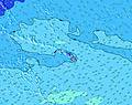 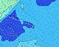 |  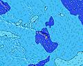 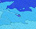 | 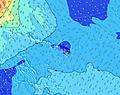 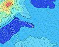 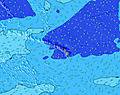 | ||||||||||||||||||||||||||||||||||||||||||||||||||||
| Wave Height (m) & direction (?) | ||||||||||||||||||||||||||||||||||||||||||||||||||||||||||||
| Period(s) (?) | 8 | 8 | 8 | 8 | 8 | 8 | 8 | 8 | 8 | 8 | 8 | 8 | 8 | 8 | 8 | 8 | 8 | 8 | 8 | 8 | 14 | 14 | 8 | 8 | 13 | 12 | 12 | 8 | 8 | 12 | 8 | 8 | 8 | 8 | 8 | 8 | 8 | 8 | 8 | 8 | 8 | 8 | 8 | 8 | 12 | 15 | 15 | 14 | 14 | 15 | 15 | 15 | 14 | 14 | 14 | 14 | 14 | 14 | 14 | 13 |
Wave (?)Graph | ||||||||||||||||||||||||||||||||||||||||||||||||||||||||||||
| Energy (?) | 597 | 627 | 650 | 650 | 650 | 682 | 646 | 592 | 497 | 460 | 352 | 402 | 359 | 224 | 175 | 341 | 377 | 216 | 453 | 442 | 536 | 507 | 451 | 437 | 369 | 335 | 240 | 346 | 310 | 167 | 153 | 130 | 123 | 114 | 149 | 338 | 190 | 291 | 253 | 241 | 239 | 201 | 172 | 177 | 184 | 259 | 897 | 902 | 1337 | 1693 | 1622 | 1622 | 1455 | 1374 | 1355 | 1206 | 1122 | 961 | 933 | 880 |
Wind (km/h) | ||||||||||||||||||||||||||||||||||||||||||||||||||||||||||||
| Wind State (?) onshore cross-onshore cross-shore cross-offshore offshore glassy | cross- off | cross- off | cross | cross | cross | cross | cross | cross | cross | cross | cross | cross | cross | cross | cross | cross | cross | cross | cross | cross | cross | cross | cross | cross- off | cross- off | cross | cross | cross | cross | cross | cross- off | cross- off | cross- off | cross- off | cross | cross | cross- off | cross- off | cross- off | cross- off | cross- off | cross- off | cross | cross- off | cross | cross | cross- off | glass | glass | glass | cross | cross | cross | cross | cross | cross | cross | cross | cross | cross- on |
High Tide / height (m) | 2:46PM 0.83 | 2:08AM 0.66 | 3:16PM 0.85 | 2:25AM 0.62 | 3:48PM 0.85 | 2:39AM 0.58 | 4:22PM 0.84 | 2:49AM 0.55 | 5:01PM 0.81 | 2:51AM 0.53 | 5:51PM 0.77 | 2:17AM 0.51 | 7:01PM 0.75 | |||||||||||||||||||||||||||||||||||||||||||||||
Low Tide / height (m) | 8:06AM 0.13 | 8:51PM 0.33 | 8:24AM 0.11 | 9:26PM 0.36 | 8:43AM 0.10 | 10:02PM 0.39 | 9:04AM 0.09 | 10:41PM 0.43 | 9:27AM 0.10 | 11:29PM 0.47 | 9:53AM 0.12 | 1:08AM 0.51 | 10:24AM 0.15 | 11:04AM 0.19 | ||||||||||||||||||||||||||||||||||||||||||||||
Saturday 12 | Sunday 13 | Monday 14 | Tuesday 15 | Wednesday 16 | Thursday 17 | Friday 18 | Saturday 19 | |||||||||||||||||||||||||||||||||||||||||||||||||||||
| Sunrise | - | 6:09 | - | - | - | - | - | - | - | 6:07 | - | - | - | - | - | - | - | 6:07 | - | - | - | - | - | - | - | 6:05 | - | - | - | - | - | - | - | 6:05 | - | - | - | - | - | - | - | 6:05 | - | - | - | - | - | - | - | 6:03 | - | - | - | - | - | - | - | 6:03 | - | - |
| Sunset | - | - | - | - | 6:43 | - | - | - | - | - | - | - | 6:43 | - | - | - | - | - | - | - | 6:44 | - | - | - | - | - | - | - | 6:44 | - | - | - | - | - | - | - | 6:44 | - | - | - | - | - | - | - | 6:45 | - | - | - | - | - | - | - | 6:45 | - | - | - | - | - | - | - |
Rain (mm) | - | - | - | - | - | - | - | - | - | - | - | - | - | - | - | - | - | - | - | - | - | - | - | - | - | - | - | - | - | - | - | - | - | - | 1 | 2 | 2 | 1 | - | - | - | - | - | 1 | 1 | 1 | - | - | - | - | - | 2 | 2 | 2 | - | 1 | - | - | - | 1 |
| Temp. °C | 23 | 24 | 25 | 25 | 24 | 23 | 23 | 23 | 22 | 23 | 24 | 25 | 24 | 23 | 23 | 22 | 22 | 23 | 25 | 25 | 24 | 23 | 23 | 23 | 22 | 23 | 24 | 24 | 24 | 23 | 23 | 23 | 23 | 23 | 24 | 24 | 24 | 23 | 23 | 23 | 23 | 23 | 24 | 23 | 23 | 23 | 23 | 23 | 22 | 23 | 23 | 24 | 23 | 23 | 23 | 23 | 22 | 23 | 23 | 24 |
| Feels °C (?) | 22 | 23 | 23 | 23 | 22 | 22 | 22 | 22 | 21 | 21 | 23 | 23 | 22 | 21 | 22 | 21 | 21 | 21 | 23 | 22 | 22 | 22 | 22 | 22 | 21 | 22 | 23 | 23 | 23 | 23 | 24 | 24 | 24 | 24 | 24 | 24 | 24 | 24 | 25 | 25 | 25 | 25 | 26 | 24 | 24 | 24 | 25 | 25 | 24 | 25 | 24 | 25 | 23 | 24 | 24 | 24 | 23 | 24 | 24 | 25 |
- Map Icons:
 Break
Break Live Wave Height (m)
 Live Wind Speed (km/h)
 Surf Rating (10 Max)
 Ocean Swells (m)
- Wind Speed (km/h)
FREE! Surf-Forecast.com widget for your website
The surf report / weather widget below is available to embed on third party websites free of charge and provides a summary of our Hookipa surf forecast. Simply grab the html code snippet that we provide and paste it into your own site. You can choose your preferred language and metric/imperial units for the surf forecast feed to suit users of your site. Click here to get the code.


 Nearest