

- Forecast
- Maps
- Live
- Weather State
- Spot Information
Akahanga Surf Forecast
/ Easter Island (16 surf breaks) /
Surf Forecasts
Akahanga surfForecast / Easter Island / Chile
Forecast update in hr min s Forecast update imminent
Akahanga surf forecast is for near shore open water. Breaking waves will often be smaller at less exposed spots.
Today's Akahanga sea temperature is
25.7° C
(Which is 1.8°C warmer than normal for this time of year)How big are the waves at Akahanga today?
The current surf forecast for Akahanga at 10AM is: 2.1m 16s primary swell from a Southwest direction and 1.3m 10s secondary swell from a South-southeast direction (forecast issued at 05:00am April 19). The wind direction is predicted to be onshore and the swell rating is 2.
| Time (-06) & Date | Wave Height | Wave Period |
|---|---|---|
| Morning (19 Apr) | 7ft (2.2m) | 16s |
| Afternoon (19 Apr) | 6ft (1.9m) | 15s |
| Evening (19 Apr) | 5ft (1.6m) | 14s |
Table - waves today at Akahanga. (Swell directed towards the surf break)
Updates in hr min s Forecast update imminent
Saturday 19 | Sunday 20 | Monday 21 | Tuesday 22 | Wednesday 23 | Thursday 24 | Friday 25 | Saturday 26 | |||||||||||||||||||||||||||||||||||||||||||||||||||||
| 3 AM | 6 AM | 9 AM | 12 PM | 3 PM | 6 PM | 9 PM | 0 AM | 3 AM | 6 AM | 9 AM | 12 PM | 3 PM | 6 PM | 9 PM | 0 AM | 3 AM | 6 AM | 9 AM | 12 PM | 3 PM | 6 PM | 9 PM | 0 AM | 3 AM | 6 AM | 9 AM | 12 PM | 3 PM | 6 PM | 9 PM | 0 AM | 3 AM | 6 AM | 9 AM | 12 PM | 3 PM | 6 PM | 9 PM | 0 AM | 3 AM | 6 AM | 9 AM | 12 PM | 3 PM | 6 PM | 9 PM | 0 AM | 3 AM | 6 AM | 9 AM | 12 PM | 3 PM | 6 PM | 9 PM | 0 AM | 3 AM | 6 AM | 9 AM | 12 PM | |
Rating (10 max) | ||||||||||||||||||||||||||||||||||||||||||||||||||||||||||||
Swell Height Map |  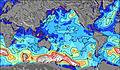 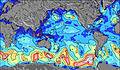 | 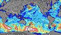 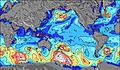  |    |    |  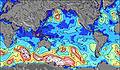 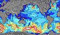 | 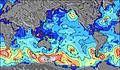 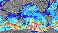 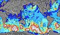 | 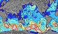 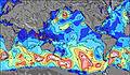 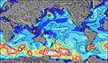 | 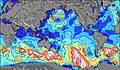 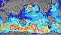 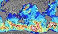 | ||||||||||||||||||||||||||||||||||||||||||||||||||||
| Wave Height (m) & direction (?) | ||||||||||||||||||||||||||||||||||||||||||||||||||||||||||||
| Period(s) (?) | 16 | 16 | 16 | 15 | 15 | 14 | 14 | 14 | 15 | 15 | 17 | 16 | 16 | 16 | 16 | 15 | 15 | 15 | 18 | 18 | 18 | 17 | 17 | 16 | 16 | 16 | 16 | 16 | 16 | 16 | 17 | 17 | 16 | 16 | 17 | 17 | 17 | 17 | 17 | 17 | 16 | 16 | 16 | 16 | 16 | 15 | 15 | 15 | 14 | 14 | 14 | 14 | 14 | 14 | 14 | 13 | 13 | 14 | 14 | 13 |
Wave (?)Graph | ||||||||||||||||||||||||||||||||||||||||||||||||||||||||||||
| Energy (?) | 2761 | 2545 | 2383 | 1860 | 1563 | 1307 | 1094 | 992 | 1421 | 1540 | 1605 | 1591 | 1664 | 1643 | 1602 | 1262 | 1246 | 1229 | 1490 | 3594 | 3513 | 3728 | 3559 | 3232 | 3504 | 3504 | 3693 | 3647 | 3253 | 3886 | 5337 | 5993 | 6587 | 7014 | 7534 | 7711 | 7628 | 7159 | 7508 | 6327 | 6694 | 6450 | 6290 | 5896 | 5450 | 4511 | 3745 | 3431 | 3071 | 3127 | 2553 | 2313 | 2031 | 1774 | 1647 | 947 | 780 | 769 | 665 | 722 |
Wind (km/h) | ||||||||||||||||||||||||||||||||||||||||||||||||||||||||||||
| Wind State (?) onshore cross-onshore cross-shore cross-offshore offshore glassy | on | on | on | on | on | on | on | cross- on | glass | glass | glass | glass | cross- off | glass | glass | glass | glass | glass | off | off | off | cross- off | cross- off | off | off | off | off | off | off | cross- off | cross- off | cross | cross- on | cross- on | cross- on | cross- on | cross- on | cross- on | on | on | on | on | on | on | on | on | cross- on | cross- on | cross- on | cross- on | cross- on | cross- on | cross- on | cross- on | cross- on | cross- on | cross- on | cross- on | cross- on | cross- on |
High Tide / height (m) | 12:19AM 0.55 | 12:06PM 0.80 | 12:40AM 0.57 | 12:34PM 0.81 | 1:03AM 0.60 | 1:03PM 0.82 | 1:29AM 0.63 | 1:34PM 0.81 | 2:01AM 0.67 | 2:10PM 0.79 | 2:40AM 0.70 | 2:51PM 0.74 | 3:27AM 0.73 | 3:39PM 0.68 | 4:25AM 0.74 | |||||||||||||||||||||||||||||||||||||||||||||
Low Tide / height (m) | 5:37AM 0.27 | 6:51PM 0.17 | 6:06AM 0.24 | 7:13PM 0.16 | 6:37AM 0.21 | 7:36PM 0.15 | 7:12AM 0.19 | 8:02PM 0.15 | 7:53AM 0.18 | 8:33PM 0.14 | 8:41AM 0.19 | 9:09PM 0.15 | 9:37AM 0.21 | 9:53PM 0.16 | 10:47AM 0.23 | |||||||||||||||||||||||||||||||||||||||||||||
Saturday 19 | Sunday 20 | Monday 21 | Tuesday 22 | Wednesday 23 | Thursday 24 | Friday 25 | Saturday 26 | |||||||||||||||||||||||||||||||||||||||||||||||||||||
| Sunrise | - | - | 7:35 | - | - | - | - | - | - | - | 7:35 | - | - | - | - | - | - | - | 7:37 | - | - | - | - | - | - | - | 7:37 | - | - | - | - | - | - | - | 7:37 | - | - | - | - | - | - | - | 7:37 | - | - | - | - | - | - | - | 7:39 | - | - | - | - | - | - | - | 7:39 | - |
| Sunset | - | - | - | - | - | 6:55 | - | - | - | - | - | - | - | 6:54 | - | - | - | - | - | - | - | 6:53 | - | - | - | - | - | - | - | 6:52 | - | - | - | - | - | - | - | 6:52 | - | - | - | - | - | - | - | 6:51 | - | - | - | - | - | - | - | 6:50 | - | - | - | - | - | - |
Rain (mm) | - | - | - | - | - | - | - | - | - | - | - | - | - | - | - | - | - | - | - | - | - | - | - | - | - | - | - | - | - | - | - | - | 1 | 1 | - | - | - | - | - | - | - | 1 | 1 | - | - | - | - | - | - | - | - | - | - | - | - | - | - | - | 1 | - |
| Temp. °C | 21 | 21 | 21 | 21 | 21 | 21 | 21 | 21 | 21 | 21 | 21 | 21 | 22 | 22 | 22 | 22 | 22 | 21 | 21 | 22 | 22 | 22 | 22 | 22 | 22 | 22 | 22 | 22 | 22 | 23 | 23 | 23 | 22 | 22 | 22 | 22 | 22 | 21 | 21 | 22 | 22 | 21 | 21 | 21 | 21 | 22 | 22 | 22 | 22 | 22 | 22 | 23 | 22 | 22 | 22 | 22 | 23 | 22 | 22 | 23 |
| Feels °C (?) | 20 | 20 | 20 | 21 | 21 | 21 | 21 | 21 | 22 | 22 | 22 | 22 | 22 | 23 | 23 | 23 | 23 | 22 | 21 | 22 | 22 | 22 | 23 | 23 | 22 | 22 | 22 | 21 | 21 | 23 | 24 | 25 | 21 | 21 | 20 | 19 | 18 | 16 | 17 | 18 | 17 | 16 | 14 | 14 | 14 | 15 | 15 | 16 | 17 | 17 | 16 | 18 | 17 | 17 | 17 | 17 | 19 | 18 | 18 | 18 |
- Map Icons:
 Break
Break Live Wave Height (m)
 Live Wind Speed (km/h)
 Surf Rating (10 Max)
 Ocean Swells (m)
- Wind Speed (km/h)
FREE! Surf-Forecast.com widget for your website
The surf report / weather widget below is available to embed on third party websites free of charge and provides a summary of our Akahanga surf forecast. Simply grab the html code snippet that we provide and paste it into your own site. You can choose your preferred language and metric/imperial units for the surf forecast feed to suit users of your site. Click here to get the code.


 Nearest