

- Forecast
- Maps
- Live
- Weather State
- Spot Information

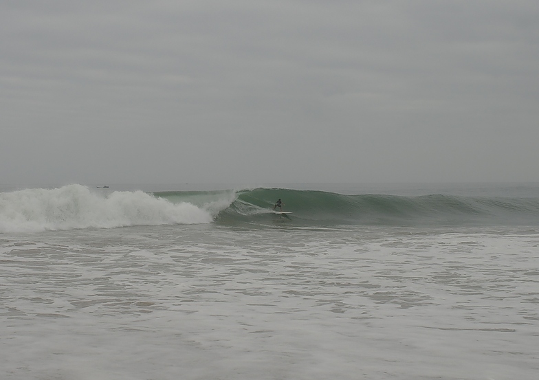
Buraco surfForecast / Luanda / Angola
How big are the waves at Buraco today?
The current surf forecast for Buraco at 3AM is: 0.9m 13s primary swell from a Southwest direction and 0.3m 18s secondary swell from a Southwest direction, 0.6m 7s secondary swell from a South-southwest direction (forecast issued at 12:00am April 19). The wind direction is predicted to be offshore.
| Time (WAT) & Date | Wave Height | Wave Period |
|---|---|---|
| Morning (19 Apr) | 3ft (0.9m) | 13s |
| Afternoon (19 Apr) | 2.5ft (0.7m) | 13s |
| Evening (19 Apr) | 2.5ft (0.8m) | 14s |
Table - waves today at Buraco. (Swell directed towards the surf break)
Saturday 19 | Sunday 20 | Monday 21 | Tuesday 22 | Wednesday 23 | Thursday 24 | Friday 25 | Saturday 26 | |||||||||||||||||||||||||||||||||||||||||||||||||||||
| 10 PM | 1 AM | 4 AM | 7 AM | 10 AM | 1 PM | 4 PM | 7 PM | 10 PM | 1 AM | 4 AM | 7 AM | 10 AM | 1 PM | 4 PM | 7 PM | 10 PM | 1 AM | 4 AM | 7 AM | 10 AM | 1 PM | 4 PM | 7 PM | 10 PM | 1 AM | 4 AM | 7 AM | 10 AM | 1 PM | 4 PM | 7 PM | 10 PM | 1 AM | 4 AM | 7 AM | 10 AM | 1 PM | 4 PM | 7 PM | 10 PM | 1 AM | 4 AM | 7 AM | 10 AM | 1 PM | 4 PM | 7 PM | 10 PM | 1 AM | 4 AM | 7 AM | 10 AM | 1 PM | 4 PM | 7 PM | 10 PM | 1 AM | 4 AM | 7 AM | |
Rating (10 max) | ||||||||||||||||||||||||||||||||||||||||||||||||||||||||||||
Swell Height Map | 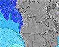 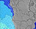 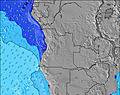 | 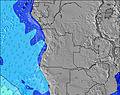 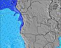 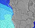 | 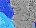   |   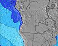 | 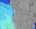 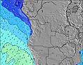 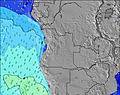 | 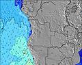 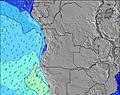 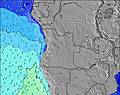 | 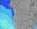 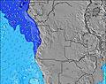 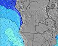 | 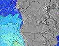 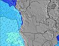 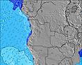 | 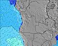 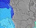 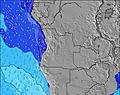 | |||||||||||||||||||||||||||||||||||||||||||||||||||
| Wave Height (m) & direction (?) | ||||||||||||||||||||||||||||||||||||||||||||||||||||||||||||
| Period(s) (?) | 13 | 13 | 13 | 13 | 13 | 13 | 12 | 12 | 14 | 14 | 14 | 14 | 13 | 13 | 13 | 13 | 13 | 13 | 16 | 16 | 15 | 15 | 15 | 15 | 14 | 14 | 14 | 13 | 13 | 13 | 13 | 13 | 13 | 12 | 12 | 12 | 12 | 12 | 12 | 7 | 7 | 11 | 11 | 11 | 11 | 10 | 10 | 10 | 10 | 10 | 10 | 10 | 10 | 10 | 9 | 9 | 9 | 9 | 10 | 10 |
Wave (?)Graph | ||||||||||||||||||||||||||||||||||||||||||||||||||||||||||||
| Energy (?) | 400 | 253 | 249 | 299 | 167 | 206 | 159 | 149 | 261 | 261 | 206 | 200 | 178 | 175 | 175 | 113 | 111 | 109 | 74 | 72 | 57 | 106 | 106 | 106 | 130 | 91 | 147 | 144 | 88 | 109 | 109 | 106 | 100 | 95 | 73 | 92 | 90 | 89 | 86 | 64 | 60 | 303 | 292 | 286 | 286 | 265 | 255 | 245 | 245 | 220 | 220 | 216 | 216 | 161 | 173 | 151 | 128 | 83 | 175 | 175 |
Wind (km/h) | ||||||||||||||||||||||||||||||||||||||||||||||||||||||||||||
| Wind State (?) onshore cross-onshore cross-shore cross-offshore offshore glassy | cross- off | off | off | off | off | cross- off | cross- off | cross- off | cross- off | cross- off | off | off | off | cross- off | cross | cross- off | cross- off | cross- off | off | cross- off | cross- off | cross | cross- off | cross- off | cross- off | cross- off | off | cross- off | cross- off | cross- off | cross- off | cross- off | cross- off | cross- off | off | off | cross- off | cross- off | cross- off | cross- off | cross- off | cross- off | cross- off | off | glass | cross | cross | cross- off | cross- off | off | off | off | cross- off | cross- off | cross- off | cross- off | cross- off | cross- off | cross- off | off |
High Tide / height (m) | 7:28AM 1.00 | 7:37PM 1.07 | 8:38AM 0.96 | 8:48PM 1.04 | 10:12AM 0.99 | 10:18PM 1.04 | 11:35AM 1.09 | 11:38PM 1.10 | 12:35PM 1.23 | 12:40AM 1.19 | 1:24PM 1.38 | 1:33AM 1.28 | 2:08PM 1.50 | 2:21AM 1.36 | ||||||||||||||||||||||||||||||||||||||||||||||
Low Tide / height (m) | 1:20AM 0.32 | 1:30PM 0.45 | 2:20AM 0.37 | 2:38PM 0.52 | 3:34AM 0.39 | 4:05PM 0.54 | 4:50AM 0.36 | 5:30PM 0.49 | 5:56AM 0.28 | 6:38PM 0.40 | 6:52AM 0.19 | 7:33PM 0.28 | 7:41AM 0.10 | 8:22PM 0.17 | ||||||||||||||||||||||||||||||||||||||||||||||
Saturday 19 | Sunday 20 | Monday 21 | Tuesday 22 | Wednesday 23 | Thursday 24 | Friday 25 | Saturday 26 | |||||||||||||||||||||||||||||||||||||||||||||||||||||
| Sunrise | - | - | - | 6:09 | - | - | - | - | - | - | - | 6:09 | - | - | - | - | - | - | - | 6:09 | - | - | - | - | - | - | - | 6:09 | - | - | - | - | - | - | - | 6:09 | - | - | - | - | - | - | - | 6:09 | - | - | - | - | - | - | - | 6:11 | - | - | - | - | - | - | - | 6:11 |
| Sunset | - | - | - | - | - | - | 6:02 | - | - | - | - | - | - | - | 6:01 | - | - | - | - | - | - | - | 6:01 | - | - | - | - | - | - | - | 6:01 | - | - | - | - | - | - | - | 6:00 | - | - | - | - | - | - | - | 6:00 | - | - | - | - | - | - | - | 6:00 | - | - | - | - | - |
Rain (mm) | - | - | - | - | - | - | - | - | - | - | - | - | - | - | 2 | 1 | - | 1 | 3 | - | - | - | - | - | - | - | - | - | - | - | - | - | - | - | - | - | - | - | - | - | - | - | - | - | - | - | - | - | - | - | - | - | - | - | - | - | - | - | - | - |
| Temp. °C | 26 | 26 | 26 | 25 | 27 | 26 | 26 | 26 | 26 | 25 | 25 | 25 | 26 | 26 | 26 | 26 | 26 | 25 | 25 | 25 | 25 | 26 | 26 | 26 | 26 | 26 | 25 | 25 | 26 | 26 | 26 | 26 | 26 | 25 | 25 | 25 | 26 | 25 | 26 | 26 | 26 | 25 | 25 | 25 | 26 | 26 | 26 | 26 | 25 | 25 | 25 | 24 | 26 | 25 | 26 | 26 | 26 | 25 | 25 | 25 |
| Feels °C (?) | 28 | 28 | 28 | 27 | 30 | 27 | 26 | 26 | 27 | 27 | 27 | 28 | 30 | 28 | 27 | 28 | 28 | 27 | 26 | 28 | 29 | 30 | 28 | 27 | 27 | 28 | 27 | 29 | 30 | 28 | 27 | 27 | 27 | 25 | 27 | 27 | 29 | 26 | 27 | 27 | 27 | 26 | 27 | 28 | 30 | 28 | 27 | 27 | 25 | 27 | 26 | 26 | 29 | 26 | 27 | 28 | 28 | 26 | 26 | 27 |
- Map Icons:
 Break
Break Live Wave Height (m)
 Live Wind Speed (km/h)
 Surf Rating (10 Max)
 Ocean Swells (m)
- Wind Speed (km/h)
FREE! Surf-Forecast.com widget for your website
The surf report / weather widget below is available to embed on third party websites free of charge and provides a summary of our Buraco surf forecast. Simply grab the html code snippet that we provide and paste it into your own site. You can choose your preferred language and metric/imperial units for the surf forecast feed to suit users of your site. Click here to get the code.


 Nearest