

- Forecast
- Maps
- Live
- Weather State
- Spot Information

Surf Forecasts
Buritaca surfForecast / Caribbean / Colombia
Forecast update in hr min s Forecast update imminent
Buritaca surf forecast is for near shore open water. Breaking waves will often be smaller at less exposed spots.
Today's Buritaca sea temperature is
27.3° C
(Which is slightly warmer than usual)How big are the waves at Buritaca today?
The current surf forecast for Buritaca at 12AM is: 2.1m 8s primary swell from a Northeast direction and 0.1m 8s secondary swell from a West direction (forecast issued at 06:00pm April 15). The wind direction is predicted to be cross-shore.
| Time (-05) & Date | Wave Height | Wave Period |
|---|---|---|
| Morning (16 Apr) | 5.5ft (1.7m) | 7s |
| Afternoon (16 Apr) | 5ft (1.6m) | 7s |
| Evening (16 Apr) | 6ft (1.9m) | 7s |
Table - waves today at Buritaca. (Swell directed towards the surf break)
Updates in hr min s Forecast update imminent
Tuesday 15 | Wednesday 16 | Thursday 17 | Friday 18 | Saturday 19 | Sunday 20 | Monday 21 | Tuesday 22 | Wed 23 | ||||||||||||||||||||||||||||||||||||||||||||||||||||
| 4 PM | 7 PM | 10 PM | 1 AM | 4 AM | 7 AM | 10 AM | 1 PM | 4 PM | 7 PM | 10 PM | 1 AM | 4 AM | 7 AM | 10 AM | 1 PM | 4 PM | 7 PM | 10 PM | 1 AM | 4 AM | 7 AM | 10 AM | 1 PM | 4 PM | 7 PM | 10 PM | 1 AM | 4 AM | 7 AM | 10 AM | 1 PM | 4 PM | 7 PM | 10 PM | 1 AM | 4 AM | 7 AM | 10 AM | 1 PM | 4 PM | 7 PM | 10 PM | 1 AM | 4 AM | 7 AM | 10 AM | 1 PM | 4 PM | 7 PM | 10 PM | 1 AM | 4 AM | 7 AM | 10 AM | 1 PM | 4 PM | 7 PM | 10 PM | 1 AM | |
Rating (10 max) | ||||||||||||||||||||||||||||||||||||||||||||||||||||||||||||
Swell Height Map | 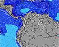 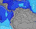 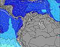 | 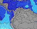 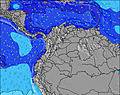 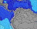 | 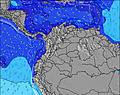 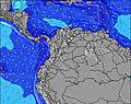 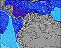 | 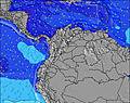 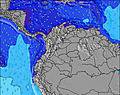 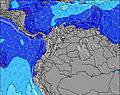 | 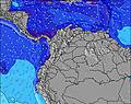 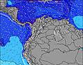 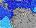 | 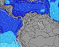 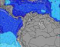 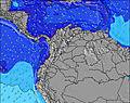 | 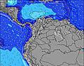 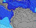 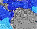 | 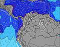 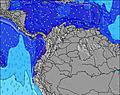 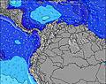 |    | |||||||||||||||||||||||||||||||||||||||||||||||||||
| Wave Height (m) & direction (?) | ||||||||||||||||||||||||||||||||||||||||||||||||||||||||||||
| Period(s) (?) | 7 | 7 | 8 | 8 | 8 | 8 | 7 | 7 | 7 | 7 | 8 | 7 | 7 | 7 | 7 | 7 | 6 | 7 | 7 | 7 | 7 | 7 | 6 | 6 | 6 | 7 | 8 | 7 | 7 | 7 | 8 | 8 | 8 | 8 | 8 | 8 | 8 | 8 | 8 | 8 | 8 | 8 | 8 | 8 | 8 | 8 | 8 | 8 | 8 | 7 | 7 | 7 | 7 | 7 | 8 | 8 | 8 | 8 | 7 | 7 |
Wave (?)Graph | ||||||||||||||||||||||||||||||||||||||||||||||||||||||||||||
| Energy (?) | 271 | 386 | 559 | 489 | 413 | 375 | 311 | 277 | 222 | 346 | 446 | 485 | 327 | 221 | 215 | 207 | 161 | 226 | 440 | 428 | 240 | 208 | 190 | 182 | 213 | 428 | 640 | 365 | 336 | 396 | 413 | 447 | 482 | 765 | 675 | 581 | 624 | 594 | 564 | 435 | 395 | 525 | 515 | 502 | 470 | 406 | 406 | 364 | 320 | 355 | 452 | 336 | 277 | 260 | 250 | 233 | 164 | 160 | 174 | 178 |
Wind (km/h) | ||||||||||||||||||||||||||||||||||||||||||||||||||||||||||||
| Wind State (?) onshore cross-onshore cross-shore cross-offshore offshore glassy | cross- on | cross | cross | cross | cross | cross | cross- on | cross- on | cross- on | cross | cross | cross | cross | cross | cross | cross- on | cross | cross | cross | cross | cross | cross | cross | cross- on | cross- off | cross- off | cross | cross | cross | cross | cross | cross- on | cross- on | cross- off | cross | cross | cross | cross | cross | glass | glass | off | cross | cross | cross | cross | cross- on | glass | cross | cross- off | off | cross- off | cross- off | cross- off | cross | cross- on | cross | cross | cross- off | cross- off |
High Tide / height (m) | 1:16AM 0.29 | 2:07AM 0.29 | 2:59AM 0.29 | 3:46AM 0.30 | 4:31AM 0.32 | 5:13AM 0.33 | 7:26PM 0.15 | 5:57AM 0.33 | 7:38PM 0.20 | |||||||||||||||||||||||||||||||||||||||||||||||||||
Low Tide / height (m) | 11:24AM 0.01 | 12:01PM 0.00 | 12:29PM 0.00 | 12:49PM 0.01 | 1:04PM 0.02 | 1:16PM 0.04 | 10:36PM 0.13 | 1:30PM 0.05 | 12:11AM 0.14 | |||||||||||||||||||||||||||||||||||||||||||||||||||
Tuesday 15 | Wednesday 16 | Thursday 17 | Friday 18 | Saturday 19 | Sunday 20 | Monday 21 | Tuesday 22 | Wed 23 | ||||||||||||||||||||||||||||||||||||||||||||||||||||
| Sunrise | - | - | - | - | - | 5:43 | - | - | - | - | - | - | - | 5:43 | - | - | - | - | - | - | - | 5:41 | - | - | - | - | - | - | - | 5:41 | - | - | - | - | - | - | - | 5:41 | - | - | - | - | - | - | - | 5:39 | - | - | - | - | - | - | - | 5:39 | - | - | - | - | - | - |
| Sunset | 6:06 | - | - | - | - | - | - | - | 6:06 | - | - | - | - | - | - | - | 6:06 | - | - | - | - | - | - | - | 6:06 | - | - | - | - | - | - | - | 6:06 | - | - | - | - | - | - | - | 6:06 | - | - | - | - | - | - | - | 6:06 | - | - | - | - | - | - | - | 6:06 | - | - | - |
Rain (mm) | - | - | - | - | - | - | - | - | - | 1 | - | 1 | - | - | - | - | - | - | - | 1 | - | - | - | - | 2 | 2 | - | 1 | 1 | 1 | - | 1 | 2 | 1 | - | - | 1 | 1 | - | - | 3 | 1 | - | 1 | 1 | - | - | 1 | 3 | 1 | - | - | - | - | - | 1 | 4 | 1 | - | - |
| Temp. °C | 28 | 26 | 27 | 26 | 25 | 26 | 28 | 28 | 27 | 26 | 26 | 26 | 26 | 26 | 27 | 28 | 27 | 26 | 26 | 26 | 26 | 26 | 27 | 28 | 28 | 27 | 27 | 26 | 26 | 26 | 28 | 29 | 29 | 28 | 27 | 26 | 26 | 26 | 27 | 28 | 28 | 28 | 27 | 26 | 25 | 26 | 27 | 27 | 27 | 26 | 26 | 26 | 25 | 25 | 27 | 27 | 27 | 26 | 26 | 26 |
| Feels °C (?) | 32 | 30 | 32 | 28 | 25 | 27 | 30 | 31 | 31 | 30 | 29 | 29 | 29 | 28 | 29 | 31 | 30 | 30 | 29 | 29 | 29 | 28 | 29 | 32 | 32 | 31 | 30 | 28 | 28 | 28 | 30 | 32 | 32 | 31 | 28 | 28 | 28 | 28 | 30 | 33 | 33 | 32 | 29 | 28 | 26 | 29 | 31 | 31 | 31 | 29 | 29 | 29 | 28 | 28 | 30 | 30 | 31 | 29 | 30 | 30 |
- Map Icons:
 Break
Break Live Wave Height (m)
 Live Wind Speed (km/h)
 Surf Rating (10 Max)
 Ocean Swells (m)
- Wind Speed (km/h)
FREE! Surf-Forecast.com widget for your website
The surf report / weather widget below is available to embed on third party websites free of charge and provides a summary of our Buritaca surf forecast. Simply grab the html code snippet that we provide and paste it into your own site. You can choose your preferred language and metric/imperial units for the surf forecast feed to suit users of your site. Click here to get the code.


 Nearest