

- Forecast
- Maps
- Live
- Weather State
- Spot Information
Moreton Island - Cape Moreton Surf Forecast
/ QLD – Brisbane (4 breaks) / Queensland (74 breaks) /
Moreton Island - Cape Moreton surfForecast / QLD – Brisbane / Australia
How big are the waves at Moreton Island - Cape Moreton today?
The current surf forecast for Moreton Island - Cape Moreton at 2AM is: 1.3m 10s primary swell from a East-southeast direction and 0.3m 10s secondary swell from a Southeast direction (forecast issued at 09:00pm April 26). The wind direction is predicted to be cross-offshore and the swell rating is 2.
| Time (AEST) & Date | Wave Height | Wave Period |
|---|---|---|
| Morning (27 Apr) | 4ft (1.2m) | 10s |
| Afternoon (27 Apr) | 4ft (1.2m) | 10s |
| Evening (27 Apr) | 3.5ft (1.1m) | 10s |
Table - waves today at Moreton Island - Cape Moreton. (Swell directed towards the surf break)
Sat 26 | Sunday 27 | Monday 28 | Tuesday 29 | Wednesday 30 | Thursday 01 | Friday 02 | Saturday 03 | Sun 04 | ||||||||||||||||||||||||||||||||||||||||||||||||||||
| 7 PM | 10 PM | 1 AM | 4 AM | 7 AM | 10 AM | 1 PM | 4 PM | 7 PM | 10 PM | 1 AM | 4 AM | 7 AM | 10 AM | 1 PM | 4 PM | 7 PM | 10 PM | 1 AM | 4 AM | 7 AM | 10 AM | 1 PM | 4 PM | 7 PM | 10 PM | 1 AM | 4 AM | 7 AM | 10 AM | 1 PM | 4 PM | 7 PM | 10 PM | 1 AM | 4 AM | 7 AM | 10 AM | 1 PM | 4 PM | 7 PM | 10 PM | 1 AM | 4 AM | 7 AM | 10 AM | 1 PM | 4 PM | 7 PM | 10 PM | 1 AM | 4 AM | 7 AM | 10 AM | 1 PM | 4 PM | 7 PM | 10 PM | 1 AM | 4 AM | |
Rating (10 max) | ||||||||||||||||||||||||||||||||||||||||||||||||||||||||||||
Swell Height Map |  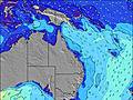 | 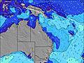 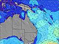 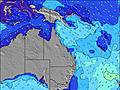 |    |    |    |  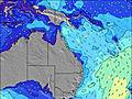 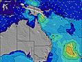 | 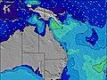 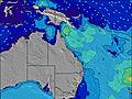 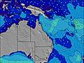 | 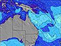 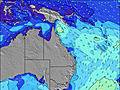 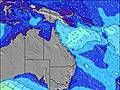 | 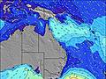 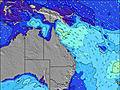 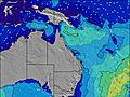 | |||||||||||||||||||||||||||||||||||||||||||||||||||
| Wave Height (m) & direction (?) | ||||||||||||||||||||||||||||||||||||||||||||||||||||||||||||
| Period(s) (?) | 10 | 8 | 10 | 10 | 10 | 10 | 10 | 11 | 10 | 10 | 10 | 10 | 11 | 11 | 11 | 11 | 11 | 11 | 9 | 10 | 9 | 9 | 9 | 10 | 8 | 7 | 10 | 10 | 10 | 10 | 10 | 10 | 10 | 10 | 6 | 7 | 8 | 8 | 8 | 8 | 8 | 7 | 7 | 7 | 7 | 7 | 7 | 7 | 7 | 7 | 7 | 9 | 10 | 6 | 10 | 10 | 10 | 6 | 10 | 11 |
Wave (?)Graph | ||||||||||||||||||||||||||||||||||||||||||||||||||||||||||||
| Energy (?) | 208 | 245 | 342 | 356 | 363 | 312 | 306 | 275 | 250 | 240 | 216 | 174 | 141 | 187 | 202 | 194 | 191 | 146 | 266 | 325 | 253 | 154 | 121 | 94 | 101 | 105 | 88 | 92 | 94 | 94 | 94 | 92 | 90 | 88 | 373 | 574 | 657 | 607 | 483 | 536 | 620 | 565 | 487 | 473 | 491 | 535 | 578 | 447 | 403 | 398 | 325 | 460 | 667 | 275 | 695 | 757 | 800 | 352 | 876 | 1015 |
Wind (km/h) | ||||||||||||||||||||||||||||||||||||||||||||||||||||||||||||
| Wind State (?) onshore cross-onshore cross-shore cross-offshore offshore glassy | glass | cross- off | cross- off | cross- off | cross- off | cross | glass | cross | on | cross- off | cross- off | cross- off | cross- off | cross- off | off | cross- off | cross | cross- off | cross- off | cross- off | off | off | cross- off | cross- off | cross- off | cross- off | cross- off | off | off | cross- off | glass | cross- on | glass | cross- off | cross- off | cross- off | cross- off | cross- off | cross- off | cross- off | cross- off | cross- off | cross- off | cross- off | cross- off | cross- off | cross- off | cross- off | cross- off | cross- off | cross- off | cross- off | cross- off | cross- off | cross- off | cross- off | cross- off | cross- off | cross- off | cross- off |
High Tide / height (m) | 7:03PM 1.75 | 7:10AM 1.58 | 7:48PM 1.89 | 7:56AM 1.47 | 8:34PM 1.97 | 8:43AM 1.34 | 9:22PM 1.97 | 9:32AM 1.20 | 10:13PM 1.92 | 10:26AM 1.07 | 11:08PM 1.82 | 11:28AM 0.96 | 12:08AM 1.71 | 12:42PM 0.90 | 1:14AM 1.61 | |||||||||||||||||||||||||||||||||||||||||||||
Low Tide / height (m) | 1:17AM 0.11 | 1:21PM -0.08 | 2:10AM 0.09 | 2:00PM -0.08 | 3:04AM 0.11 | 2:40PM -0.04 | 4:00AM 0.17 | 3:22PM 0.05 | 5:00AM 0.24 | 4:08PM 0.16 | 6:06AM 0.32 | 5:00PM 0.28 | 7:18AM 0.37 | 6:03PM 0.40 | ||||||||||||||||||||||||||||||||||||||||||||||
Sat 26 | Sunday 27 | Monday 28 | Tuesday 29 | Wednesday 30 | Thursday 01 | Friday 02 | Saturday 03 | Sun 04 | ||||||||||||||||||||||||||||||||||||||||||||||||||||
| Sunrise | - | - | - | - | 6:07 | - | - | - | - | - | - | - | 6:07 | - | - | - | - | - | - | - | 6:09 | - | - | - | - | - | - | - | 6:09 | - | - | - | - | - | - | - | 6:09 | - | - | - | - | - | - | - | 6:11 | - | - | - | - | - | - | - | 6:11 | - | - | - | - | - | - | - |
| Sunset | - | - | - | - | - | - | - | 5:19 | - | - | - | - | - | - | - | 5:17 | - | - | - | - | - | - | - | 5:16 | - | - | - | - | - | - | - | 5:15 | - | - | - | - | - | - | - | 5:15 | - | - | - | - | - | - | - | 5:15 | - | - | - | - | - | - | - | 5:14 | - | - | - | - |
Rain (mm) | 2 | 1 | 1 | - | - | - | - | 1 | 1 | - | - | - | - | - | - | - | - | - | - | - | - | - | - | - | - | - | - | 1 | 2 | 2 | 1 | - | - | 1 | 1 | - | - | - | - | - | - | 1 | 1 | 1 | 1 | 1 | 1 | 1 | 1 | 2 | 2 | 2 | 1 | 2 | 1 | 1 | - | 1 | 1 | 1 |
| Temp. °C | 23 | 23 | 22 | 21 | 21 | 21 | 23 | 24 | 23 | 24 | 22 | 22 | 20 | 21 | 23 | 23 | 23 | 23 | 23 | 21 | 21 | 21 | 21 | 22 | 23 | 23 | 22 | 22 | 21 | 22 | 23 | 23 | 24 | 21 | 20 | 19 | 19 | 19 | 20 | 20 | 20 | 21 | 20 | 19 | 18 | 19 | 20 | 20 | 21 | 20 | 20 | 20 | 20 | 20 | 21 | 22 | 22 | 21 | 22 | 21 |
| Feels °C (?) | 25 | 25 | 22 | 21 | 22 | 21 | 25 | 25 | 23 | 24 | 18 | 18 | 16 | 17 | 22 | 22 | 20 | 22 | 22 | 20 | 20 | 20 | 20 | 21 | 22 | 23 | 23 | 23 | 21 | 22 | 24 | 23 | 25 | 14 | 14 | 13 | 13 | 13 | 13 | 12 | 12 | 13 | 13 | 12 | 11 | 12 | 13 | 13 | 14 | 13 | 14 | 13 | 15 | 14 | 14 | 15 | 15 | 15 | 14 | 14 |
- Map Icons:
 Break
Break Live Wave Height (m)
 Live Wind Speed (km/h)
 Surf Rating (10 Max)
 Ocean Swells (m)
- Wind Speed (km/h)
FREE! Surf-Forecast.com widget for your website
The surf report / weather widget below is available to embed on third party websites free of charge and provides a summary of our Moreton Island - Cape Moreton surf forecast. Simply grab the html code snippet that we provide and paste it into your own site. You can choose your preferred language and metric/imperial units for the surf forecast feed to suit users of your site. Click here to get the code.


 Nearest