

- Forecast
- Maps
- Live
- Weather State
- Spot Information

Surf Forecasts
Cuango surfForecast / Colón / Panama
Forecast update in hr min s Forecast update imminent
Cuango surf forecast is for near shore open water. Breaking waves will often be smaller at less exposed spots.
Today's Cuango sea temperature is
28.1° C
(Which is slightly warmer than usual)How big are the waves at Cuango today?
The current surf forecast for Cuango at 9PM is: 2.2m 8s primary swell from a Northeast direction (forecast issued at 06:00pm April 18). The wind direction is predicted to be onshore.
| Time (EST) & Date | Wave Height | Wave Period |
|---|---|---|
| Morning (18 Apr) | - | - |
| Afternoon (18 Apr) | 7ft (2.2m) | 8s |
| Evening (18 Apr) | 7ft (2.2m) | 8s |
Table - waves today at Cuango. (Swell directed towards the surf break)
Updates in hr min s Forecast update imminent
Friday 18 | Saturday 19 | Sunday 20 | Monday 21 | Tuesday 22 | Wednesday 23 | Thursday 24 | Friday 25 | Sat 26 | ||||||||||||||||||||||||||||||||||||||||||||||||||||
| 4 PM | 7 PM | 10 PM | 1 AM | 4 AM | 7 AM | 10 AM | 1 PM | 4 PM | 7 PM | 10 PM | 1 AM | 4 AM | 7 AM | 10 AM | 1 PM | 4 PM | 7 PM | 10 PM | 1 AM | 4 AM | 7 AM | 10 AM | 1 PM | 4 PM | 7 PM | 10 PM | 1 AM | 4 AM | 7 AM | 10 AM | 1 PM | 4 PM | 7 PM | 10 PM | 1 AM | 4 AM | 7 AM | 10 AM | 1 PM | 4 PM | 7 PM | 10 PM | 1 AM | 4 AM | 7 AM | 10 AM | 1 PM | 4 PM | 7 PM | 10 PM | 1 AM | 4 AM | 7 AM | 10 AM | 1 PM | 4 PM | 7 PM | 10 PM | 1 AM | |
Rating (10 max) | ||||||||||||||||||||||||||||||||||||||||||||||||||||||||||||
Swell Height Map |    |    |    | 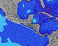 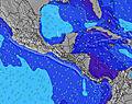 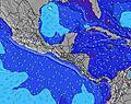 | 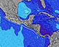 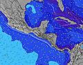 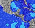 | 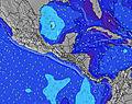 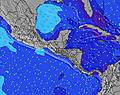 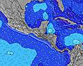 | 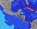 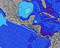 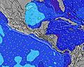 | 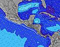 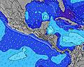 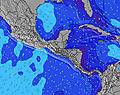 | 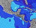 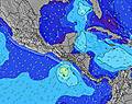 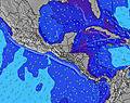 | |||||||||||||||||||||||||||||||||||||||||||||||||||
| Wave Height (m) & direction (?) | ||||||||||||||||||||||||||||||||||||||||||||||||||||||||||||
| Period(s) (?) | 8 | 8 | 8 | 8 | 8 | 8 | 8 | 9 | 9 | 9 | 9 | 9 | 9 | 9 | 9 | 9 | 9 | 10 | 9 | 9 | 9 | 8 | 8 | 9 | 9 | 9 | 9 | 9 | 9 | 8 | 8 | 9 | 9 | 9 | 9 | 8 | 8 | 8 | 8 | 8 | 8 | 8 | 8 | 8 | 8 | 8 | 7 | 7 | 7 | 7 | 7 | 7 | 7 | 7 | 7 | 7 | 6 | 7 | 6 | 6 |
Wave (?)Graph | ||||||||||||||||||||||||||||||||||||||||||||||||||||||||||||
| Energy (?) | 619 | 634 | 678 | 678 | 694 | 760 | 822 | 937 | 958 | 1010 | 952 | 952 | 1006 | 1064 | 1147 | 1263 | 658 | 863 | 813 | 699 | 571 | 505 | 505 | 582 | 654 | 813 | 795 | 777 | 653 | 623 | 665 | 742 | 714 | 730 | 625 | 517 | 457 | 314 | 207 | 175 | 166 | 154 | 154 | 154 | 133 | 186 | 152 | 130 | 64 | 61 | 59 | 59 | 59 | 53 | 53 | 51 | 54 | 51 | 51 | 54 |
Wind (km/h) | ||||||||||||||||||||||||||||||||||||||||||||||||||||||||||||
| Wind State (?) onshore cross-onshore cross-shore cross-offshore offshore glassy | cross- on | on | on | on | on | on | on | on | cross- on | on | on | on | on | on | on | on | cross- on | cross- on | cross- on | on | glass | glass | cross- on | on | on | on | on | on | on | on | on | on | on | on | on | on | on | on | on | on | on | on | on | on | on | on | on | on | cross- on | cross- on | on | cross- on | cross- on | cross- on | cross- on | cross- on | cross- on | cross | glass | cross |
High Tide / height (m) | 4:21AM 0.38 | 4:57AM 0.39 | 5:36AM 0.40 | 7:38PM 0.20 | 6:18AM 0.40 | 7:54PM 0.25 | 7:06AM 0.37 | 8:32PM 0.31 | 8:03AM 0.33 | 9:19PM 0.36 | 9:16AM 0.28 | 10:13PM 0.41 | ||||||||||||||||||||||||||||||||||||||||||||||||
Low Tide / height (m) | 12:51PM 0.03 | 1:14PM 0.05 | 1:36PM 0.07 | 11:29PM 0.18 | 1:59PM 0.09 | 1:03AM 0.19 | 2:23PM 0.11 | 2:29AM 0.18 | 2:50PM 0.12 | 3:55AM 0.16 | 3:19PM 0.13 | |||||||||||||||||||||||||||||||||||||||||||||||||
Friday 18 | Saturday 19 | Sunday 20 | Monday 21 | Tuesday 22 | Wednesday 23 | Thursday 24 | Friday 25 | Sat 26 | ||||||||||||||||||||||||||||||||||||||||||||||||||||
| Sunrise | - | - | - | - | - | 6:05 | - | - | - | - | - | - | - | 6:03 | - | - | - | - | - | - | - | 6:03 | - | - | - | - | - | - | - | 6:03 | - | - | - | - | - | - | - | 6:03 | - | - | - | - | - | - | - | 6:03 | - | - | - | - | - | - | - | 6:01 | - | - | - | - | - | - |
| Sunset | 6:27 | - | - | - | - | - | - | - | 6:27 | - | - | - | - | - | - | - | 6:27 | - | - | - | - | - | - | - | 6:27 | - | - | - | - | - | - | - | 6:27 | - | - | - | - | - | - | - | 6:27 | - | - | - | - | - | - | - | 6:27 | - | - | - | - | - | - | - | 6:27 | - | - | - |
Rain (mm) | 2 | 1 | 1 | - | 1 | 2 | 3 | 2 | 3 | 2 | 2 | 3 | 5 | 7 | 5 | 3 | 2 | 1 | 1 | 1 | 1 | - | 1 | 1 | 2 | 1 | 2 | 5 | 4 | 3 | 3 | 3 | 1 | 2 | 1 | 1 | 2 | 1 | - | - | - | - | - | - | 1 | - | - | - | - | - | - | - | - | - | 1 | 2 | 1 | - | - | 1 |
| Temp. °C | 27 | 26 | 26 | 26 | 26 | 26 | 27 | 27 | 27 | 26 | 26 | 26 | 26 | 26 | 27 | 27 | 26 | 26 | 26 | 25 | 25 | 25 | 27 | 28 | 27 | 25 | 25 | 25 | 25 | 25 | 26 | 27 | 26 | 25 | 26 | 25 | 25 | 26 | 27 | 28 | 27 | 26 | 26 | 26 | 25 | 26 | 28 | 28 | 27 | 26 | 25 | 25 | 25 | 25 | 27 | 27 | 27 | 26 | 26 | 25 |
| Feels °C (?) | 29 | 28 | 28 | 28 | 28 | 27 | 29 | 29 | 30 | 29 | 29 | 28 | 28 | 28 | 30 | 30 | 29 | 30 | 30 | 29 | 30 | 29 | 30 | 31 | 30 | 29 | 29 | 29 | 28 | 28 | 29 | 30 | 28 | 28 | 29 | 27 | 27 | 28 | 28 | 29 | 28 | 29 | 29 | 30 | 28 | 29 | 30 | 29 | 29 | 29 | 28 | 29 | 29 | 29 | 30 | 30 | 30 | 30 | 31 | 29 |
- Map Icons:
 Break
Break Live Wave Height (m)
 Live Wind Speed (km/h)
 Surf Rating (10 Max)
 Ocean Swells (m)
- Wind Speed (km/h)
FREE! Surf-Forecast.com widget for your website
The surf report / weather widget below is available to embed on third party websites free of charge and provides a summary of our Cuango surf forecast. Simply grab the html code snippet that we provide and paste it into your own site. You can choose your preferred language and metric/imperial units for the surf forecast feed to suit users of your site. Click here to get the code.


 Nearest