

- Forecast
- Maps
- Live
- Weather State
- Spot Information
Double Island Point - North Coast Surf Forecast
/ QLD – North Coast (14 breaks) / Queensland (74 breaks) /
Double Island Point - North Coast surfForecast / QLD – North Coast / Australia
How big are the waves at Double Island Point - North Coast today?
The current surf forecast for Double Island Point - North Coast at 1AM is: 1.7m 12s primary swell from a Southeast direction and 0.2m 8s secondary swell from a North-northeast direction (forecast issued at 09:00pm April 19). The wind direction is predicted to be cross-onshore.
| Time (AEST) & Date | Wave Height | Wave Period |
|---|---|---|
| Morning (20 Apr) | 5ft (1.5m) | 11s |
| Afternoon (20 Apr) | 4.5ft (1.3m) | 11s |
| Evening (20 Apr) | 3.5ft (1.1m) | 11s |
Table - waves today at Double Island Point - North Coast. (Swell directed towards the surf break)
Sat 19 | Sunday 20 | Monday 21 | Tuesday 22 | Wednesday 23 | Thursday 24 | Friday 25 | Saturday 26 | Sun 27 | ||||||||||||||||||||||||||||||||||||||||||||||||||||
| 7 PM | 10 PM | 1 AM | 4 AM | 7 AM | 10 AM | 1 PM | 4 PM | 7 PM | 10 PM | 1 AM | 4 AM | 7 AM | 10 AM | 1 PM | 4 PM | 7 PM | 10 PM | 1 AM | 4 AM | 7 AM | 10 AM | 1 PM | 4 PM | 7 PM | 10 PM | 1 AM | 4 AM | 7 AM | 10 AM | 1 PM | 4 PM | 7 PM | 10 PM | 1 AM | 4 AM | 7 AM | 10 AM | 1 PM | 4 PM | 7 PM | 10 PM | 1 AM | 4 AM | 7 AM | 10 AM | 1 PM | 4 PM | 7 PM | 10 PM | 1 AM | 4 AM | 7 AM | 10 AM | 1 PM | 4 PM | 7 PM | 10 PM | 1 AM | 4 AM | |
Rating (10 max) | ||||||||||||||||||||||||||||||||||||||||||||||||||||||||||||
Swell Height Map |    |    |    | 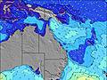 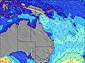  | 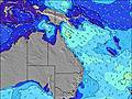 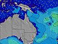  |    |    |    |   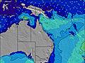 | |||||||||||||||||||||||||||||||||||||||||||||||||||
| Wave Height (m) & direction (?) | ||||||||||||||||||||||||||||||||||||||||||||||||||||||||||||
| Period(s) (?) | 12 | 12 | 12 | 12 | 12 | 11 | 11 | 11 | 11 | 11 | 11 | 10 | 10 | 10 | 10 | 10 | 10 | 10 | 9 | 10 | 10 | 9 | 9 | 9 | 9 | 9 | 9 | 9 | 9 | 9 | 9 | 9 | 9 | 9 | 9 | 9 | 9 | 9 | 10 | 10 | 10 | 10 | 8 | 10 | 10 | 10 | 12 | 11 | 11 | 11 | 11 | 11 | 11 | 11 | 11 | 11 | 11 | 11 | 11 | 11 |
Wave (?)Graph | ||||||||||||||||||||||||||||||||||||||||||||||||||||||||||||
| Energy (?) | 1042 | 880 | 805 | 736 | 583 | 501 | 437 | 384 | 377 | 293 | 254 | 173 | 145 | 120 | 117 | 98 | 76 | 61 | 58 | 49 | 48 | 45 | 43 | 42 | 42 | 27 | 27 | 27 | 40 | 40 | 39 | 39 | 42 | 44 | 64 | 61 | 43 | 85 | 94 | 125 | 127 | 127 | 98 | 96 | 158 | 98 | 220 | 195 | 195 | 191 | 195 | 198 | 195 | 151 | 191 | 191 | 151 | 114 | 114 | 112 |
Wind (km/h) | ||||||||||||||||||||||||||||||||||||||||||||||||||||||||||||
| Wind State (?) onshore cross-onshore cross-shore cross-offshore offshore glassy | cross- on | cross- on | cross- on | on | cross- on | glass | cross | cross | cross | cross- on | cross- on | on | cross- on | glass | cross- on | cross- on | cross- on | on | cross- on | cross | cross | cross- off | off | cross- off | glass | glass | cross- off | cross- off | cross- off | cross- off | cross- off | cross- off | cross- off | cross- off | glass | cross- off | cross- off | off | off | cross- off | cross- off | cross- on | cross- on | cross- on | cross | cross- on | cross | cross- on | cross- on | cross- on | on | cross- on | cross- on | cross- on | cross | cross- off | cross- off | cross- off | cross- off | off |
High Tide / height (m) | 12:35AM 1.40 | 1:22PM 0.86 | 1:47AM 1.42 | 2:49PM 0.91 | 2:55AM 1.48 | 3:56PM 1.03 | 3:54AM 1.55 | 4:48PM 1.20 | 4:47AM 1.61 | 5:35PM 1.39 | 5:35AM 1.64 | 6:18PM 1.59 | 6:22AM 1.62 | 7:02PM 1.76 | ||||||||||||||||||||||||||||||||||||||||||||||
Low Tide / height (m) | 5:26PM 0.47 | 7:51AM 0.47 | 6:38PM 0.52 | 9:05AM 0.40 | 8:06PM 0.52 | 10:02AM 0.30 | 9:25PM 0.46 | 10:47AM 0.18 | 10:32PM 0.37 | 11:27AM 0.07 | 11:30PM 0.26 | 12:05PM -0.02 | 12:24AM 0.16 | 12:42PM -0.09 | 1:16AM 0.08 | |||||||||||||||||||||||||||||||||||||||||||||
Sat 19 | Sunday 20 | Monday 21 | Tuesday 22 | Wednesday 23 | Thursday 24 | Friday 25 | Saturday 26 | Sun 27 | ||||||||||||||||||||||||||||||||||||||||||||||||||||
| Sunrise | - | - | - | - | 6:03 | - | - | - | - | - | - | - | 6:05 | - | - | - | - | - | - | - | 6:05 | - | - | - | - | - | - | - | 6:05 | - | - | - | - | - | - | - | 6:05 | - | - | - | - | - | - | - | 6:07 | - | - | - | - | - | - | - | 6:07 | - | - | - | - | - | - | - |
| Sunset | - | - | - | - | - | - | - | 5:27 | - | - | - | - | - | - | - | 5:25 | - | - | - | - | - | - | - | 5:24 | - | - | - | - | - | - | - | 5:23 | - | - | - | - | - | - | - | 5:23 | - | - | - | - | - | - | - | 5:22 | - | - | - | - | - | - | - | 5:22 | - | - | - | - |
Rain (mm) | - | - | - | - | - | - | - | - | - | - | - | - | - | - | - | - | - | - | - | 1 | - | - | - | - | - | - | - | - | - | - | - | - | - | - | - | - | - | - | - | - | - | - | - | 1 | - | - | - | - | - | - | - | - | - | - | - | - | - | - | - | - |
| Temp. °C | 23 | 23 | 22 | 22 | 21 | 22 | 23 | 23 | 23 | 23 | 22 | 21 | 20 | 22 | 24 | 24 | 23 | 22 | 20 | 20 | 20 | 23 | 25 | 25 | 23 | 23 | 20 | 19 | 19 | 21 | 22 | 22 | 22 | 22 | 21 | 20 | 19 | 21 | 22 | 22 | 22 | 21 | 21 | 19 | 19 | 21 | 23 | 23 | 23 | 23 | 22 | 19 | 19 | 22 | 24 | 23 | 23 | 23 | 22 | 22 |
| Feels °C (?) | 23 | 24 | 22 | 24 | 23 | 25 | 23 | 22 | 23 | 23 | 22 | 21 | 21 | 23 | 23 | 23 | 21 | 21 | 20 | 21 | 20 | 23 | 24 | 24 | 22 | 22 | 17 | 17 | 17 | 20 | 20 | 20 | 20 | 21 | 21 | 20 | 18 | 20 | 21 | 21 | 22 | 22 | 22 | 19 | 20 | 21 | 22 | 22 | 22 | 22 | 22 | 19 | 19 | 23 | 24 | 22 | 22 | 23 | 23 | 23 |
- Map Icons:
 Break
Break Live Wave Height (m)
 Live Wind Speed (km/h)
 Surf Rating (10 Max)
 Ocean Swells (m)
- Wind Speed (km/h)
FREE! Surf-Forecast.com widget for your website
The surf report / weather widget below is available to embed on third party websites free of charge and provides a summary of our Double Island Point - North Coast surf forecast. Simply grab the html code snippet that we provide and paste it into your own site. You can choose your preferred language and metric/imperial units for the surf forecast feed to suit users of your site. Click here to get the code.


 Nearest