

- Forecast
- Maps
- Live
- Weather State
- Spot Information
Dunes Surf Forecast
/ WA – North West (27 breaks) / Western Australia (159 breaks) /

Dunes surfForecast / WA – North West / Australia
How big are the waves at Dunes today?
The current surf forecast for Dunes at 10PM is: 1.0m 16s primary swell from a Southwest direction and 0.4m 11s secondary swell from a Southwest direction (forecast issued at 07:00pm April 22). An open ocean swell of 0.2m 7s is not directed at the surf break. The wind direction is predicted to be cross-onshore.
| Time (AWST) & Date | Wave Height | Wave Period |
|---|---|---|
| Morning (22 Apr) | - | - |
| Afternoon (22 Apr) | 3.5ft (1.0m) | 17s |
| Evening (22 Apr) | 3ft (0.9m) | 16s |
Table - waves today at Dunes. (Swell directed towards the surf break)
Tuesday 22 | Wednesday 23 | Thursday 24 | Friday 25 | Saturday 26 | Sunday 27 | Monday 28 | Tuesday 29 | Wed 30 | ||||||||||||||||||||||||||||||||||||||||||||||||||||
| 5 PM | 8 PM | 11 PM | 2 AM | 5 AM | 8 AM | 11 AM | 2 PM | 5 PM | 8 PM | 11 PM | 2 AM | 5 AM | 8 AM | 11 AM | 2 PM | 5 PM | 8 PM | 11 PM | 2 AM | 5 AM | 8 AM | 11 AM | 2 PM | 5 PM | 8 PM | 11 PM | 2 AM | 5 AM | 8 AM | 11 AM | 2 PM | 5 PM | 8 PM | 11 PM | 2 AM | 5 AM | 8 AM | 11 AM | 2 PM | 5 PM | 8 PM | 11 PM | 2 AM | 5 AM | 8 AM | 11 AM | 2 PM | 5 PM | 8 PM | 11 PM | 2 AM | 5 AM | 8 AM | 11 AM | 2 PM | 5 PM | 8 PM | 11 PM | 2 AM | |
Rating (10 max) | ||||||||||||||||||||||||||||||||||||||||||||||||||||||||||||
Swell Height Map |   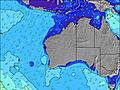 |  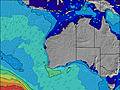 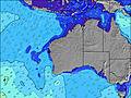 |  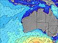  |    |  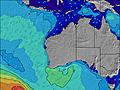 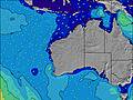 | 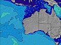 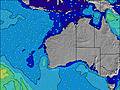  |    |    |    | |||||||||||||||||||||||||||||||||||||||||||||||||||
| Wave Height (m) & direction (?) | ||||||||||||||||||||||||||||||||||||||||||||||||||||||||||||
| Period(s) (?) | 16 | 16 | 16 | 16 | 16 | 16 | 16 | 16 | 15 | 15 | 15 | 14 | 14 | 14 | 14 | 14 | 14 | 7 | 13 | 11 | 11 | 12 | 13 | 13 | 13 | 13 | 11 | 14 | 14 | 14 | 13 | 13 | 13 | 13 | 13 | 13 | 13 | 13 | 13 | 13 | 13 | 13 | 14 | 8 | 8 | 8 | 9 | 10 | 10 | 13 | 13 | 13 | 13 | 15 | 15 | 14 | 14 | 14 | 13 | 13 |
Wave (?)Graph | ||||||||||||||||||||||||||||||||||||||||||||||||||||||||||||
| Energy (?) | 527 | 381 | 502 | 502 | 427 | 421 | 416 | 353 | 344 | 331 | 314 | 305 | 297 | 245 | 241 | 200 | 189 | 180 | 205 | 293 | 263 | 298 | 369 | 374 | 369 | 369 | 162 | 377 | 366 | 350 | 250 | 246 | 168 | 168 | 168 | 168 | 171 | 61 | 61 | 136 | 130 | 128 | 261 | 84 | 107 | 84 | 79 | 76 | 82 | 84 | 59 | 42 | 100 | 215 | 104 | 103 | 102 | 131 | 144 | 116 |
Wind (km/h) | ||||||||||||||||||||||||||||||||||||||||||||||||||||||||||||
| Wind State (?) onshore cross-onshore cross-shore cross-offshore offshore glassy | on | cross- on | cross | cross- off | cross- off | off | off | glass | cross- on | cross | cross- off | cross- off | cross- off | cross- off | off | cross- off | cross | cross- off | cross- off | cross- off | off | off | off | cross- off | cross | cross | cross- off | cross- off | cross- off | cross- off | cross- off | cross | cross | cross- off | cross- off | cross- off | cross- off | cross- off | cross- off | cross | cross | cross- off | cross- off | cross- off | cross- off | cross- off | cross- off | glass | cross- on | cross | cross- on | cross- on | glass | glass | cross- off | cross | cross- on | on | cross- on | cross- off |
High Tide / height (m) | 4:21PM 1.76 | 7:10AM 1.50 | 6:48PM 1.67 | 8:39AM 1.66 | 8:49PM 1.76 | 9:25AM 1.86 | 9:55PM 1.90 | 10:03AM 2.06 | 10:44PM 2.01 | 10:40AM 2.24 | 11:28PM 2.08 | 11:16AM 2.38 | 12:08AM 2.09 | 11:52AM 2.46 | 12:47AM 2.05 | |||||||||||||||||||||||||||||||||||||||||||||
Low Tide / height (m) | 12:17AM 1.07 | 12:43PM 1.33 | 2:05AM 1.04 | 2:41PM 1.12 | 3:07AM 0.97 | 3:40PM 0.87 | 3:52AM 0.88 | 4:26PM 0.62 | 4:32AM 0.82 | 5:08PM 0.42 | 5:08AM 0.78 | 5:48PM 0.29 | 5:43AM 0.78 | 6:28PM 0.25 | ||||||||||||||||||||||||||||||||||||||||||||||
Tuesday 22 | Wednesday 23 | Thursday 24 | Friday 25 | Saturday 26 | Sunday 27 | Monday 28 | Tuesday 29 | Wed 30 | ||||||||||||||||||||||||||||||||||||||||||||||||||||
| Sunrise | - | - | - | - | - | 6:37 | - | - | - | - | - | - | - | 6:37 | - | - | - | - | - | - | - | 6:39 | - | - | - | - | - | - | - | 6:39 | - | - | - | - | - | - | - | 6:39 | - | - | - | - | - | - | - | 6:39 | - | - | - | - | - | - | - | 6:39 | - | - | - | - | - | - |
| Sunset | 6:06 | - | - | - | - | - | - | - | 6:05 | - | - | - | - | - | - | - | 6:04 | - | - | - | - | - | - | - | 6:02 | - | - | - | - | - | - | - | 6:02 | - | - | - | - | - | - | - | 6:01 | - | - | - | - | - | - | - | 6:00 | - | - | - | - | - | - | - | 6:00 | - | - | - |
Rain (mm) | - | - | - | - | - | - | - | - | - | - | - | - | - | - | - | - | - | - | - | - | - | - | - | - | - | - | - | - | - | - | - | - | - | - | - | - | - | - | - | - | - | - | - | - | - | - | - | - | - | - | - | - | - | - | - | - | - | - | - | - |
| Temp. °C | 29 | 28 | 27 | 27 | 26 | 26 | 27 | 28 | 28 | 27 | 27 | 26 | 25 | 25 | 26 | 29 | 30 | 29 | 28 | 26 | 26 | 26 | 28 | 31 | 30 | 28 | 28 | 28 | 27 | 27 | 28 | 28 | 28 | 29 | 26 | 24 | 23 | 22 | 25 | 27 | 27 | 27 | 27 | 26 | 25 | 24 | 26 | 27 | 27 | 27 | 27 | 27 | 27 | 27 | 27 | 28 | 28 | 28 | 27 | 27 |
| Feels °C (?) | 29 | 28 | 28 | 28 | 27 | 27 | 28 | 31 | 29 | 28 | 27 | 25 | 22 | 21 | 23 | 27 | 28 | 25 | 22 | 21 | 21 | 21 | 24 | 29 | 28 | 24 | 25 | 25 | 25 | 25 | 29 | 28 | 25 | 25 | 19 | 19 | 20 | 19 | 24 | 27 | 25 | 23 | 21 | 20 | 20 | 20 | 24 | 29 | 28 | 27 | 28 | 28 | 30 | 30 | 28 | 29 | 28 | 29 | 29 | 29 |
- Map Icons:
 Break
Break Live Wave Height (m)
 Live Wind Speed (km/h)
 Surf Rating (10 Max)
 Ocean Swells (m)
- Wind Speed (km/h)
FREE! Surf-Forecast.com widget for your website
The surf report / weather widget below is available to embed on third party websites free of charge and provides a summary of our Dunes surf forecast. Simply grab the html code snippet that we provide and paste it into your own site. You can choose your preferred language and metric/imperial units for the surf forecast feed to suit users of your site. Click here to get the code.


 Nearest