

- Forecast
- Maps
- Live
- Weather State
- Spot Information

Surf Forecasts
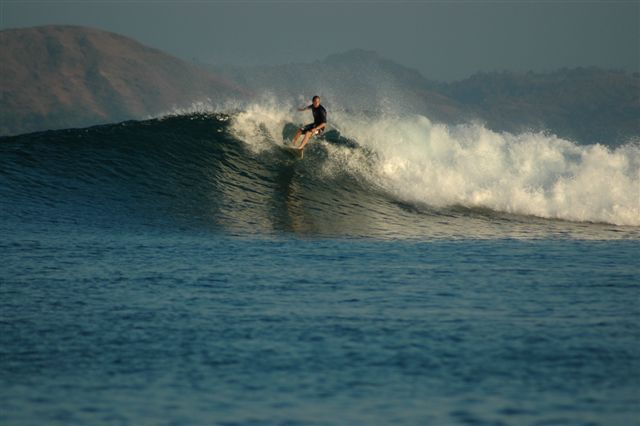
Ekas-Inside surfForecast / Lombok – South / Indonesia
Forecast update in hr min s Forecast update imminent
Ekas-Inside surf forecast is for near shore open water. Breaking waves will often be smaller at less exposed spots.
Today's Ekas-Inside sea temperature is
28.8° C
(Which is normal for this time of year)How big are the waves at Ekas-Inside today?
The current surf forecast for Ekas-Inside at 12PM is: 0.9m 12s primary swell from a South-southwest direction and 0.3m 11s secondary swell from a West-southwest direction (forecast issued at 07:00am April 03). The wind direction is predicted to be cross-offshore.
| Time (WITA) & Date | Wave Height | Wave Period |
|---|---|---|
| Morning (03 Apr) | 3ft (0.9m) | 12s |
| Afternoon (03 Apr) | 3ft (0.9m) | 12s |
| Evening (03 Apr) | 2.5ft (0.8m) | 12s |
Table - waves today at Ekas-Inside. (Swell directed towards the surf break)
Updates in hr min s Forecast update imminent
Thursday 03 | Friday 04 | Saturday 05 | Sunday 06 | Monday 07 | Tuesday 08 | Wednesday 09 | Thursday 10 | |||||||||||||||||||||||||||||||||||||||||||||||||||||
| 5 AM | 8 AM | 11 AM | 2 PM | 5 PM | 8 PM | 11 PM | 2 AM | 5 AM | 8 AM | 11 AM | 2 PM | 5 PM | 8 PM | 11 PM | 2 AM | 5 AM | 8 AM | 11 AM | 2 PM | 5 PM | 8 PM | 11 PM | 2 AM | 5 AM | 8 AM | 11 AM | 2 PM | 5 PM | 8 PM | 11 PM | 2 AM | 5 AM | 8 AM | 11 AM | 2 PM | 5 PM | 8 PM | 11 PM | 2 AM | 5 AM | 8 AM | 11 AM | 2 PM | 5 PM | 8 PM | 11 PM | 2 AM | 5 AM | 8 AM | 11 AM | 2 PM | 5 PM | 8 PM | 11 PM | 2 AM | 5 AM | 8 AM | 11 AM | 2 PM | |
Rating (10 max) | ||||||||||||||||||||||||||||||||||||||||||||||||||||||||||||
Swell Height Map |    |    |    |    |   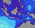 |  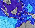 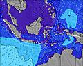 |  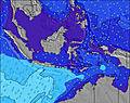 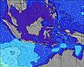 | 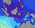 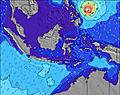 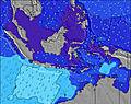 | ||||||||||||||||||||||||||||||||||||||||||||||||||||
| Wave Height (m) & direction (?) | ||||||||||||||||||||||||||||||||||||||||||||||||||||||||||||
| Period(s) (?) | 12 | 12 | 12 | 12 | 12 | 12 | 12 | 11 | 11 | 11 | 13 | 19 | 18 | 18 | 17 | 16 | 16 | 16 | 15 | 15 | 14 | 14 | 14 | 14 | 14 | 13 | 13 | 13 | 13 | 13 | 13 | 13 | 13 | 12 | 12 | 12 | 12 | 12 | 13 | 13 | 13 | 13 | 13 | 13 | 13 | 13 | 13 | 13 | 13 | 12 | 12 | 12 | 15 | 15 | 15 | 16 | 15 | 14 | 14 | 14 |
Wave (?)Graph | ||||||||||||||||||||||||||||||||||||||||||||||||||||||||||||
| Energy (?) | 299 | 247 | 247 | 218 | 218 | 174 | 171 | 166 | 76 | 75 | 225 | 207 | 249 | 356 | 1099 | 1179 | 1310 | 1136 | 1198 | 1106 | 1076 | 1061 | 930 | 917 | 733 | 700 | 577 | 569 | 569 | 569 | 569 | 560 | 614 | 585 | 608 | 699 | 688 | 787 | 745 | 781 | 781 | 690 | 569 | 560 | 484 | 476 | 402 | 395 | 426 | 413 | 426 | 339 | 283 | 305 | 736 | 926 | 786 | 678 | 668 | 789 |
Wind (km/h) | ||||||||||||||||||||||||||||||||||||||||||||||||||||||||||||
| Wind State (?) onshore cross-onshore cross-shore cross-offshore offshore glassy | glass | glass | cross- off | cross | cross- off | cross- off | cross- off | cross- off | cross- off | off | cross- off | cross- off | cross- off | cross- off | cross- off | glass | glass | glass | cross- off | cross | cross | glass | glass | glass | glass | glass | cross- off | cross | cross | glass | glass | glass | glass | glass | cross | cross | cross | glass | glass | glass | glass | glass | glass | cross- off | cross- off | cross- off | off | glass | glass | cross- off | glass | cross | cross | glass | glass | glass | cross- on | glass | cross | cross |
High Tide / height (m) | 12:57PM 2.49 | 1:49AM 1.56 | 1:35PM 2.28 | 2:39AM 1.35 | 2:18PM 2.02 | 4:14AM 1.19 | 3:25PM 1.75 | 9:34AM 1.32 | 5:56PM 1.59 | 9:05AM 1.52 | 7:56PM 1.66 | 9:19AM 1.70 | 8:54PM 1.78 | 9:36AM 1.87 | ||||||||||||||||||||||||||||||||||||||||||||||
Low Tide / height (m) | 6:39AM 0.59 | 7:56PM 0.21 | 7:06AM 0.75 | 8:46PM 0.45 | 7:30AM 0.92 | 10:00PM 0.68 | 7:40AM 1.11 | 12:19AM 0.79 | 11:44AM 1.31 | 2:00AM 0.72 | 2:19PM 1.12 | 2:47AM 0.63 | 3:07PM 0.90 | 3:20AM 0.57 | ||||||||||||||||||||||||||||||||||||||||||||||
Thursday 03 | Friday 04 | Saturday 05 | Sunday 06 | Monday 07 | Tuesday 08 | Wednesday 09 | Thursday 10 | |||||||||||||||||||||||||||||||||||||||||||||||||||||
| Sunrise | - | 6:16 | - | - | - | - | - | - | - | 6:16 | - | - | - | - | - | - | - | 6:16 | - | - | - | - | - | - | - | 6:16 | - | - | - | - | - | - | - | 6:16 | - | - | - | - | - | - | - | 6:16 | - | - | - | - | - | - | - | 6:16 | - | - | - | - | - | - | - | 6:16 | - | - |
| Sunset | - | - | - | - | 6:16 | - | - | - | - | - | - | - | 6:16 | - | - | - | - | - | - | - | 6:15 | - | - | - | - | - | - | - | 6:15 | - | - | - | - | - | - | - | 6:15 | - | - | - | - | - | - | - | 6:15 | - | - | - | - | - | - | - | 6:14 | - | - | - | - | - | - | - |
Rain (mm) | - | - | - | - | - | - | - | - | - | - | - | - | - | - | - | - | - | - | - | - | - | - | - | - | - | - | - | - | - | - | - | - | - | - | - | 1 | - | - | - | - | - | - | - | - | - | - | - | - | - | - | - | - | 1 | 1 | - | - | - | - | - | - |
| Temp. °C | 26 | 26 | 28 | 28 | 28 | 27 | 27 | 26 | 26 | 27 | 28 | 28 | 28 | 27 | 26 | 26 | 25 | 25 | 27 | 28 | 28 | 26 | 26 | 25 | 25 | 26 | 27 | 28 | 28 | 27 | 26 | 25 | 25 | 26 | 27 | 28 | 28 | 27 | 26 | 25 | 25 | 25 | 27 | 28 | 28 | 27 | 26 | 26 | 25 | 26 | 27 | 28 | 28 | 27 | 26 | 26 | 25 | 26 | 28 | 26 |
| Feels °C (?) | 30 | 30 | 31 | 30 | 31 | 30 | 30 | 29 | 29 | 30 | 30 | 29 | 30 | 30 | 29 | 30 | 29 | 29 | 30 | 30 | 30 | 29 | 30 | 29 | 29 | 30 | 30 | 29 | 30 | 31 | 31 | 29 | 29 | 30 | 30 | 30 | 30 | 31 | 31 | 29 | 29 | 29 | 31 | 30 | 30 | 30 | 29 | 30 | 29 | 30 | 31 | 31 | 31 | 31 | 30 | 30 | 28 | 30 | 30 | 29 |
- Map Icons:
 Break
Break Live Wave Height (m)
 Live Wind Speed (km/h)
 Surf Rating (10 Max)
 Ocean Swells (m)
- Wind Speed (km/h)
FREE! Surf-Forecast.com widget for your website
The surf report / weather widget below is available to embed on third party websites free of charge and provides a summary of our Ekas-Inside surf forecast. Simply grab the html code snippet that we provide and paste it into your own site. You can choose your preferred language and metric/imperial units for the surf forecast feed to suit users of your site. Click here to get the code.


 Nearest