
Surf Forecasts:

El Olon de Ilo surf forecast from 30 Jul 2026:
- Best quality surf: Thursday 6 Aug, 1AM (local time) - 4.5ft (1.3m), 13s period, SW swell with glassy winds.
- Most powerful swell: Thursday 30 Jul, 1AM (local time) - 5ft (1.6m), 13s period, SW swell with 851 kJ wave energy.
- Next surfable swell (1★+): Thursday 30 Jul, 1AM (local time) - 5ft (1.6m), 13s period with SW swell.
Best Forecast Surf Conditions for El Olon de Ilo this week:
The surf forecast for El Olon de Ilo over the next 16 days: The first swell (rated 1 star or higher) is forecast to arrive on Thursday (Jul 30) at 1AM. The primary swell is predicted to be 1.6m and 13s period with a secondary swell of 0.3m and 11s. The wind is predicted to be glassy as the swell arrives.
The most powerful waves expected at El Olon de Ilo in the next 16 days are 1.6m 13s and forecast to arrive on Thursday (Jul 30) at 1AM. Winds are predicted to be glassy at the time the swell arrives. The largest open ocean swell (not directed at the beach) is 0.6m 4s period and expected on Saturday (Aug 01) at 1AM.
| Wave Type | Time (-05) & Date | Wave Height & Period |
|---|---|---|
| Next good surf (1 star+) | 1AM (Thu 30th Jul) | 5ft (1.6m) 13s |
| Best Surf | 1AM (Thu 6th Aug) | 4.5ft (1.3m) 13s |
| Most Powerful | 1AM (Thu 30th Jul) | 5ft (1.6m) 13s |
Table - best surf conditions forecast for El Olon de Ilo over the next 16 days.
The Lowdown
G'day, Rusty here, and I've been staring at the charts for El Olon de Ilo and there's a proper run of waves coming through. This is a reef break that rarely sees crowds, so you’ve got a real chance to score some quality ones without jostling for position. The water is sitting at 65.5°, which is a touch warmer than normal for this time of year, so the wetsuit might be a bit lighter than usual.
We kick off on Wednesday the 29th of July with a solid pulse. The swell is a clean 5.9ft from the SW, with a 13-second period pushing a heap of energy in – that’s a strong 1068 (moderate energy) on the scale. The wind is a light cross-off from the south, keeping the surface nice and clean. This is excellent surf for experienced surfers, so if you've got the skills, this is the day to be out.
Thursday the 30th stays good but drops a touch. The morning is a standout with glassy conditions and a 4.6ft SW swell at 12 seconds. The wind is almost nothing, just a slight air from the SW, making it perfectly clean. The afternoon stays clean with a cross-off breeze. Friday the 31st and into the weekend sees the swell ease into the 2.9ft to 3.9ft range, but it’s still clean and rideable with the same SW direction. The energy drops to moderate (around 282-475), but for a longboard or a funboard, it’s still a good time.
Now, Monday the 3rd of August brings a new push. The morning sees the swell jump back to 4.9ft from the SSW, with a 12-second period and energy at 730 (moderate). The wind is a light cross-off, keeping it tidy. Tuesday the 4th is a bit of a write-off with onshore winds and questionable conditions, so give that a miss.
But then, hold onto your board. Wednesday the 5th of August is a beauty. The afternoon is glassy, with a 4.3ft SW swell and a 13-second period pushing energy up to 933 (moderate). The wind is just a slight air, so the surface will be like a mirror. This is the kind of session you dream about.
We get another big spike on Thursday the 6th of August. The morning has a 5.6ft SW swell with a very long 17-second period, and the energy jumps to 1804 (strong). The wind is a light cross-shore, which might put a small ripple on it, but it’s still good. The afternoon, however, is the real pick – glassy conditions, a 4.3ft SW swell, and a 16-second period with energy at 1529 (strong). This is excellent for experienced surfers. Friday the 7th of August is another cracker, with a 6.6ft SW swell at 14 seconds and a gentle cross-off breeze. The energy is 1659 (strong). This is a big, powerful wave, so only for the confident crew.
The second week sees a few more options. Saturday the 8th of August has a clean afternoon with a 4.6ft SW swell. Sunday the 9th of August has a tiny, weird 2.0ft swell with a massive 21-second period, but it’s clean and glassy in the afternoon – worth a look for a longboard if you want a calm session. Monday the 10th of August has a glassy 2.9ft SW swell with an 18-second period, which is a proper long-period groundswell. It’ll be very clean but might be slow between sets.
The real standout in the second week is Tuesday the 11th of August. The morning is glassy, with a 4.9ft SSW swell at 12 seconds and energy at 1232 (strong). This is excellent for experienced surfers and promises to be a clean, powerful session. It’s a bit far out, so keep an eye on the charts, but it looks promising.
Overall, the best windows are Wednesday the 29th of July, Wednesday the 5th of August, and the morning of Tuesday the 11th of August. Get out there and get some.
Short Range ForecastMostly dry. Warm (max 20°C on Thu morning, min 17°C on Wed night). Wind will be generally light. | Days 5-7 Weather SummaryMostly dry. Warm (max 20°C on Sun morning, min 16°C on Mon night). Wind will be generally light. | |||||||||||||||||||
Wed 29 | Thursday 30 | Friday 31 | Saturday 1 | Sunday 2 | Monday 3 | Tuesday 4 | ||||||||||||||
PM | Night | AM | PM | Night | AM | PM | Night | AM | PM | Night | AM | PM | Night | AM | PM | Night | AM | PM | Night | |
Swell Height Map |  | 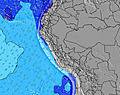 | 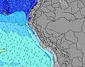 | 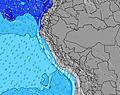 | 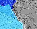 | 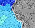 | 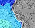 | |||||||||||||
Wave Height (m) Direction Period (s) | SW 13 | SW 13 | SW 12 | SW 12 | SW 13 | SW 12 | SW 12 | SW 12 | SW 11 | SW 11 | SW 10 | SW 10 | SW 10 | SSW 13 | SSW 12 | SSW 12 | SSW 11 | SW 12 | SW 12 | SW 11 |
Wave Graph | ||||||||||||||||||||
1037 | 851 | 580 | 580 | 479 | 278 | 236 | 228 | 344 | 332 | 324 | 196 | 163 | 317 | 616 | 500 | 346 | 277 | 694 | 369 | |
Wind (km/h) | ||||||||||||||||||||
Wind State on-shore cross-onshore cross-shore cross-offshore off-shore glassy | cross-off | glassy | glassy | cross-off | glassy | cross-off | cross-off | glassy | cross-off | cross-off | cross-off | cross-off | cross-off | cross-off | cross-off | cross-off | glassy | cross-on | on | glassy |
High Tide | 8:31PM0.57m | 8:46AM1.07m | 9:08PM0.60m | 9:17AM1.06m | 9:44PM0.63m | 9:48AM1.02m | 10:21PM0.67m | 10:18AM0.96m | 11:00PM0.70m | 10:48AM0.89m | 11:42PM0.74m | 11:23AM0.79m | 00:31AM0.78m | |||||||
Low Tide | 1:55AM0.11m | 3:35PM0.09m | 2:33AM0.12m | 4:04PM0.09m | 3:11AM0.15m | 4:32PM0.09m | 3:51AM0.19m | 4:59PM0.10m | 4:35AM0.24m | 5:26PM0.11m | 5:26AM0.29m | 5:57PM0.12m | ||||||||
— | — | 6:11 | — | — | 6:11 | — | — | 6:11 | — | — | 6:11 | — | — | 6:11 | — | — | 6:09 | — | — | |
5:30 | — | — | 5:30 | — | — | 5:30 | — | — | 5:30 | — | — | 5:31 | — | — | 5:31 | — | — | 5:31 | — | |
mm | — | — | — | — | — | — | — | — | — | — | — | — | — | — | — | — | — | — | — | — |
Temp °C | 19 | 17 | 20 | 20 | 18 | 19 | 19 | 19 | 20 | 19 | 17 | 20 | 19 | 17 | 20 | 19 | 17 | 20 | 19 | 18 |
Feels °C | 19 | 18 | 21 | 20 | 19 | 19 | 18 | 20 | 20 | 19 | 18 | 19 | 19 | 18 | 20 | 19 | 18 | 20 | 19 | 19 |
Swell 1 Height (m) Direction Period (s) | SW 13 | SW 13 | SW 12 | SW 12 | SW 13 | SW 12 | SW 12 | SW 12 | SW 11 | SW 11 | SW 10 | SW 10 | SW 10 | SW 10 | SSW 12 | SSW 12 | SSW 11 | SSW 8 | SW 12 | SW 11 |
1037 | 851 | 580 | 580 | 479 | 278 | 236 | 228 | 344 | 332 | 324 | 196 | 163 | 177 | 616 | 500 | 346 | 157 | 694 | 369 | |
Swell 2 Height (m) Direction Period (s) | SSW 12 | SSW 11 | SSW 11 | SSW 10 | SSW 10 | SSW 9 | S 9 | S 4 | SSW 9 | SSW 5 | WSW 15 | WSW 14 | S 6 | SSW 13 | WSW 13 | WSW 12 | SW 12 | SW 12 | SSW 10 | SSW 8 |
28 | 24 | 40 | 36 | 78 | 68 | 43 | 9 | 25 | 19 | 144 | 138 | 27 | 317 | 114 | 138 | 175 | 277 | 22 | 127 | |
Swell 3 Height (m) Direction Period (s) | W 13 | SSW 11 | S 5 | — | — | SW 16 | W 12 | SSW 8 | SW 16 | SW 16 | WSW 15 | S 6 | WSW 14 | WSW 13 | — | SW 15 | WSW 12 | SSW 11 | SW 19 | SW 16 |
3 | 24 | 5 | — | — | 10 | 3 | 24 | 66 | 124 | 142 | 25 | 123 | 154 | — | 8 | 14 | 64 | 14 | 41 | |
Wind waves Height (m) Direction Period (s) | — | — | — | — | — | — | S 4 | S 4 | S 5 | — | — | — | — | — | — | — | — | — | — | — |
— | — | — | — | — | — | 6 | 13 | 11 | — | — | — | — | — | — | — | — | — | — | — | |
Nearest Offshore or Glassy | ||||||||||||||||||||
Distance (km) | 0 | 0 | 0 | 0 | 0 | 0 | 0 | 0 | 0 | 0 | 0 | 0 | 0 | 0 | 0 | 0 | 0 | 242 | 141 | 0 |
Best forecast wave conditions in Arequipa, Moquegua and Tacna | ||||||||||||||||||||
Best forecast wave conditions in Peru | ||||||||||||||||||||
Header Global | ||||||||||||||||||||
- Map Icons:
 Break
Break Live Wave Height (m)
 Live Wind Speed (km/h)
 Surf Rating (10 Max)
 Ocean Swells (m)
- Wind Speed (km/h)


FREE! Surf-Forecast.com widget for your website
The surf report / weather widget below is available to embed on third party websites free of charge and provides a summary of our El Olon de Ilo surf forecast. Simply grab the html code snippet that we provide and paste it into your own site. You can choose your preferred language and metric/imperial units for the surf forecast feed to suit users of your site. Click here to get the code.
Information about the El Olon de Ilo Surf forecast
The above surf forecast table for El Olon de Ilo provides essential information for determining whether the surfing conditions will be good over the next 16 days. A general guide to surfing at El Olon de Ilo can be found by selecting the local surf guide option on the grey menu. Our El Olon de Ilo surf forecast is unique since it includes wave energy (power) that defines the real feel of the surf rather than just the height or the period. If you surf the same spot (El Olon de Ilo) regularly then make a mental note of the wave energy from the surf forecast table each time you go. Very soon you may start to choose your surf days based on the wave energy alone combined with our forecast of favourable offshore wind conditions. Our star ratings will help here and of course you will also find the usual wave height and period predictions on our surf forecasts as well as a full break down of the swell components under our advanced users option (to reveal that, click the little Einstein character under the tide times).
Further information to help with frequently asked questions about our surf forecast for El Olon de Ilo may be found under the help tab on the top menu and also by moving your mouse over the question marks on the surf forecast table itself. Please always bear in mind that the forecast is for near-shore open water and local factors at each surf break influence the actual breaking wave height, such as the beach / reef profile, water depths offshore and shelter.
Are you planning a holiday in Arequipa, Moquegua and Tacna? If you are looking for accommodation near El Olon de Ilo, camping, hotels and holiday cottages in Arequipa, Moquegua and Tacna, consider staying in Ilo which is 11 km (7 miles) away. Other places in and around Arequipa, Moquegua and Tacna where you can find information about places to rent, and car hire include Moquegua which is 63 km (39 miles) away and Mollendo, 94 km (58 miles) away.
 Nearest