

- Forecast
- Maps
- Live
- Weather State
- Spot Information
Geriba Surf Forecast
/ Rio de Janeiro (47 surf breaks) /
Geriba surfForecast / Rio de Janeiro / Brazil
How big are the waves at Geriba today?
The current surf forecast for Geriba at 10AM is: 0.9m 11s primary swell from a South direction and 0.9m 8s secondary swell from a East-southeast direction (forecast issued at 08:00am April 09). An open ocean swell of 0.6m 4s is not directed at the surf break. The wind direction is predicted to be offshore.
| Time (-03) & Date | Wave Height | Wave Period |
|---|---|---|
| Morning (09 Apr) | 3.5ft (1.0m) | 11s |
| Afternoon (09 Apr) | 4.5ft (1.3m) | 8s |
| Evening (09 Apr) | 3.5ft (1.0m) | 11s |
Table - waves today at Geriba. (Swell directed towards the surf break)
Wednesday 09 | Thursday 10 | Friday 11 | Saturday 12 | Sunday 13 | Monday 14 | Tuesday 15 | Wednesday 16 | |||||||||||||||||||||||||||||||||||||||||||||||||||||
| 6 AM | 9 AM | 12 PM | 3 PM | 6 PM | 9 PM | 0 AM | 3 AM | 6 AM | 9 AM | 12 PM | 3 PM | 6 PM | 9 PM | 0 AM | 3 AM | 6 AM | 9 AM | 12 PM | 3 PM | 6 PM | 9 PM | 0 AM | 3 AM | 6 AM | 9 AM | 12 PM | 3 PM | 6 PM | 9 PM | 0 AM | 3 AM | 6 AM | 9 AM | 12 PM | 3 PM | 6 PM | 9 PM | 0 AM | 3 AM | 6 AM | 9 AM | 12 PM | 3 PM | 6 PM | 9 PM | 0 AM | 3 AM | 6 AM | 9 AM | 12 PM | 3 PM | 6 PM | 9 PM | 0 AM | 3 AM | 6 AM | 9 AM | 12 PM | 3 PM | |
Rating (10 max) | ||||||||||||||||||||||||||||||||||||||||||||||||||||||||||||
Swell Height Map |    |    |    |    |    |  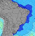 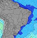 |  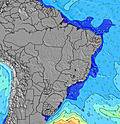 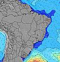 | 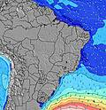 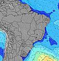 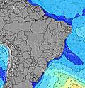 | ||||||||||||||||||||||||||||||||||||||||||||||||||||
| Wave Height (m) & direction (?) | ||||||||||||||||||||||||||||||||||||||||||||||||||||||||||||
| Period(s) (?) | 11 | 11 | 11 | 8 | 11 | 11 | 11 | 10 | 10 | 10 | 10 | 11 | 11 | 12 | 11 | 11 | 11 | 11 | 11 | 11 | 11 | 12 | 12 | 12 | 12 | 11 | 11 | 11 | 11 | 11 | 11 | 11 | 10 | 10 | 10 | 10 | 10 | 10 | 10 | 10 | 9 | 9 | 9 | 9 | 9 | 9 | 9 | 9 | 9 | 10 | 10 | 10 | 10 | 10 | 10 | 10 | 10 | 9 | 9 | 8 |
Wave (?)Graph | ||||||||||||||||||||||||||||||||||||||||||||||||||||||||||||
| Energy (?) | 235 | 231 | 184 | 219 | 198 | 242 | 245 | 231 | 260 | 260 | 296 | 359 | 460 | 623 | 1092 | 894 | 806 | 844 | 860 | 741 | 1004 | 1040 | 980 | 980 | 892 | 817 | 716 | 716 | 659 | 606 | 505 | 548 | 527 | 459 | 408 | 400 | 363 | 356 | 290 | 278 | 226 | 221 | 199 | 199 | 222 | 222 | 222 | 222 | 265 | 157 | 139 | 139 | 94 | 94 | 94 | 113 | 110 | 106 | 103 | 86 |
Wind (km/h) | ||||||||||||||||||||||||||||||||||||||||||||||||||||||||||||
| Wind State (?) onshore cross-onshore cross-shore cross-offshore offshore glassy | off | off | cross- off | cross- off | cross- off | off | off | off | off | cross | on | cross- on | on | glass | cross- on | cross- on | cross- on | on | cross- on | cross- on | cross- on | cross | glass | glass | glass | glass | cross- off | cross- off | cross- off | cross- off | cross- off | off | cross- off | cross- off | cross- off | cross- off | cross- off | cross- off | off | off | off | cross- off | cross- off | cross- off | cross- off | cross- off | off | off | off | cross- off | cross- off | cross- off | cross- off | cross- off | off | off | off | off | off | cross- off |
High Tide / height (m) | 12:19PM 1.05 | 1:07AM 1.02 | 12:56PM 1.14 | 1:33AM 1.06 | 1:39PM 1.19 | 2:05AM 1.09 | 2:22PM 1.22 | 2:36AM 1.12 | 2:58PM 1.24 | 3:05AM 1.12 | 3:30PM 1.23 | 3:33AM 1.09 | 4:01PM 1.19 | 4:01AM 1.04 | ||||||||||||||||||||||||||||||||||||||||||||||
Low Tide / height (m) | 6:16AM 0.35 | 6:35PM 0.08 | 6:52AM 0.26 | 7:16PM 0.06 | 7:28AM 0.17 | 7:53PM 0.07 | 7:59AM 0.11 | 8:23PM 0.10 | 8:25AM 0.08 | 8:49PM 0.16 | 8:46AM 0.09 | 9:10PM 0.24 | 9:00AM 0.13 | 9:27PM 0.35 | 9:08AM 0.19 | |||||||||||||||||||||||||||||||||||||||||||||
Wednesday 09 | Thursday 10 | Friday 11 | Saturday 12 | Sunday 13 | Monday 14 | Tuesday 15 | Wednesday 16 | |||||||||||||||||||||||||||||||||||||||||||||||||||||
| Sunrise | 5:58 | - | - | - | - | - | - | - | 5:58 | - | - | - | - | - | - | - | 5:58 | - | - | - | - | - | - | - | 5:58 | - | - | - | - | - | - | - | 5:58 | - | - | - | - | - | - | - | - | 6:00 | - | - | - | - | - | - | - | 6:00 | - | - | - | - | - | - | - | 6:00 | - | - |
| Sunset | - | - | - | 5:39 | - | - | - | - | - | - | - | 5:38 | - | - | - | - | - | - | - | 5:37 | - | - | - | - | - | - | - | 5:37 | - | - | - | - | - | - | - | 5:36 | - | - | - | - | - | - | - | 5:35 | - | - | - | - | - | - | - | 5:34 | - | - | - | - | - | - | - | 5:32 |
Rain (mm) | - | - | - | - | - | 1 | - | - | - | - | - | - | 1 | 2 | - | - | - | - | - | 1 | 2 | 2 | 1 | 1 | - | - | - | - | - | 1 | - | - | - | - | - | - | - | - | - | - | - | - | - | - | - | - | - | - | - | - | - | - | - | - | - | - | - | - | - | - |
| Temp. °C | 22 | 23 | 26 | 25 | 24 | 23 | 23 | 23 | 23 | 24 | 25 | 25 | 24 | 23 | 22 | 23 | 23 | 24 | 25 | 24 | 23 | 23 | 22 | 22 | 22 | 23 | 24 | 25 | 24 | 24 | 23 | 23 | 23 | 23 | 24 | 25 | 24 | 24 | 23 | 23 | 23 | 24 | 25 | 25 | 24 | 24 | 24 | 23 | 23 | 24 | 25 | 25 | 25 | 24 | 24 | 23 | 23 | 24 | 27 | 28 |
| Feels °C (?) | 21 | 21 | 25 | 24 | 23 | 22 | 22 | 24 | 25 | 27 | 24 | 23 | 25 | 26 | 25 | 25 | 25 | 25 | 25 | 24 | 24 | 25 | 25 | 25 | 25 | 26 | 26 | 26 | 24 | 24 | 23 | 24 | 24 | 23 | 23 | 23 | 23 | 23 | 23 | 23 | 24 | 24 | 25 | 25 | 24 | 24 | 25 | 24 | 24 | 25 | 25 | 24 | 24 | 23 | 23 | 22 | 21 | 22 | 25 | 27 |
- Map Icons:
 Break
Break Live Wave Height (m)
 Live Wind Speed (km/h)
 Surf Rating (10 Max)
 Ocean Swells (m)
- Wind Speed (km/h)
FREE! Surf-Forecast.com widget for your website
The surf report / weather widget below is available to embed on third party websites free of charge and provides a summary of our Geriba surf forecast. Simply grab the html code snippet that we provide and paste it into your own site. You can choose your preferred language and metric/imperial units for the surf forecast feed to suit users of your site. Click here to get the code.


 Nearest