

- Forecast
- Maps
- Live
- Weather State
- Spot Information
Glenfield Surf Forecast
/ WA – North West (27 breaks) / Western Australia (159 breaks) /
Glenfield surfForecast / WA – North West / Australia
How big are the waves at Glenfield today?
The current surf forecast for Glenfield at 9AM is: 1.1m 13s primary swell from a Southwest direction and 0.7m 6s secondary swell from a South direction (forecast issued at 07:00am April 28). An open ocean swell of 0.7m 4s is not directed at the surf break. The wind direction is predicted to be cross-offshore.
| Time (AWST) & Date | Wave Height | Wave Period |
|---|---|---|
| Morning (28 Apr) | 3.5ft (1.1m) | 13s |
| Afternoon (28 Apr) | 3.5ft (1.0m) | 12s |
| Evening (28 Apr) | 3.5ft (1.1m) | 12s |
Table - waves today at Glenfield. (Swell directed towards the surf break)
Monday 28 | Tuesday 29 | Wednesday 30 | Thursday 01 | Friday 02 | Saturday 03 | Sunday 04 | Monday 05 | |||||||||||||||||||||||||||||||||||||||||||||||||||||
| 5 AM | 8 AM | 11 AM | 2 PM | 5 PM | 8 PM | 11 PM | 2 AM | 5 AM | 8 AM | 11 AM | 2 PM | 5 PM | 8 PM | 11 PM | 2 AM | 5 AM | 8 AM | 11 AM | 2 PM | 5 PM | 8 PM | 11 PM | 2 AM | 5 AM | 8 AM | 11 AM | 2 PM | 5 PM | 8 PM | 11 PM | 2 AM | 5 AM | 8 AM | 11 AM | 2 PM | 5 PM | 8 PM | 11 PM | 2 AM | 5 AM | 8 AM | 11 AM | 2 PM | 5 PM | 8 PM | 11 PM | 2 AM | 5 AM | 8 AM | 11 AM | 2 PM | 5 PM | 8 PM | 11 PM | 2 AM | 5 AM | 8 AM | 11 AM | 2 PM | |
Rating (10 max) | ||||||||||||||||||||||||||||||||||||||||||||||||||||||||||||
Swell Height Map |    |  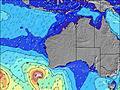 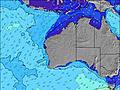 |  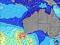 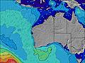 |  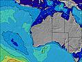 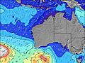 | 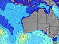 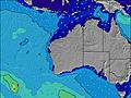 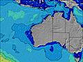 | 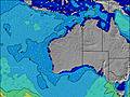 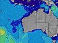 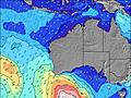 | 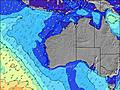 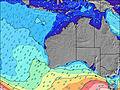 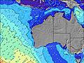 | 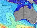 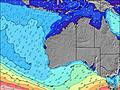 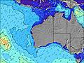 | ||||||||||||||||||||||||||||||||||||||||||||||||||||
| Wave Height (m) & direction (?) | ||||||||||||||||||||||||||||||||||||||||||||||||||||||||||||
| Period(s) (?) | 13 | 13 | 13 | 12 | 12 | 12 | 12 | 15 | 14 | 14 | 13 | 13 | 13 | 13 | 12 | 12 | 12 | 16 | 16 | 15 | 16 | 16 | 16 | 16 | 16 | 16 | 16 | 15 | 15 | 15 | 15 | 15 | 15 | 14 | 14 | 14 | 14 | 14 | 13 | 13 | 13 | 13 | 13 | 12 | 8 | 12 | 13 | 13 | 13 | 14 | 14 | 14 | 16 | 16 | 16 | 16 | 16 | 16 | 16 | 16 |
Wave (?)Graph | ||||||||||||||||||||||||||||||||||||||||||||||||||||||||||||
| Energy (?) | 451 | 431 | 320 | 300 | 397 | 419 | 319 | 142 | 167 | 160 | 299 | 205 | 239 | 196 | 306 | 175 | 137 | 125 | 198 | 242 | 462 | 546 | 619 | 553 | 553 | 636 | 612 | 581 | 499 | 499 | 499 | 485 | 472 | 407 | 401 | 401 | 401 | 384 | 299 | 290 | 286 | 282 | 315 | 248 | 227 | 913 | 1374 | 1619 | 1919 | 2073 | 2357 | 2782 | 3827 | 4242 | 4402 | 4402 | 4076 | 3840 | 3222 | 2453 |
Wind (km/h) | ||||||||||||||||||||||||||||||||||||||||||||||||||||||||||||
| Wind State (?) onshore cross-onshore cross-shore cross-offshore offshore glassy | cross- off | cross- off | cross- off | cross- off | cross- off | cross- off | cross- off | cross- off | off | off | off | off | cross- off | cross- off | off | off | off | off | cross- off | cross- off | cross | cross- off | cross- off | off | off | cross- off | cross- off | cross- on | cross- on | glass | cross- off | glass | glass | glass | cross- on | cross- off | glass | glass | glass | cross- on | on | on | cross- on | on | on | cross- on | on | on | on | cross- on | cross- on | cross | cross | cross- off | cross- off | cross- off | cross- off | cross- off | glass | cross- on |
High Tide / height (m) | 9:31AM 0.74 | 9:59AM 0.79 | 10:31AM 0.79 | 11:04AM 0.76 | 11:34AM 0.71 | 11:49AM 0.63 | 11:34AM 0.56 | 11:16AM 0.50 | ||||||||||||||||||||||||||||||||||||||||||||||||||||
Low Tide / height (m) | 2:02AM 0.34 | 5:46PM 0.00 | 6:44PM -0.00 | 7:58PM 0.02 | 10:02PM 0.05 | 11:36PM 0.08 | 12:33AM 0.11 | 1:09AM 0.15 | ||||||||||||||||||||||||||||||||||||||||||||||||||||
Monday 28 | Tuesday 29 | Wednesday 30 | Thursday 01 | Friday 02 | Saturday 03 | Sunday 04 | Monday 05 | |||||||||||||||||||||||||||||||||||||||||||||||||||||
| Sunrise | - | 6:46 | - | - | - | - | - | - | - | 6:47 | - | - | - | - | - | - | - | 6:47 | - | - | - | - | - | - | - | 6:48 | - | - | - | - | - | - | - | 6:48 | - | - | - | - | - | - | - | 6:48 | - | - | - | - | - | - | - | 6:48 | - | - | - | - | - | - | - | 6:50 | - | - |
| Sunset | - | - | - | - | 5:51 | - | - | - | - | - | - | - | 5:50 | - | - | - | - | - | - | - | 5:49 | - | - | - | - | - | - | - | 5:49 | - | - | - | - | - | - | - | 5:47 | - | - | - | - | - | - | - | 5:46 | - | - | - | - | - | - | - | 5:45 | - | - | - | - | - | - | - |
Rain (mm) | - | - | - | - | - | - | - | - | - | - | - | - | - | - | - | - | - | - | - | - | - | - | - | - | - | - | - | - | - | - | - | - | - | - | - | - | - | - | - | - | - | - | - | - | - | - | - | - | - | - | - | 1 | - | - | - | - | - | - | - | - |
| Temp. °C | 17 | 17 | 23 | 26 | 26 | 24 | 22 | 20 | 19 | 19 | 25 | 27 | 27 | 26 | 24 | 23 | 22 | 21 | 27 | 30 | 29 | 27 | 25 | 24 | 23 | 23 | 29 | 30 | 27 | 24 | 24 | 23 | 23 | 23 | 24 | 23 | 25 | 23 | 22 | 22 | 22 | 22 | 23 | 23 | 22 | 21 | 21 | 20 | 20 | 20 | 20 | 20 | 20 | 18 | 17 | 16 | 15 | 15 | 19 | 20 |
| Feels °C (?) | 12 | 11 | 17 | 21 | 21 | 19 | 17 | 14 | 13 | 12 | 19 | 23 | 23 | 22 | 20 | 17 | 16 | 14 | 21 | 27 | 25 | 23 | 21 | 20 | 16 | 16 | 23 | 25 | 24 | 25 | 25 | 24 | 24 | 23 | 24 | 23 | 26 | 25 | 24 | 23 | 23 | 23 | 22 | 21 | 20 | 21 | 20 | 19 | 20 | 20 | 18 | 17 | 16 | 15 | 15 | 14 | 13 | 13 | 18 | 17 |
- Map Icons:
 Break
Break Live Wave Height (m)
 Live Wind Speed (km/h)
 Surf Rating (10 Max)
 Ocean Swells (m)
- Wind Speed (km/h)
FREE! Surf-Forecast.com widget for your website
The surf report / weather widget below is available to embed on third party websites free of charge and provides a summary of our Glenfield surf forecast. Simply grab the html code snippet that we provide and paste it into your own site. You can choose your preferred language and metric/imperial units for the surf forecast feed to suit users of your site. Click here to get the code.


 Nearest