

- Forecast
- Maps
- Live
- Weather State
- Spot Information
Ile de Re - Rivedoux Surf Forecast
/ Charente Maritime (28 surf breaks) /
Surf Forecasts
Ile de Re - Rivedoux surfForecast / Charente Maritime / France
Forecast update in hr min s Forecast update imminent
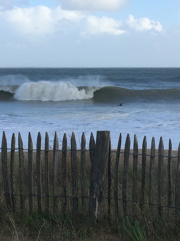
Ile de Re - Rivedoux surf forecast is for near shore open water. Breaking waves will often be smaller at less exposed spots.
Today's Ile de Re - Rivedoux sea temperature is
13.9° C
(Which is 1.4°C warmer than normal for this time of year)How big are the waves at Ile de Re - Rivedoux today?
The current surf forecast for Ile de Re - Rivedoux at 8PM is: 0.8m 13s primary swell from a West-southwest direction (forecast issued at 07:00pm April 19). The wind direction is predicted to be cross-shore.
| Time (CEST) & Date | Wave Height | Wave Period |
|---|---|---|
| Morning (19 Apr) | - | - |
| Afternoon (19 Apr) | 2.5ft (0.8m) | 8s |
| Evening (19 Apr) | 2.5ft (0.8m) | 13s |
Table - waves today at Ile de Re - Rivedoux. (Swell directed towards the surf break)
Updates in hr min s Forecast update imminent
Saturday 19 | Sunday 20 | Monday 21 | Tuesday 22 | Wednesday 23 | Thursday 24 | Friday 25 | Saturday 26 | Sun 27 | ||||||||||||||||||||||||||||||||||||||||||||||||||||
| 5 PM | 8 PM | 11 PM | 2 AM | 5 AM | 8 AM | 11 AM | 2 PM | 5 PM | 8 PM | 11 PM | 2 AM | 5 AM | 8 AM | 11 AM | 2 PM | 5 PM | 8 PM | 11 PM | 2 AM | 5 AM | 8 AM | 11 AM | 2 PM | 5 PM | 8 PM | 11 PM | 2 AM | 5 AM | 8 AM | 11 AM | 2 PM | 5 PM | 8 PM | 11 PM | 2 AM | 5 AM | 8 AM | 11 AM | 2 PM | 5 PM | 8 PM | 11 PM | 2 AM | 5 AM | 8 AM | 11 AM | 2 PM | 5 PM | 8 PM | 11 PM | 2 AM | 5 AM | 8 AM | 11 AM | 2 PM | 5 PM | 8 PM | 11 PM | 2 AM | |
Rating (10 max) | ||||||||||||||||||||||||||||||||||||||||||||||||||||||||||||
Swell Height Map |    |    |    |  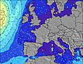 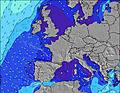 |  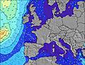  |    |   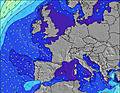 |  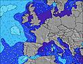 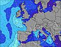 | 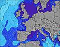 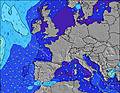 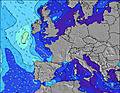 | |||||||||||||||||||||||||||||||||||||||||||||||||||
| Wave Height (m) & direction (?) | ||||||||||||||||||||||||||||||||||||||||||||||||||||||||||||
| Period(s) (?) | 12 | 13 | 13 | 13 | 12 | 6 | 7 | 7 | 12 | 12 | 7 | 7 | 7 | 11 | 11 | 7 | 7 | 7 | 7 | 7 | 7 | 6 | 10 | 10 | 10 | 10 | 10 | 10 | 10 | 10 | 10 | 4 | 6 | 10 | 9 | 10 | 10 | 12 | 10 | 11 | 11 | 11 | 13 | 12 | 12 | 12 | 14 | 14 | 14 | 14 | 14 | 14 | 14 | 14 | 13 | 13 | 13 | 13 | 13 | 12 |
Wave (?)Graph | ||||||||||||||||||||||||||||||||||||||||||||||||||||||||||||
| Energy (?) | 179 | 218 | 303 | 280 | 267 | 164 | 229 | 81 | 294 | 347 | 131 | 131 | 87 | 154 | 91 | 30 | 91 | 18 | 18 | 18 | 11 | 14 | 21 | 36 | 76 | 75 | 35 | 35 | 35 | 54 | 92 | 0 | 0 | 96 | 64 | 67 | 96 | 134 | 141 | 62 | 86 | 40 | 82 | 77 | 47 | 47 | 163 | 160 | 158 | 144 | 145 | 143 | 143 | 143 | 141 | 139 | 417 | 86 | 85 | 78 |
Wind (km/h) | ||||||||||||||||||||||||||||||||||||||||||||||||||||||||||||
| Wind State (?) onshore cross-onshore cross-shore cross-offshore offshore glassy | cross- off | cross | cross | cross- off | cross- off | off | cross- off | cross- off | cross- off | cross- off | cross- off | cross | cross- off | cross- off | cross- off | cross- off | cross | cross | cross | cross- on | cross- on | cross- on | cross- on | cross | cross | cross | cross- on | cross- on | cross- on | cross- on | cross- off | cross- off | cross- off | cross- off | off | cross- off | cross | cross | on | on | on | on | on | on | on | cross- on | cross- on | cross- on | cross- on | on | on | on | on | on | on | on | cross- on | on | on | on |
High Tide / height (m) | 8:39PM 4.89 | 9:11AM 4.55 | 9:43PM 4.62 | 12:31PM 4.44 | 12:58AM 4.68 | 1:47PM 4.69 | 2:05AM 5.01 | 2:41PM 5.04 | 2:56AM 5.40 | 3:26PM 5.41 | 3:41AM 5.78 | 4:07PM 5.75 | 4:22AM 6.08 | 4:44PM 6.02 | ||||||||||||||||||||||||||||||||||||||||||||||
Low Tide / height (m) | 3:31PM 2.46 | 4:02AM 2.45 | 4:26PM 2.68 | 5:04AM 2.60 | 5:33PM 2.77 | 6:18AM 2.58 | 6:50PM 2.65 | 7:35AM 2.32 | 8:03PM 2.30 | 8:40AM 1.90 | 9:03PM 1.83 | 9:34AM 1.44 | 9:55PM 1.34 | 10:22AM 1.03 | 10:43PM 0.93 | |||||||||||||||||||||||||||||||||||||||||||||
Saturday 19 | Sunday 20 | Monday 21 | Tuesday 22 | Wednesday 23 | Thursday 24 | Friday 25 | Saturday 26 | Sun 27 | ||||||||||||||||||||||||||||||||||||||||||||||||||||
| Sunrise | - | - | - | - | - | 7:09 | - | - | - | - | - | - | - | 7:09 | - | - | - | - | - | - | - | 7:07 | - | - | - | - | - | - | - | 7:05 | - | - | - | - | - | - | - | 7:03 | - | - | - | - | - | - | - | 7:01 | - | - | - | - | - | - | - | 7:00 | - | - | - | - | - | - |
| Sunset | - | 8:55 | - | - | - | - | - | - | - | 8:58 | - | - | - | - | - | - | - | 8:59 | - | - | - | - | - | - | - | 9:00 | - | - | - | - | - | - | - | 9:01 | - | - | - | - | - | - | - | 9:02 | - | - | - | - | - | - | - | 9:04 | - | - | - | - | - | - | - | 9:06 | - | - |
Rain (mm) | 1 | 1 | 3 | 5 | 8 | 8 | 11 | 3 | - | 1 | 1 | - | - | - | - | 1 | - | - | - | - | - | - | - | - | - | - | - | - | - | - | - | - | - | 1 | 1 | 1 | - | - | - | - | - | - | - | - | - | - | - | - | - | - | - | - | - | - | - | - | - | - | - | - |
| Temp. °C | 11 | 11 | 11 | 11 | 11 | 11 | 12 | 13 | 13 | 12 | 12 | 12 | 12 | 12 | 12 | 13 | 13 | 12 | 12 | 11 | 11 | 9 | 10 | 12 | 12 | 12 | 12 | 11 | 11 | 11 | 12 | 12 | 11 | 10 | 11 | 13 | 13 | 13 | 11 | 13 | 15 | 14 | 14 | 14 | 12 | 10 | 11 | 15 | 16 | 16 | 16 | 15 | 12 | 10 | 12 | 15 | 14 | 14 | 14 | 13 |
| Feels °C (?) | 4 | 5 | 5 | 4 | 4 | 0 | 7 | 6 | 6 | 4 | 4 | 4 | 4 | 6 | 9 | 8 | 8 | 6 | 7 | 7 | 7 | 6 | 7 | 9 | 7 | 7 | 8 | 8 | 8 | 10 | 10 | 9 | 6 | 6 | 6 | 10 | 10 | 10 | 7 | 8 | 12 | 11 | 10 | 10 | 8 | 6 | 8 | 13 | 13 | 12 | 11 | 10 | 7 | 5 | 8 | 11 | 8 | 10 | 10 | 8 |
- Map Icons:
 Break
Break Live Wave Height (m)
 Live Wind Speed (km/h)
 Surf Rating (10 Max)
 Ocean Swells (m)
- Wind Speed (km/h)
FREE! Surf-Forecast.com widget for your website
The surf report / weather widget below is available to embed on third party websites free of charge and provides a summary of our Ile de Re - Rivedoux surf forecast. Simply grab the html code snippet that we provide and paste it into your own site. You can choose your preferred language and metric/imperial units for the surf forecast feed to suit users of your site. Click here to get the code.


 Nearest