

- Forecast
- Maps
- Live
- Weather State
- Spot Information
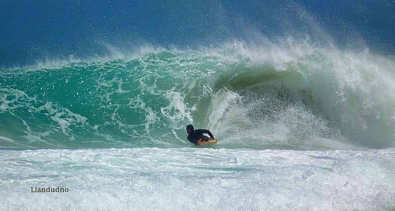
Llandudno Surf Forecast
/ Cape Town (69 surf breaks) /
Surf Forecasts
Llandudno surfForecast / Cape Town / South Africa
Forecast update in hr min s Forecast update imminent
Llandudno surf forecast is for near shore open water. Breaking waves will often be smaller at less exposed spots.
Today's Llandudno sea temperature is
12.9° C
(Which is 4.7°C colder than average for this time of year)How big are the waves at Llandudno today?
The current surf forecast for Llandudno at 12PM is: 2.2m 12s primary swell from a Southwest direction and 0.2m 15s secondary swell from a South direction (forecast issued at 07:00am April 29). The wind direction is predicted to be cross-shore.
| Time (SAST) & Date | Wave Height | Wave Period |
|---|---|---|
| Morning (29 Apr) | 6ft (1.8m) | 13s |
| Afternoon (29 Apr) | 7.5ft (2.3m) | 12s |
| Evening (29 Apr) | 8ft (2.5m) | 12s |
Table - waves today at Llandudno. (Swell directed towards the surf break)
Updates in hr min s Forecast update imminent
Tuesday 29 | Wednesday 30 | Thursday 01 | Friday 02 | Saturday 03 | Sunday 04 | Monday 05 | Tuesday 06 | |||||||||||||||||||||||||||||||||||||||||||||||||||||
| 5 AM | 8 AM | 11 AM | 2 PM | 5 PM | 8 PM | 11 PM | 2 AM | 5 AM | 8 AM | 11 AM | 2 PM | 5 PM | 8 PM | 11 PM | 2 AM | 5 AM | 8 AM | 11 AM | 2 PM | 5 PM | 8 PM | 11 PM | 2 AM | 5 AM | 8 AM | 11 AM | 2 PM | 5 PM | 8 PM | 11 PM | 2 AM | 5 AM | 8 AM | 11 AM | 2 PM | 5 PM | 8 PM | 11 PM | 2 AM | 5 AM | 8 AM | 11 AM | 2 PM | 5 PM | 8 PM | 11 PM | 2 AM | 5 AM | 8 AM | 11 AM | 2 PM | 5 PM | 8 PM | 11 PM | 2 AM | 5 AM | 8 AM | 11 AM | 2 PM | |
Rating (10 max) | ||||||||||||||||||||||||||||||||||||||||||||||||||||||||||||
Swell Height Map |    |    |    |  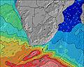 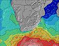 | 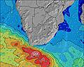 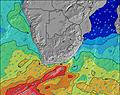 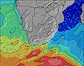 | 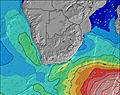 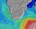 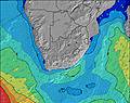 | 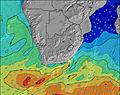 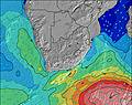 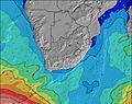 | 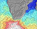 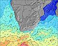 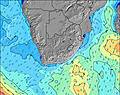 | ||||||||||||||||||||||||||||||||||||||||||||||||||||
| Wave Height (m) & direction (?) | ||||||||||||||||||||||||||||||||||||||||||||||||||||||||||||
| Period(s) (?) | 14 | 13 | 12 | 12 | 12 | 12 | 12 | 12 | 12 | 11 | 13 | 12 | 12 | 12 | 12 | 11 | 13 | 12 | 12 | 12 | 12 | 12 | 11 | 11 | 11 | 11 | 11 | 11 | 11 | 11 | 12 | 11 | 11 | 11 | 11 | 11 | 11 | 11 | 11 | 11 | 11 | 11 | 11 | 11 | 15 | 14 | 14 | 14 | 13 | 13 | 13 | 13 | 13 | 13 | 13 | 12 | 12 | 12 | 10 | 12 |
Wave (?)Graph | ||||||||||||||||||||||||||||||||||||||||||||||||||||||||||||
| Energy (?) | 650 | 809 | 1256 | 1447 | 1444 | 1761 | 2113 | 2483 | 2287 | 2003 | 1321 | 1426 | 923 | 761 | 816 | 984 | 2381 | 3224 | 3151 | 3290 | 3234 | 2797 | 2367 | 2116 | 1987 | 1764 | 1580 | 1643 | 1606 | 1835 | 1784 | 1674 | 1324 | 1081 | 955 | 839 | 731 | 745 | 764 | 675 | 629 | 545 | 478 | 407 | 326 | 389 | 537 | 643 | 768 | 737 | 809 | 835 | 848 | 835 | 775 | 795 | 703 | 626 | 210 | 469 |
Wind (km/h) | ||||||||||||||||||||||||||||||||||||||||||||||||||||||||||||
| Wind State (?) onshore cross-onshore cross-shore cross-offshore offshore glassy | cross | glass | cross | cross | cross- off | cross- off | cross- off | cross- off | cross | cross- off | cross | cross- on | cross- on | cross- on | on | on | on | cross- on | cross- on | cross- on | cross | cross | cross- on | cross- on | cross | cross- off | cross- off | cross- off | cross- off | cross- off | cross- off | cross- off | cross- off | cross- off | glass | glass | cross | cross- off | cross- off | glass | cross- off | off | glass | cross- on | cross | cross- off | cross- off | cross- off | cross- off | cross- off | cross- off | cross | cross- off | cross- off | cross- off | cross- off | cross- off | cross- off | cross- off | cross- off |
High Tide / height (m) | 4:26PM 1.54 | 4:40AM 1.60 | 5:11PM 1.45 | 5:26AM 1.45 | 5:59PM 1.34 | 6:18AM 1.29 | 6:57PM 1.23 | 7:21AM 1.13 | 8:13PM 1.14 | 8:49AM 1.03 | 9:47PM 1.12 | 10:30AM 1.02 | 11:08PM 1.17 | 11:44AM 1.07 | ||||||||||||||||||||||||||||||||||||||||||||||
Low Tide / height (m) | 10:17AM -0.05 | 10:30PM 0.10 | 10:59AM 0.05 | 11:16PM 0.20 | 11:45AM 0.19 | 12:08AM 0.33 | 12:37PM 0.33 | 1:13AM 0.46 | 1:42PM 0.46 | 2:43AM 0.55 | 3:11PM 0.54 | 4:29AM 0.55 | 4:42PM 0.53 | 5:45AM 0.48 | ||||||||||||||||||||||||||||||||||||||||||||||
Tuesday 29 | Wednesday 30 | Thursday 01 | Friday 02 | Saturday 03 | Sunday 04 | Monday 05 | Tuesday 06 | |||||||||||||||||||||||||||||||||||||||||||||||||||||
| Sunrise | - | 7:18 | - | - | - | - | - | - | - | 7:20 | - | - | - | - | - | - | - | 7:20 | - | - | - | - | - | - | - | 7:20 | - | - | - | - | - | - | - | 7:22 | - | - | - | - | - | - | - | 7:22 | - | - | - | - | - | - | - | 7:24 | - | - | - | - | - | - | - | 7:24 | - | - |
| Sunset | - | - | - | - | 6:07 | - | - | - | - | - | - | - | 6:07 | - | - | - | - | - | - | - | 6:06 | - | - | - | - | - | - | - | 6:05 | - | - | - | - | - | - | - | 6:04 | - | - | - | - | - | - | - | 6:02 | - | - | - | - | - | - | - | 6:01 | - | - | - | - | - | - | - |
Rain (mm) | - | - | - | - | - | - | - | - | - | - | - | - | - | - | - | 1 | - | 1 | 1 | - | - | - | - | - | - | - | - | - | - | - | - | - | - | - | - | - | - | - | - | - | - | - | - | - | - | - | - | - | - | - | - | - | - | - | - | - | - | - | - | - |
| Temp. °C | 16 | 17 | 17 | 17 | 17 | 16 | 16 | 15 | 15 | 15 | 15 | 16 | 16 | 15 | 15 | 15 | 15 | 16 | 15 | 15 | 14 | 14 | 14 | 14 | 14 | 14 | 15 | 15 | 14 | 14 | 14 | 13 | 12 | 12 | 14 | 16 | 17 | 17 | 18 | 17 | 17 | 17 | 18 | 21 | 20 | 18 | 19 | 19 | 19 | 18 | 20 | 22 | 19 | 18 | 17 | 17 | 16 | 16 | 17 | 18 |
| Feels °C (?) | 16 | 18 | 15 | 13 | 12 | 12 | 11 | 10 | 10 | 11 | 10 | 11 | 11 | 11 | 12 | 11 | 10 | 11 | 10 | 9 | 9 | 10 | 10 | 9 | 10 | 10 | 10 | 10 | 9 | 8 | 9 | 10 | 9 | 9 | 12 | 14 | 13 | 14 | 16 | 15 | 14 | 14 | 16 | 17 | 16 | 14 | 15 | 15 | 16 | 14 | 17 | 18 | 15 | 15 | 14 | 15 | 13 | 14 | 14 | 15 |
- Map Icons:
 Break
Break Live Wave Height (m)
 Live Wind Speed (km/h)
 Surf Rating (10 Max)
 Ocean Swells (m)
- Wind Speed (km/h)
FREE! Surf-Forecast.com widget for your website
The surf report / weather widget below is available to embed on third party websites free of charge and provides a summary of our Llandudno surf forecast. Simply grab the html code snippet that we provide and paste it into your own site. You can choose your preferred language and metric/imperial units for the surf forecast feed to suit users of your site. Click here to get the code.


 Nearest