

- Forecast
- Maps
- Live
- Weather State
- Spot Information
Madeiro Surf Forecast
/ Rio Grande Do Norte (34 surf breaks) /
Madeiro surfForecast / Rio Grande Do Norte / Brazil
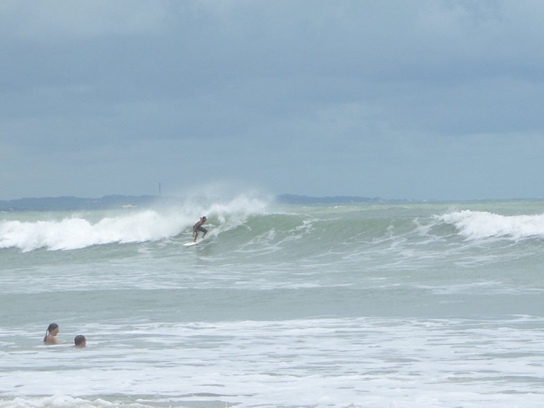
How big are the waves at Madeiro today?
The current surf forecast for Madeiro at 7PM is: 0.7m 9s primary swell from a Northeast direction and 0.1m 10s secondary swell from a Southeast direction, 0.8m 8s secondary swell from a East-southeast direction (forecast issued at 02:00pm March 31). The wind direction is predicted to be cross-shore.
| Time (-03) & Date | Wave Height | Wave Period |
|---|---|---|
| Morning (31 Mar) | - | - |
| Afternoon (31 Mar) | 2.5ft (0.7m) | 9s |
| Evening (31 Mar) | 2.5ft (0.7m) | 9s |
Table - waves today at Madeiro. (Swell directed towards the surf break)
Monday 31 | Tuesday 01 | Wednesday 02 | Thursday 03 | Friday 04 | Saturday 05 | Sunday 06 | Monday 07 | |||||||||||||||||||||||||||||||||||||||||||||||||||||
| 12 PM | 3 PM | 6 PM | 9 PM | 0 AM | 3 AM | 6 AM | 9 AM | 12 PM | 3 PM | 6 PM | 9 PM | 0 AM | 3 AM | 6 AM | 9 AM | 12 PM | 3 PM | 6 PM | 9 PM | 0 AM | 3 AM | 6 AM | 9 AM | 12 PM | 3 PM | 6 PM | 9 PM | 0 AM | 3 AM | 6 AM | 9 AM | 12 PM | 3 PM | 6 PM | 9 PM | 0 AM | 3 AM | 6 AM | 9 AM | 12 PM | 3 PM | 6 PM | 9 PM | 0 AM | 3 AM | 6 AM | 9 AM | 12 PM | 3 PM | 6 PM | 9 PM | 0 AM | 3 AM | 6 AM | 9 AM | 12 PM | 3 PM | 6 PM | 9 PM | |
Rating (10 max) | ||||||||||||||||||||||||||||||||||||||||||||||||||||||||||||
Swell Height Map |    |    |    |   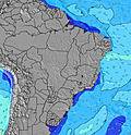 |  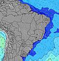 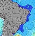 |  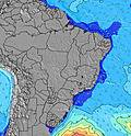 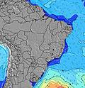 |  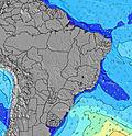 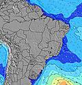 | 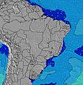 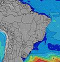 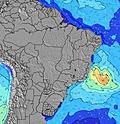 | ||||||||||||||||||||||||||||||||||||||||||||||||||||
| Wave Height (m) & direction (?) | ||||||||||||||||||||||||||||||||||||||||||||||||||||||||||||
| Period(s) (?) | 9 | 9 | 8 | 9 | 6 | 6 | 7 | 7 | 7 | 7 | 7 | 7 | 7 | 7 | 7 | 7 | 7 | 7 | 8 | 8 | 8 | 8 | 9 | 8 | 8 | 7 | 7 | 8 | 8 | 8 | 8 | 8 | 8 | 8 | 8 | 7 | 8 | 8 | 8 | 8 | 8 | 8 | 8 | 7 | 8 | 8 | 8 | 8 | 8 | 8 | 8 | 8 | 16 | 8 | 8 | 8 | 8 | 9 | 9 | 9 |
Wave (?)Graph | ||||||||||||||||||||||||||||||||||||||||||||||||||||||||||||
| Energy (?) | 84 | 83 | 83 | 81 | 90 | 133 | 139 | 147 | 151 | 120 | 97 | 163 | 142 | 100 | 102 | 84 | 74 | 100 | 178 | 111 | 114 | 111 | 96 | 94 | 91 | 117 | 183 | 199 | 199 | 178 | 178 | 178 | 178 | 115 | 329 | 183 | 159 | 113 | 114 | 114 | 118 | 142 | 138 | 131 | 270 | 270 | 315 | 206 | 212 | 206 | 307 | 298 | 182 | 212 | 339 | 190 | 205 | 215 | 311 | 267 |
Wind (km/h) | ||||||||||||||||||||||||||||||||||||||||||||||||||||||||||||
| Wind State (?) onshore cross-onshore cross-shore cross-offshore offshore glassy | cross | cross | cross | cross | cross | cross- off | cross | cross | cross | cross | cross | cross | cross | cross- off | cross- off | cross | cross- on | cross- on | cross | cross- on | cross- on | cross | cross- off | cross | cross | cross | cross | cross | cross | cross | cross | cross | cross | cross | cross | cross | cross- on | cross- on | cross- on | cross | cross- on | cross | cross | cross | cross | cross | cross | cross | cross | cross | cross | cross | cross | cross- off | cross- off | cross | cross | cross- on | cross | cross |
High Tide / height (m) | 5:36PM 2.41 | 5:54AM 2.33 | 6:23PM 2.21 | 6:40AM 2.16 | 7:15PM 1.97 | 7:32AM 1.97 | 8:18PM 1.74 | 8:38AM 1.78 | 9:42PM 1.58 | 10:07AM 1.68 | 11:23PM 1.56 | 11:42AM 1.71 | 12:41AM 1.66 | 12:52PM 1.83 | ||||||||||||||||||||||||||||||||||||||||||||||
Low Tide / height (m) | 11:21AM -0.06 | 11:43PM 0.06 | 12:07PM 0.04 | 12:27AM 0.25 | 12:57PM 0.20 | 1:17AM 0.46 | 1:57PM 0.40 | 2:19AM 0.66 | 3:18PM 0.56 | 3:48AM 0.80 | 4:57PM 0.62 | 5:28AM 0.79 | 6:20PM 0.56 | 6:41AM 0.69 | 7:17PM 0.47 | |||||||||||||||||||||||||||||||||||||||||||||
Monday 31 | Tuesday 01 | Wednesday 02 | Thursday 03 | Friday 04 | Saturday 05 | Sunday 06 | Monday 07 | |||||||||||||||||||||||||||||||||||||||||||||||||||||
| Sunrise | - | - | - | - | - | - | 5:22 | - | - | - | - | - | - | - | 5:22 | - | - | - | - | - | - | - | 5:22 | - | - | - | - | - | - | - | 5:22 | - | - | - | - | - | - | - | 5:22 | - | - | - | - | - | - | - | 5:22 | - | - | - | - | - | - | - | 5:22 | - | - | - | - | - |
| Sunset | - | 5:24 | - | - | - | - | - | - | - | 5:24 | - | - | - | - | - | - | - | 5:24 | - | - | - | - | - | - | - | 5:23 | - | - | - | - | - | - | - | 5:23 | - | - | - | - | - | - | - | 5:22 | - | - | - | - | - | - | - | 5:22 | - | - | - | - | - | - | - | 5:22 | - | - |
Rain (mm) | - | - | - | 1 | 1 | - | - | - | - | - | - | - | - | 1 | 1 | 1 | 1 | 1 | 2 | - | 1 | - | - | - | - | - | - | - | - | 1 | 2 | 2 | 2 | 1 | - | - | - | - | - | 1 | 1 | - | 1 | - | 2 | 1 | 2 | 3 | - | - | - | - | - | 1 | 2 | 2 | - | - | - | - |
| Temp. °C | 29 | 29 | 27 | 27 | 26 | 26 | 26 | 28 | 29 | 29 | 27 | 27 | 26 | 26 | 26 | 28 | 29 | 29 | 27 | 27 | 26 | 26 | 25 | 28 | 28 | 28 | 27 | 26 | 26 | 26 | 26 | 26 | 27 | 26 | 25 | 26 | 26 | 26 | 26 | 27 | 28 | 28 | 27 | 26 | 26 | 26 | 26 | 27 | 29 | 28 | 27 | 27 | 26 | 25 | 25 | 28 | 29 | 28 | 27 | 26 |
| Feels °C (?) | 29 | 30 | 28 | 28 | 27 | 27 | 26 | 27 | 28 | 29 | 28 | 29 | 28 | 29 | 29 | 30 | 31 | 31 | 29 | 29 | 28 | 29 | 27 | 29 | 28 | 29 | 29 | 27 | 27 | 28 | 28 | 27 | 28 | 27 | 27 | 28 | 28 | 28 | 29 | 28 | 29 | 30 | 29 | 28 | 28 | 28 | 28 | 27 | 29 | 28 | 28 | 28 | 28 | 27 | 27 | 28 | 30 | 29 | 29 | 28 |
- Map Icons:
 Break
Break Live Wave Height (m)
 Live Wind Speed (km/h)
 Surf Rating (10 Max)
 Ocean Swells (m)
- Wind Speed (km/h)
FREE! Surf-Forecast.com widget for your website
The surf report / weather widget below is available to embed on third party websites free of charge and provides a summary of our Madeiro surf forecast. Simply grab the html code snippet that we provide and paste it into your own site. You can choose your preferred language and metric/imperial units for the surf forecast feed to suit users of your site. Click here to get the code.


 Nearest