

- Forecast
- Maps
- Live
- Weather State
- Spot Information

Surf Forecasts
Maitencillo surfForecast / Santiago / Chile
Forecast update in hr min s Forecast update imminent
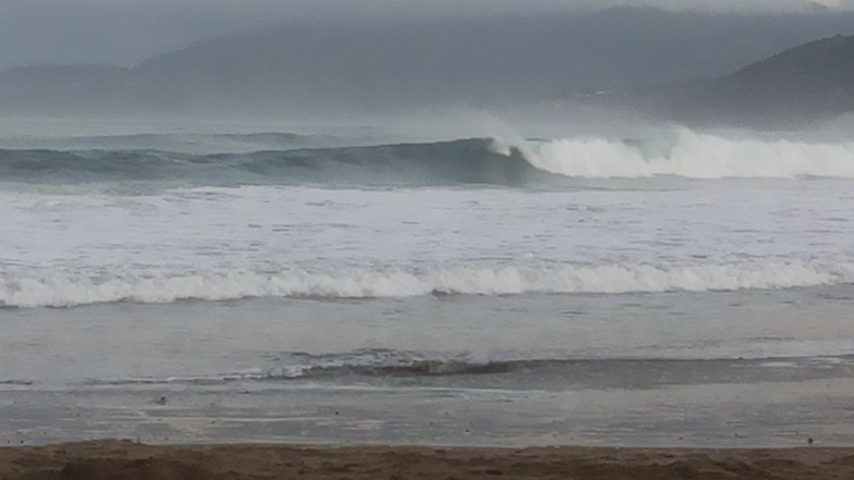
Maitencillo surf forecast is for near shore open water. Breaking waves will often be smaller at less exposed spots.
Today's Maitencillo sea temperature is
13.9° C
(Which is 2.0°C colder than average for this time of year)How big are the waves at Maitencillo today?
The current surf forecast for Maitencillo at 11AM is: 1.1m 19s primary swell from a Southwest direction and 1.8m 11s secondary swell from a Southwest direction (forecast issued at 07:00am April 19). The wind direction is predicted to be cross-onshore and the swell rating is 2.
| Time (-04) & Date | Wave Height | Wave Period |
|---|---|---|
| Morning (19 Apr) | 6ft (1.8m) | 11s |
| Afternoon (19 Apr) | 5ft (1.6m) | 11s |
| Evening (19 Apr) | 3.5ft (1.0m) | 16s |
Table - waves today at Maitencillo. (Swell directed towards the surf break)
Updates in hr min s Forecast update imminent
Saturday 19 | Sunday 20 | Monday 21 | Tuesday 22 | Wednesday 23 | Thursday 24 | Friday 25 | Saturday 26 | |||||||||||||||||||||||||||||||||||||||||||||||||||||
| 5 AM | 8 AM | 11 AM | 2 PM | 5 PM | 8 PM | 11 PM | 2 AM | 5 AM | 8 AM | 11 AM | 2 PM | 5 PM | 8 PM | 11 PM | 2 AM | 5 AM | 8 AM | 11 AM | 2 PM | 5 PM | 8 PM | 11 PM | 2 AM | 5 AM | 8 AM | 11 AM | 2 PM | 5 PM | 8 PM | 11 PM | 2 AM | 5 AM | 8 AM | 11 AM | 2 PM | 5 PM | 8 PM | 11 PM | 2 AM | 5 AM | 8 AM | 11 AM | 2 PM | 5 PM | 8 PM | 11 PM | 2 AM | 5 AM | 8 AM | 11 AM | 2 PM | 5 PM | 8 PM | 11 PM | 2 AM | 5 AM | 8 AM | 11 AM | 2 PM | |
Rating (10 max) | ||||||||||||||||||||||||||||||||||||||||||||||||||||||||||||
Swell Height Map |    |  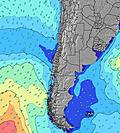 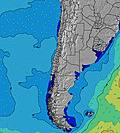 |  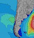 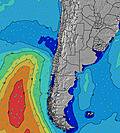 |  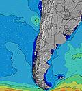 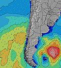 | 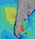 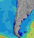 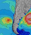 | 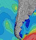 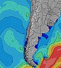 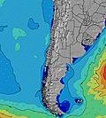 | 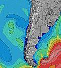 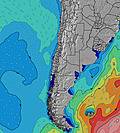 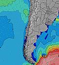 | 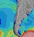 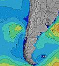 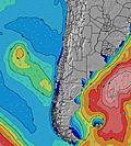 | ||||||||||||||||||||||||||||||||||||||||||||||||||||
| Wave Height (m) & direction (?) | ||||||||||||||||||||||||||||||||||||||||||||||||||||||||||||
| Period(s) (?) | 11 | 11 | 19 | 11 | 11 | 19 | 18 | 18 | 18 | 17 | 16 | 16 | 16 | 16 | 16 | 16 | 15 | 14 | 14 | 14 | 14 | 14 | 13 | 13 | 13 | 19 | 18 | 18 | 17 | 17 | 16 | 16 | 16 | 16 | 15 | 14 | 15 | 16 | 17 | 16 | 16 | 16 | 17 | 18 | 17 | 17 | 17 | 16 | 16 | 16 | 16 | 16 | 16 | 15 | 15 | 15 | 14 | 14 | 14 | 14 |
Wave (?)Graph | ||||||||||||||||||||||||||||||||||||||||||||||||||||||||||||
| Energy (?) | 851 | 821 | 949 | 627 | 584 | 451 | 985 | 1099 | 881 | 1074 | 909 | 1014 | 1109 | 1096 | 1068 | 1041 | 936 | 821 | 821 | 736 | 650 | 696 | 553 | 609 | 600 | 600 | 1162 | 3122 | 3443 | 3496 | 3784 | 2944 | 3483 | 3246 | 2959 | 3154 | 3532 | 4605 | 5628 | 5233 | 4643 | 4869 | 5561 | 5825 | 5758 | 5128 | 4545 | 3818 | 3304 | 2911 | 2354 | 2185 | 2009 | 1932 | 1808 | 1881 | 2082 | 2562 | 2815 | 2842 |
Wind (km/h) | ||||||||||||||||||||||||||||||||||||||||||||||||||||||||||||
| Wind State (?) onshore cross-onshore cross-shore cross-offshore offshore glassy | glass | glass | cross- on | on | on | glass | glass | cross | glass | cross- on | glass | cross- on | cross- on | glass | glass | cross- on | glass | cross- on | cross- on | cross- on | cross- on | glass | glass | glass | glass | glass | cross- on | cross- on | cross- on | cross- on | glass | glass | glass | glass | cross- on | cross- on | cross- on | cross | cross- on | cross- on | glass | glass | cross- on | cross- on | cross- on | glass | glass | glass | glass | glass | cross- on | cross- on | cross- on | cross | cross | cross | cross | cross | cross- on | cross- on |
High Tide / height (m) | 2:02AM 0.70 | 2:17PM 1.12 | 3:21AM 0.65 | 3:26PM 1.09 | 5:05AM 0.66 | 4:43PM 1.10 | 6:20AM 0.74 | 5:52PM 1.14 | 7:08AM 0.86 | 6:50PM 1.20 | 7:48AM 1.01 | 7:41PM 1.25 | 8:26AM 1.17 | 8:30PM 1.27 | 9:04AM 1.33 | |||||||||||||||||||||||||||||||||||||||||||||
Low Tide / height (m) | 7:02AM 0.46 | 9:53PM 0.41 | 7:56AM 0.51 | 11:17PM 0.38 | 9:35AM 0.54 | 12:17AM 0.31 | 11:18AM 0.51 | 1:00AM 0.22 | 12:33PM 0.42 | 1:36AM 0.14 | 1:32PM 0.30 | 2:11AM 0.07 | 2:25PM 0.18 | 2:47AM 0.02 | ||||||||||||||||||||||||||||||||||||||||||||||
Saturday 19 | Sunday 20 | Monday 21 | Tuesday 22 | Wednesday 23 | Thursday 24 | Friday 25 | Saturday 26 | |||||||||||||||||||||||||||||||||||||||||||||||||||||
| Sunrise | - | 7:09 | - | - | - | - | - | - | - | 7:09 | - | - | - | - | - | - | - | 7:11 | - | - | - | - | - | - | - | 7:11 | - | - | - | - | - | - | - | 7:13 | - | - | - | - | - | - | - | 7:13 | - | - | - | - | - | - | - | 7:13 | - | - | - | - | - | - | - | 7:15 | - | - |
| Sunset | - | - | - | - | 6:19 | - | - | - | - | - | - | - | 6:16 | - | - | - | - | - | - | - | 6:15 | - | - | - | - | - | - | - | 6:15 | - | - | - | - | - | - | - | 6:14 | - | - | - | - | - | - | - | 6:13 | - | - | - | - | - | - | - | 6:12 | - | - | - | - | - | - | - |
Rain (mm) | - | - | - | - | - | - | - | - | - | - | - | - | - | - | - | - | - | - | - | - | - | - | - | - | - | - | - | - | - | - | - | - | - | - | - | - | - | - | - | - | - | - | - | - | - | - | - | - | - | - | - | - | - | - | - | - | - | - | - | - |
| Temp. °C | 14 | 14 | 15 | 16 | 15 | 14 | 14 | 14 | 14 | 14 | 16 | 15 | 15 | 14 | 15 | 15 | 16 | 15 | 17 | 17 | 16 | 17 | 16 | 16 | 16 | 17 | 18 | 17 | 17 | 17 | 17 | 16 | 16 | 16 | 18 | 17 | 18 | 18 | 17 | 16 | 16 | 16 | 17 | 17 | 16 | 16 | 17 | 17 | 17 | 17 | 18 | 17 | 16 | 16 | 15 | 14 | 13 | 13 | 15 | 16 |
| Feels °C (?) | 13 | 14 | 13 | 15 | 14 | 14 | 13 | 13 | 14 | 13 | 15 | 13 | 12 | 14 | 15 | 13 | 16 | 14 | 15 | 15 | 15 | 17 | 15 | 16 | 15 | 16 | 16 | 14 | 16 | 17 | 17 | 16 | 17 | 16 | 17 | 16 | 16 | 18 | 17 | 16 | 17 | 16 | 16 | 16 | 15 | 16 | 17 | 17 | 17 | 16 | 15 | 15 | 14 | 14 | 13 | 11 | 11 | 11 | 12 | 11 |
- Map Icons:
 Break
Break Live Wave Height (m)
 Live Wind Speed (km/h)
 Surf Rating (10 Max)
 Ocean Swells (m)
- Wind Speed (km/h)
FREE! Surf-Forecast.com widget for your website
The surf report / weather widget below is available to embed on third party websites free of charge and provides a summary of our Maitencillo surf forecast. Simply grab the html code snippet that we provide and paste it into your own site. You can choose your preferred language and metric/imperial units for the surf forecast feed to suit users of your site. Click here to get the code.


 Nearest