

- Forecast
- Maps
- Live
- Weather State
- Spot Information
Mullaloo Surf Forecast
/ WA – Perth City (29 breaks) / Western Australia (159 breaks) /
Surf Forecasts

Mullaloo surfForecast / WA – Perth City / Australia
Forecast update in hr min s Forecast update imminent
Mullaloo surf forecast is for near shore open water. Breaking waves will often be smaller at less exposed spots.
Today's Mullaloo sea temperature is
22.8° C
(Which is slightly warmer than usual)How big are the waves at Mullaloo today?
The current surf forecast for Mullaloo at 6AM is: 1.2m 13s primary swell from a Southwest direction (forecast issued at 01:00am April 26). An open ocean swell of 0.5m 3s is not directed at the surf break. The wind direction is predicted to be cross-offshore and the swell rating is 3.
| Time (AWST) & Date | Wave Height | Wave Period |
|---|---|---|
| Morning (26 Apr) | 4ft (1.2m) | 13s |
| Afternoon (26 Apr) | 4ft (1.2m) | 13s |
| Evening (26 Apr) | 4ft (1.2m) | 14s |
Table - waves today at Mullaloo. (Swell directed towards the surf break)
Updates in hr min s Forecast update imminent
Saturday 26 | Sunday 27 | Monday 28 | Tuesday 29 | Wednesday 30 | Thursday 01 | Friday 02 | Saturday 03 | |||||||||||||||||||||||||||||||||||||||||||||||||||||
| 11 PM | 2 AM | 5 AM | 8 AM | 11 AM | 2 PM | 5 PM | 8 PM | 11 PM | 2 AM | 5 AM | 8 AM | 11 AM | 2 PM | 5 PM | 8 PM | 11 PM | 2 AM | 5 AM | 8 AM | 11 AM | 2 PM | 5 PM | 8 PM | 11 PM | 2 AM | 5 AM | 8 AM | 11 AM | 2 PM | 5 PM | 8 PM | 11 PM | 2 AM | 5 AM | 8 AM | 11 AM | 2 PM | 5 PM | 8 PM | 11 PM | 2 AM | 5 AM | 8 AM | 11 AM | 2 PM | 5 PM | 8 PM | 11 PM | 2 AM | 5 AM | 8 AM | 11 AM | 2 PM | 5 PM | 8 PM | 11 PM | 2 AM | 5 AM | 8 AM | |
Rating (10 max) | ||||||||||||||||||||||||||||||||||||||||||||||||||||||||||||
Swell Height Map |  |  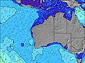 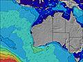 |  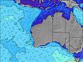 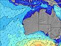 |  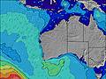 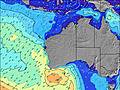 |  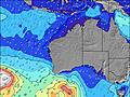 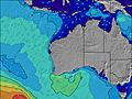 |  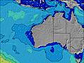 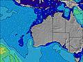 |  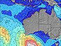 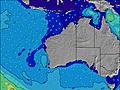 |  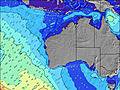 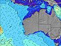 | 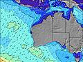 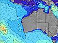 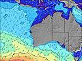 | |||||||||||||||||||||||||||||||||||||||||||||||||||
| Wave Height (m) & direction (?) | ||||||||||||||||||||||||||||||||||||||||||||||||||||||||||||
| Period(s) (?) | 13 | 13 | 13 | 13 | 13 | 13 | 13 | 14 | 14 | 13 | 13 | 13 | 13 | 13 | 13 | 13 | 13 | 13 | 13 | 12 | 12 | 12 | 12 | 11 | 11 | 11 | 11 | 13 | 13 | 13 | 13 | 12 | 12 | 12 | 16 | 16 | 16 | 16 | 16 | 16 | 13 | 15 | 15 | 15 | 15 | 16 | 16 | 15 | 14 | 14 | 14 | 14 | 14 | 13 | 13 | 13 | 13 | 13 | 8 | 8 |
Wave (?)Graph | ||||||||||||||||||||||||||||||||||||||||||||||||||||||||||||
| Energy (?) | 704 | 637 | 511 | 503 | 503 | 503 | 511 | 518 | 518 | 511 | 553 | 488 | 480 | 480 | 444 | 451 | 509 | 501 | 424 | 430 | 373 | 361 | 314 | 223 | 237 | 202 | 172 | 158 | 357 | 189 | 186 | 237 | 180 | 174 | 171 | 217 | 215 | 506 | 512 | 314 | 313 | 624 | 584 | 584 | 632 | 649 | 649 | 600 | 561 | 545 | 530 | 523 | 501 | 412 | 362 | 299 | 290 | 281 | 253 | 253 |
Wind (km/h) | ||||||||||||||||||||||||||||||||||||||||||||||||||||||||||||
| Wind State (?) onshore cross-onshore cross-shore cross-offshore offshore glassy | cross- off | off | cross- off | off | off | cross | cross- on | cross | cross- off | off | cross- off | cross- off | cross- off | cross- on | cross- on | cross | cross- off | cross- off | cross- off | cross- off | cross- off | cross- on | cross- on | cross | off | off | off | off | off | glass | cross- on | cross- off | off | off | off | off | cross- off | cross | cross- on | cross- off | off | off | cross- off | cross- off | cross- off | cross- on | cross- on | glass | cross- off | cross- on | on | cross- on | cross- on | cross- on | on | on | on | on | on | on |
High Tide / height (m) | 8:49PM 0.42 | 8:43AM 0.57 | 10:13PM 0.36 | 8:58AM 0.65 | 9:18AM 0.71 | 9:44AM 0.76 | 10:12AM 0.77 | 10:42AM 0.74 | 11:10AM 0.69 | |||||||||||||||||||||||||||||||||||||||||||||||||||
Low Tide / height (m) | 2:09AM 0.27 | 4:04PM 0.14 | 1:49AM 0.31 | 5:03PM 0.07 | 6:09PM 0.03 | 7:34PM 0.02 | 9:36PM 0.02 | 11:14PM 0.03 | 12:17AM 0.05 | |||||||||||||||||||||||||||||||||||||||||||||||||||
Saturday 26 | Sunday 27 | Monday 28 | Tuesday 29 | Wednesday 30 | Thursday 01 | Friday 02 | Saturday 03 | |||||||||||||||||||||||||||||||||||||||||||||||||||||
| Sunrise | - | - | - | 6:43 | - | - | - | - | - | - | - | 6:45 | - | - | - | - | - | - | - | 6:46 | - | - | - | - | - | - | - | 6:46 | - | - | - | - | - | - | - | 6:47 | - | - | - | - | - | - | - | 6:48 | - | - | - | - | - | - | - | 6:48 | - | - | - | - | - | - | - | 6:48 |
| Sunset | - | - | - | - | - | - | 5:45 | - | - | - | - | - | - | - | 5:44 | - | - | - | - | - | - | - | 5:43 | - | - | - | - | - | - | - | 5:42 | - | - | - | - | - | - | - | 5:40 | - | - | - | - | - | - | - | 5:39 | - | - | - | - | - | - | - | 5:38 | - | - | - | - | - |
Rain (mm) | - | - | - | - | - | - | - | - | - | - | - | - | - | - | - | - | - | - | - | - | - | - | - | - | - | - | - | - | - | - | - | - | - | - | - | - | - | - | - | - | - | - | - | - | - | - | - | - | - | - | - | - | - | - | - | 1 | - | - | - | - |
| Temp. °C | 17 | 15 | 15 | 14 | 18 | 20 | 19 | 18 | 18 | 17 | 16 | 15 | 18 | 19 | 19 | 19 | 18 | 17 | 16 | 15 | 20 | 21 | 20 | 20 | 19 | 19 | 17 | 17 | 22 | 24 | 23 | 22 | 21 | 20 | 19 | 18 | 24 | 26 | 25 | 24 | 22 | 22 | 21 | 20 | 26 | 26 | 23 | 23 | 22 | 21 | 21 | 21 | 21 | 22 | 21 | 21 | 21 | 20 | 21 | 20 |
| Feels °C (?) | 12 | 11 | 11 | 10 | 14 | 17 | 15 | 14 | 15 | 14 | 13 | 12 | 15 | 15 | 15 | 15 | 15 | 13 | 13 | 12 | 17 | 18 | 16 | 17 | 16 | 15 | 13 | 12 | 18 | 22 | 19 | 18 | 17 | 15 | 14 | 12 | 19 | 23 | 21 | 21 | 18 | 18 | 16 | 15 | 22 | 23 | 22 | 24 | 22 | 22 | 22 | 18 | 17 | 20 | 19 | 18 | 19 | 19 | 19 | 17 |
- Map Icons:
 Break
Break Live Wave Height (m)
 Live Wind Speed (km/h)
 Surf Rating (10 Max)
 Ocean Swells (m)
- Wind Speed (km/h)
FREE! Surf-Forecast.com widget for your website
The surf report / weather widget below is available to embed on third party websites free of charge and provides a summary of our Mullaloo surf forecast. Simply grab the html code snippet that we provide and paste it into your own site. You can choose your preferred language and metric/imperial units for the surf forecast feed to suit users of your site. Click here to get the code.


 Nearest