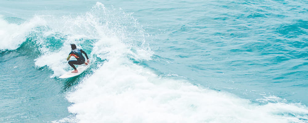

Surf Forecasts:

Nanwan Beach (South Bay) surf forecast from 3 Aug 2026:
- Best quality surf: Sunday 9 Aug, 8AM (local time) - 11ft (3.5m), 9s period, WSW swell with cross-offshore winds.
- Most powerful swell: Monday 10 Aug, 11AM (local time) - 13ft (4.0m), 10s period, WSW swell with 3,371 kJ wave energy.
- Next surfable swell (1★+): Monday 3 Aug, 5PM (local time) - 3ft (0.9m), 16s period with E swell.
Best Forecast Surf Conditions for Nanwan Beach (South Bay) this week:
The surf forecast for Nanwan Beach (South Bay) over the next 16 days: The first swell (rated 1 star or higher) is forecast to arrive on Monday (Aug 03) at 5PM. The primary swell is predicted to be 0.9m and 16s period with a secondary swell of 0.5m and 7s. Another secondary swell of 1.0m and 6s is also forecast. The wind is predicted to be cross-offshore as the swell arrives.
The most powerful waves expected at Nanwan Beach (South Bay) in the next 16 days are 4.0m 10s and forecast to arrive on Monday (Aug 10) at 11AM. Winds are predicted to be cross-offshore at the time the swell arrives. The largest open ocean swell (not directed at the beach) is 3.0m 18s period and expected on Thursday (Aug 06) at 5PM.
| Wave Type | Time (CST) & Date | Wave Height & Period |
|---|---|---|
| Next good surf (1 star+) | 5PM (Mon 3rd Aug) | 3ft (0.9m) 16s |
| Best Surf | 8AM (Sun 9th Aug) | 11ft (3.5m) 9s |
| Most Powerful | 11AM (Mon 10th Aug) | 13ft (4.0m) 10s |
Table - best surf conditions forecast for Nanwan Beach (South Bay) over the next 16 days.
The Lowdown
Alright, Rusty here, and I've been staring at the charts for Nanwan Beach (South Bay). Let’s get into it.
Right off the bat, we’ve got a bit of a late start. Nothing worth paddling out for right this minute, but the good stuff starts to build from Monday 3rd August. The water temp is sitting at 85°, which is pretty much what you’d expect for this time of year – nothing weird going on there.
Monday 3rd August kicks off with a tiny, clean 2ft easterly swell, but the combined energy is still weak (323). It’s more of a longboard cruise than a proper session. The afternoon picks up to 3ft with a 16-second period, and the energy bumps up to a moderate 504, making it a bit more interesting.
Now, Tuesday 4th August is where it starts to get good. The morning swell builds to 4ft from the east, period hanging at 16 seconds, with the combined energy jumping to 905 (moderate). But the real standout is Tuesday afternoon. The swell hits 5ft from the east with that long 16-second period, and the wind goes glassy – dead calm. The energy is solid at 1174. That is the pick of the first part of the week. Clean, lined-up waves with that long period groundswell will be running nicely along the beach and reef setup. Keep an eye on the crowds though – this spot can get busy, and with conditions like that, everyone will be out.
Wednesday 5th August is the big one for experienced surfers. The swell pushes up to 6ft from the east, with a very long 17-second period. The combined energy is roaring at 2207 (strong). The morning looks cross-off with a light W wind, so the waves will be holding shape. This is excellent surf, but it's getting into that size range where it's too much for beginners. If you know what you're doing, this Wednesday morning is the absolute highlight of the entire forecast. The afternoon stays solid at 6ft with similar energy.
Then things go downhill fast. From Thursday 6th August through to the end of the first week, the wind swings onshore and absolutely howls. The swell changes direction to the WSW and the period drops to a weak 8 seconds. By Friday 7th, the wind is 31 mph and the wave quality is just poor. Sure, the swell size climbs, but with that wind? Forget it.
The second week gets wild but unrideable. From Sunday 9th August through to Wednesday 13th August, we’re looking at 15ft to 16ft swell, with combined energy readings of 4000 to nearly 7000 – that's strong to very strong energy. But it's accompanied by 28–34 mph winds and cross-shore conditions. This is not paddle surfing territory. At a beach and reef setup like this, it's a kite surfer's dream, not ours. Even on Thursday 13th, when the wind eases to 19 mph, the swell is still 12ft – too big and messy.
The tail end of the forecast, from Friday 14th August onwards, sees the swell slowly dropping back down to 5ft to 7ft, with clean conditions and light winds. The combined energy drops back to moderate levels. The Sunday 16th afternoon and Tuesday 18th afternoon look promising again, with that 5ft southwest swell and some glassy conditions, but it’s a distant promise after the stormy middle of the month.
The Standouts: Wednesday morning 5th August for the experienced crew – 6ft, 17-second east groundswell, and clean conditions. And for the more relaxed surfer, Tuesday afternoon 4th August – 5ft, 16-second swell with glassy wind. That's your window.
Rusty.
Short Range ForecastMostly dry. Warm (max 30°C on Mon afternoon, min 27°C on Mon night). Wind will be generally light. | Days 5-7 Weather SummaryMostly dry. Warm (max 30°C on Sat night, min 28°C on Thu night). Winds increasing (light winds from the WNW on Thu night, strong winds from the WNW by Sat night). | |||||||||||||||||||
Mon 3 | Tuesday 4 | Wednesday 5 | Thursday 6 | Friday 7 | Saturday 8 | Sunday 9 | ||||||||||||||
PM | Night | AM | PM | Night | AM | PM | Night | AM | PM | Night | AM | PM | Night | AM | PM | Night | AM | PM | Night | |
Swell Height Map | 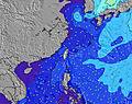 | 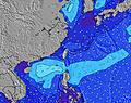 | 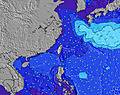 | 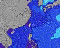 | 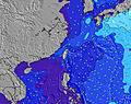 | 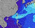 | 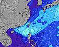 | |||||||||||||
Wave Height (m) Direction Period (s) | E 16 | E 16 | E 16 | E 16 | E 18 | E 17 | E 17 | SSW 8 | WSW 8 | SW 8 | SW 9 | SW 9 | SW 9 | ENE 16 | WSW 7 | WSW 7 | SW 9 | WSW 9 | SW 10 | SW 10 |
Wave Graph | ||||||||||||||||||||
412 | 705 | 822 | 1106 | 1561 | 2196 | 2023 | 43 | 105 | 132 | 107 | 211 | 255 | 0 | 537 | 637 | 1710 | 2210 | 2402 | 2749 | |
Wind (km/h) | ||||||||||||||||||||
Wind State on-shore cross-onshore cross-shore cross-offshore off-shore glassy | cross-off | cross-off | cross-off | cross-off | cross-off | glassy | cross-off | cross-off | cross-off | cross-off | cross-off | cross-off | cross-off | cross-off | cross-off | cross-off | cross-off | cross-off | cross-off | cross-off |
High Tide | 10:03PM0.79m | 9:57AM0.86m | 10:43PM0.86m | 10:48AM0.72m | 11:31PM0.93m | 12:04PM0.58m | 00:31AM0.99m | 2:26PM0.49m | 1:43AM1.07m | 5:31PM0.49m | 2:58AM1.15m | 6:13PM0.51m | 4:05AM1.24m | |||||||
Low Tide | 3:56PM0.26m | 3:48AM0.37m | 4:18PM0.31m | 5:01AM0.38m | 4:40PM0.37m | 6:37AM0.37m | 5:03PM0.41m | 8:36AM0.31m | 5:28PM0.46m | 10:14AM0.20m | 6:01PM0.49m | 11:21AM0.09m | 8:02PM0.49m | |||||||
— | — | 5:30 | — | — | 5:30 | — | — | 5:31 | — | — | 5:31 | — | — | 5:31 | — | — | 5:31 | — | — | |
6:36 | — | — | 6:35 | — | — | 6:34 | — | — | 6:34 | — | — | 6:32 | — | — | 6:32 | — | — | 6:31 | — | |
mm | — | — | — | — | — | — | — | — | — | — | — | — | — | — | — | — | — | — | — | 3 |
Temp °C | 30 | 28 | 29 | 30 | 28 | 29 | 29 | 29 | 29 | 29 | 29 | 29 | 29 | 29 | 29 | 29 | 30 | 30 | 31 | 30 |
Feels °C | 32 | 31 | 30 | 33 | 31 | 34 | 33 | 34 | 32 | 31 | 33 | 28 | 27 | 29 | 28 | 28 | 28 | 29 | 30 | 29 |
Swell 1 Height (m) Direction Period (s) | E 16 | E 16 | E 16 | E 16 | E 18 | E 17 | E 17 | ENE 18 | ENE 19 | ENE 18 | ENE 18 | ENE 17 | ENE 17 | ENE 16 | NE 16 | NE 16 | NE 16 | NE 16 | NE 16 | NE 16 |
412 | 705 | 822 | 1106 | 1561 | 2196 | 2023 | 2552 | 4674 | 5032 | 5221 | 4959 | 5016 | 2663 | 1384 | 1410 | 1552 | 1685 | 1420 | 1101 | |
Swell 2 Height (m) Direction Period (s) | SW 7 | WSW 7 | SW 7 | SE 7 | SW 7 | SW 7 | S 8 | SSW 8 | — | — | SW 9 | SW 9 | SW 9 | — | — | SSW 10 | — | SSE 10 | SSE 10 | SSE 10 |
26 | 19 | 12 | 31 | 12 | 11 | 12 | 43 | — | — | 107 | 211 | 255 | — | — | 163 | — | 11 | 11 | 11 | |
Swell 3 Height (m) Direction Period (s) | E 8 | E 8 | E 8 | SW 7 | SW 7 | — | SSW 8 | NE 19 | — | — | — | — | — | — | — | — | — | — | — | E 15 |
6 | 5 | 5 | 12 | 12 | — | 13 | 56 | — | — | — | — | — | — | — | — | — | — | — | 17 | |
Wind waves Height (m) Direction Period (s) | E 6 | E 6 | E 6 | E 5 | ESE 6 | — | WSW 6 | — | WSW 8 | SW 8 | WNW 4 | WNW 6 | WNW 6 | WSW 5 | WSW 7 | WSW 7 | SW 9 | WSW 9 | SW 10 | SW 10 |
62 | 89 | 71 | 27 | 26 | — | 13 | — | 105 | 132 | 40 | 168 | 154 | 186 | 537 | 637 | 1710 | 2210 | 2402 | 2749 | |
Nearest Offshore or Glassy | ||||||||||||||||||||
Distance (km) | 676 | 0 | 0 | 0 | 0 | 0 | 0 | 0 | 2 | 676 | 2 | 148 | 79 | 538 | 148 | 535 | 148 | 148 | 442 | 148 |
Best forecast wave conditions in South Taiwan | ||||||||||||||||||||
Best forecast wave conditions in Taiwan | ||||||||||||||||||||
Header Global | ||||||||||||||||||||
- Map Icons:
 Break
Break Live Wave Height (m)
 Live Wind Speed (km/h)
 Surf Rating (10 Max)
 Ocean Swells (m)
- Wind Speed (km/h)
Latest Updates


FREE! Surf-Forecast.com widget for your website
The surf report / weather widget below is available to embed on third party websites free of charge and provides a summary of our Nanwan Beach (South Bay) surf forecast. Simply grab the html code snippet that we provide and paste it into your own site. You can choose your preferred language and metric/imperial units for the surf forecast feed to suit users of your site. Click here to get the code.
Information about the Nanwan Beach (South Bay) Surf forecast
The above surf forecast table for Nanwan Beach (South Bay) provides essential information for determining whether the surfing conditions will be good over the next 16 days. A general guide to surfing at Nanwan Beach (South Bay) can be found by selecting the local surf guide option on the grey menu. Our Nanwan Beach (South Bay) surf forecast is unique since it includes wave energy (power) that defines the real feel of the surf rather than just the height or the period. If you surf the same spot (Nanwan Beach (South Bay)) regularly then make a mental note of the wave energy from the surf forecast table each time you go. Very soon you may start to choose your surf days based on the wave energy alone combined with our forecast of favourable offshore wind conditions. Our star ratings will help here and of course you will also find the usual wave height and period predictions on our surf forecasts as well as a full break down of the swell components under our advanced users option (to reveal that, click the little Einstein character under the tide times).
Further information to help with frequently asked questions about our surf forecast for Nanwan Beach (South Bay) may be found under the help tab on the top menu and also by moving your mouse over the question marks on the surf forecast table itself. Please always bear in mind that the forecast is for near-shore open water and local factors at each surf break influence the actual breaking wave height, such as the beach / reef profile, water depths offshore and shelter.
 Nearest