

- Forecast
- Maps
- Live
- Weather State
- Spot Information
Pacific City/Cape Kiwanda Surf Forecast
/ Oregon North (24 breaks) / Oregon (49 breaks) /
Pacific City/Cape Kiwanda surfForecast / Oregon North / USA
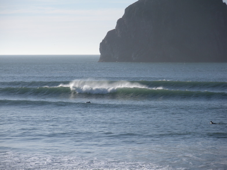
How big are the waves at Pacific City/Cape Kiwanda today?
The current surf forecast for Pacific City/Cape Kiwanda at 12PM is: 3.0m 13s primary swell from a Northwest direction and 0.4m 13s secondary swell from a Southwest direction (forecast issued at 10:00am April 16). The wind direction is predicted to be cross-onshore and the swell rating is 2.
| Time (PDT) & Date | Wave Height | Wave Period |
|---|---|---|
| Morning (16 Apr) | 10ft (3.0m) | 14s |
| Afternoon (16 Apr) | 10ft (3.0m) | 13s |
| Evening (16 Apr) | 8ft (2.5m) | 12s |
Table - waves today at Pacific City/Cape Kiwanda. (Swell directed towards the surf break)
Wednesday 16 | Thursday 17 | Friday 18 | Saturday 19 | Sunday 20 | Monday 21 | Tuesday 22 | Wednesday 23 | |||||||||||||||||||||||||||||||||||||||||||||||||||||
| 8 AM | 11 AM | 2 PM | 5 PM | 8 PM | 11 PM | 2 AM | 5 AM | 8 AM | 11 AM | 2 PM | 5 PM | 8 PM | 11 PM | 2 AM | 5 AM | 8 AM | 11 AM | 2 PM | 5 PM | 8 PM | 11 PM | 2 AM | 5 AM | 8 AM | 11 AM | 2 PM | 5 PM | 8 PM | 11 PM | 2 AM | 5 AM | 8 AM | 11 AM | 2 PM | 5 PM | 8 PM | 11 PM | 2 AM | 5 AM | 8 AM | 11 AM | 2 PM | 5 PM | 8 PM | 11 PM | 2 AM | 5 AM | 8 AM | 11 AM | 2 PM | 5 PM | 8 PM | 11 PM | 2 AM | 5 AM | 8 AM | 11 AM | 2 PM | 5 PM | |
Rating (10 max) | ||||||||||||||||||||||||||||||||||||||||||||||||||||||||||||
Swell Height Map |  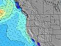 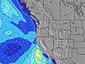 |  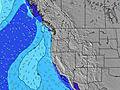  |  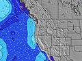 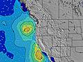 | 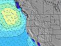 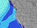  |    | 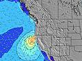 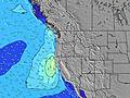 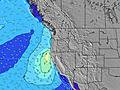 | 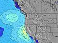 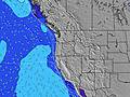  |   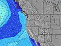 | ||||||||||||||||||||||||||||||||||||||||||||||||||||
| Wave Height (m) & direction (?) | ||||||||||||||||||||||||||||||||||||||||||||||||||||||||||||
| Period(s) (?) | 14 | 13 | 13 | 13 | 12 | 12 | 12 | 12 | 11 | 11 | 11 | 11 | 10 | 10 | 10 | 10 | 13 | 13 | 14 | 13 | 13 | 13 | 12 | 7 | 8 | 9 | 9 | 9 | 9 | 9 | 11 | 10 | 8 | 12 | 12 | 11 | 11 | 11 | 11 | 11 | 10 | 10 | 10 | 10 | 10 | 10 | 10 | 9 | 9 | 9 | 9 | 8 | 7 | 7 | 7 | 7 | 7 | 11 | 11 | 11 |
Wave (?)Graph | ||||||||||||||||||||||||||||||||||||||||||||||||||||||||||||
| Energy (?) | 3647 | 3292 | 3028 | 2711 | 2267 | 1880 | 1655 | 1447 | 1065 | 862 | 777 | 698 | 478 | 416 | 380 | 303 | 137 | 178 | 331 | 273 | 414 | 437 | 377 | 353 | 551 | 828 | 508 | 866 | 747 | 686 | 516 | 348 | 522 | 1064 | 1026 | 974 | 940 | 890 | 873 | 831 | 815 | 784 | 739 | 800 | 777 | 761 | 646 | 632 | 542 | 459 | 449 | 383 | 365 | 233 | 211 | 168 | 234 | 471 | 515 | 671 |
Wind (km/h) | ||||||||||||||||||||||||||||||||||||||||||||||||||||||||||||
| Wind State (?) onshore cross-onshore cross-shore cross-offshore offshore glassy | cross | cross- on | cross- on | cross- on | cross | cross- off | cross- off | cross- off | off | cross- off | cross- on | cross | cross | cross- off | cross- off | glass | glass | cross- on | cross- on | cross- on | cross | cross | cross- on | cross | cross | cross- on | cross- on | cross- on | cross- on | cross | cross | glass | glass | on | cross- on | cross- on | cross- on | cross | cross | cross | cross | cross | cross- on | cross | cross | cross | cross- off | cross- off | cross- off | cross | cross- on | cross | cross | cross | cross- off | off | glass | cross- on | cross- on | cross |
High Tide / height (m) | 4:11PM 1.67 | 2:55AM 2.16 | 5:04PM 1.58 | 3:31AM 2.09 | 6:07PM 1.51 | 4:16AM 2.01 | 7:20PM 1.49 | 5:14AM 1.92 | 8:27PM 1.54 | 6:30AM 1.85 | 9:16PM 1.65 | 7:53AM 1.82 | 9:54PM 1.80 | 9:11AM 1.85 | ||||||||||||||||||||||||||||||||||||||||||||||
Low Tide / height (m) | 9:47AM -0.05 | 9:17PM 0.87 | 10:29AM -0.02 | 9:51PM 0.95 | 11:18AM 0.03 | 10:35PM 1.01 | 12:16PM 0.06 | 11:39PM 1.05 | 1:19PM 0.07 | 1:09AM 1.03 | 2:22PM 0.06 | 2:38AM 0.91 | 3:18PM 0.04 | 3:48AM 0.69 | 4:08PM 0.05 | |||||||||||||||||||||||||||||||||||||||||||||
Wednesday 16 | Thursday 17 | Friday 18 | Saturday 19 | Sunday 20 | Monday 21 | Tuesday 22 | Wednesday 23 | |||||||||||||||||||||||||||||||||||||||||||||||||||||
| Sunrise | 6:28 | - | - | - | - | - | - | - | 6:26 | - | - | - | - | - | - | - | 6:26 | - | - | - | - | - | - | - | 6:24 | - | - | - | - | - | - | - | 6:22 | - | - | - | - | - | - | - | 6:20 | - | - | - | - | - | - | - | 6:18 | - | - | - | - | - | - | - | 6:16 | - | - | - |
| Sunset | - | - | - | - | 8:01 | - | - | - | - | - | - | - | 8:02 | - | - | - | - | - | - | - | 8:05 | - | - | - | - | - | - | - | 8:06 | - | - | - | - | - | - | - | 8:07 | - | - | - | - | - | - | - | 8:07 | - | - | - | - | - | - | - | 8:09 | - | - | - | - | - | - | - |
Rain (mm) | - | - | - | - | - | - | - | - | - | - | - | - | - | - | - | - | - | - | - | - | - | - | 1 | - | - | - | - | - | - | - | - | - | 1 | - | - | - | - | - | - | - | - | - | - | - | - | - | - | - | - | - | - | - | - | - | - | - | - | - | - | - |
| Temp. °C | 8 | 10 | 10 | 9 | 8 | 7 | 7 | 8 | 9 | 16 | 15 | 13 | 11 | 10 | 9 | 8 | 9 | 11 | 11 | 10 | 9 | 9 | 9 | 8 | 8 | 9 | 9 | 9 | 8 | 8 | 8 | 8 | 8 | 9 | 10 | 10 | 9 | 8 | 8 | 8 | 9 | 9 | 10 | 9 | 8 | 8 | 6 | 5 | 7 | 10 | 10 | 10 | 9 | 8 | 6 | 5 | 6 | 10 | 11 | 11 |
| Feels °C (?) | 5 | 6 | 6 | 6 | 4 | 5 | 4 | 4 | 5 | 12 | 10 | 8 | 7 | 7 | 6 | 6 | 7 | 8 | 7 | 7 | 6 | 6 | 3 | 2 | 3 | 4 | 4 | 4 | 4 | 4 | 5 | 6 | 7 | 6 | 7 | 6 | 5 | 4 | 4 | 4 | 4 | 4 | 4 | 3 | 3 | 3 | 2 | 2 | 4 | 5 | 4 | 4 | 4 | 4 | 3 | 3 | 4 | 7 | 6 | 7 |
- Map Icons:
 Break
Break Live Wave Height (m)
 Live Wind Speed (km/h)
 Surf Rating (10 Max)
 Ocean Swells (m)
- Wind Speed (km/h)
FREE! Surf-Forecast.com widget for your website
The surf report / weather widget below is available to embed on third party websites free of charge and provides a summary of our Pacific City/Cape Kiwanda surf forecast. Simply grab the html code snippet that we provide and paste it into your own site. You can choose your preferred language and metric/imperial units for the surf forecast feed to suit users of your site. Click here to get the code.


 Nearest