

- Forecast
- Maps
- Live
- Weather State
- Spot Information
Paea Surf Forecast
/ Tahiti (22 surf breaks) /
Paea surfForecast / Tahiti / French Polynesia
How big are the waves at Paea today?
The current surf forecast for Paea at 1AM is: 1.4m 15s primary swell from a South-southwest direction and 1.9m 9s secondary swell from a Southeast direction (forecast issued at 07:00pm April 21). An open ocean swell of 0.3m 8s is not directed at the surf break. The wind direction is predicted to be cross-offshore.
| Time (-10) & Date | Wave Height | Wave Period |
|---|---|---|
| Morning (22 Apr) | 4ft (1.2m) | 15s |
| Afternoon (22 Apr) | 2.5ft (0.8m) | 20s |
| Evening (22 Apr) | 3.5ft (1.0m) | 19s |
Table - waves today at Paea. (Swell directed towards the surf break)
Monday 21 | Tuesday 22 | Wednesday 23 | Thursday 24 | Friday 25 | Saturday 26 | Sunday 27 | Monday 28 | Tue 29 | ||||||||||||||||||||||||||||||||||||||||||||||||||||
| 5 PM | 8 PM | 11 PM | 2 AM | 5 AM | 8 AM | 11 AM | 2 PM | 5 PM | 8 PM | 11 PM | 2 AM | 5 AM | 8 AM | 11 AM | 2 PM | 5 PM | 8 PM | 11 PM | 2 AM | 5 AM | 8 AM | 11 AM | 2 PM | 5 PM | 8 PM | 11 PM | 2 AM | 5 AM | 8 AM | 11 AM | 2 PM | 5 PM | 8 PM | 11 PM | 2 AM | 5 AM | 8 AM | 11 AM | 2 PM | 5 PM | 8 PM | 11 PM | 2 AM | 5 AM | 8 AM | 11 AM | 2 PM | 5 PM | 8 PM | 11 PM | 2 AM | 5 AM | 8 AM | 11 AM | 2 PM | 5 PM | 8 PM | 11 PM | 2 AM | |
Rating (10 max) | ||||||||||||||||||||||||||||||||||||||||||||||||||||||||||||
Swell Height Map |   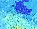 |    |   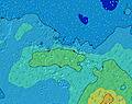 | 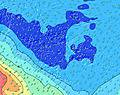  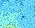 | 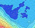   |  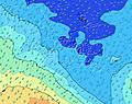 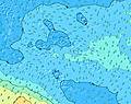 | 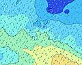 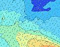 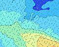 | 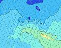 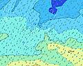 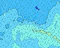 | 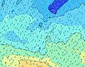   | |||||||||||||||||||||||||||||||||||||||||||||||||||
| Wave Height (m) & direction (?) | ||||||||||||||||||||||||||||||||||||||||||||||||||||||||||||
| Period(s) (?) | 16 | 16 | 15 | 15 | 15 | 15 | 15 | 20 | 20 | 19 | 18 | 18 | 18 | 17 | 16 | 16 | 16 | 16 | 15 | 15 | 15 | 14 | 14 | 14 | 13 | 13 | 13 | 14 | 14 | 13 | 13 | 13 | 13 | 12 | 12 | 12 | 12 | 18 | 18 | 17 | 16 | 16 | 16 | 16 | 22 | 21 | 20 | 19 | 19 | 18 | 17 | 17 | 16 | 16 | 16 | 16 | 15 | 15 | 14 | 14 |
Wave (?)Graph | ||||||||||||||||||||||||||||||||||||||||||||||||||||||||||||
| Energy (?) | 1239 | 1055 | 867 | 816 | 706 | 596 | 573 | 512 | 634 | 736 | 785 | 799 | 919 | 809 | 916 | 905 | 882 | 839 | 636 | 543 | 619 | 443 | 411 | 388 | 299 | 295 | 295 | 249 | 308 | 295 | 286 | 225 | 222 | 190 | 187 | 184 | 192 | 209 | 273 | 373 | 525 | 768 | 933 | 519 | 628 | 1646 | 2925 | 3727 | 3575 | 3366 | 3520 | 6044 | 5022 | 2940 | 3330 | 3054 | 2383 | 1877 | 1614 | 1303 |
Wind (km/h) | ||||||||||||||||||||||||||||||||||||||||||||||||||||||||||||
| Wind State (?) onshore cross-onshore cross-shore cross-offshore offshore glassy | cross- off | cross- off | cross- off | cross- off | cross- off | cross- off | cross- off | cross- off | cross- off | cross- off | cross- off | cross- off | cross- off | cross- off | off | off | off | off | off | cross- off | cross- off | cross- off | cross- off | cross- off | cross- off | cross- off | cross- off | cross- off | cross- off | cross- off | cross- off | cross- off | cross | cross | cross | cross | cross | cross | cross- on | cross- on | on | on | on | on | cross- on | cross | cross | cross | cross | cross | cross | cross | cross | cross | cross | cross | cross | cross | cross | cross |
High Tide / height (m) | 9:57PM 0.22 | 10:24AM 0.22 | 10:15PM 0.26 | 10:33AM 0.25 | 10:38PM 0.30 | 10:49AM 0.27 | 11:04PM 0.33 | 11:09AM 0.29 | 11:32PM 0.35 | 11:31AM 0.31 | 12:01AM 0.35 | 11:57AM 0.32 | 12:31AM 0.33 | 12:24PM 0.32 | 1:01AM 0.30 | |||||||||||||||||||||||||||||||||||||||||||||
Low Tide / height (m) | 4:27PM 0.13 | 4:27AM 0.09 | 4:15PM 0.10 | 4:38AM 0.07 | 4:27PM 0.07 | 4:57AM 0.06 | 4:48PM 0.04 | 5:19AM 0.05 | 5:14PM 0.02 | 5:43AM 0.04 | 5:44PM -0.00 | 6:08AM 0.04 | 6:16PM -0.01 | 6:33AM 0.05 | 6:49PM -0.01 | |||||||||||||||||||||||||||||||||||||||||||||
Monday 21 | Tuesday 22 | Wednesday 23 | Thursday 24 | Friday 25 | Saturday 26 | Sunday 27 | Monday 28 | Tue 29 | ||||||||||||||||||||||||||||||||||||||||||||||||||||
| Sunrise | - | - | - | - | - | 6:09 | - | - | - | - | - | - | - | 6:09 | - | - | - | - | - | - | - | 6:09 | - | - | - | - | - | - | - | 6:09 | - | - | - | - | - | - | - | 6:09 | - | - | - | - | - | - | - | 6:09 | - | - | - | - | - | - | - | 6:09 | - | - | - | - | - | - |
| Sunset | 5:45 | - | - | - | - | - | - | - | 5:44 | - | - | - | - | - | - | - | 5:43 | - | - | - | - | - | - | - | 5:43 | - | - | - | - | - | - | - | 5:42 | - | - | - | - | - | - | - | 5:40 | - | - | - | - | - | - | - | 5:40 | - | - | - | - | - | - | - | 5:39 | - | - | - |
Rain (mm) | 4 | 4 | 3 | 4 | 4 | 4 | 3 | 2 | 1 | 1 | 2 | 2 | 2 | 2 | 1 | - | 3 | 3 | 2 | 1 | 1 | 2 | 1 | 3 | 2 | 2 | 1 | 2 | 2 | 1 | 2 | 1 | 1 | - | - | - | 1 | 1 | 3 | - | - | - | - | - | - | 1 | 1 | 1 | 1 | 1 | - | - | 1 | 1 | - | 1 | 1 | 1 | 1 | 2 |
| Temp. °C | 26 | 26 | 26 | 26 | 26 | 26 | 26 | 26 | 27 | 27 | 27 | 27 | 27 | 27 | 27 | 27 | 27 | 27 | 27 | 28 | 27 | 28 | 28 | 27 | 27 | 28 | 28 | 27 | 27 | 28 | 28 | 28 | 28 | 28 | 27 | 27 | 27 | 27 | 27 | 27 | 27 | 27 | 26 | 26 | 26 | 25 | 26 | 26 | 26 | 26 | 26 | 25 | 26 | 26 | 26 | 25 | 25 | 25 | 25 | 25 |
| Feels °C (?) | 26 | 25 | 25 | 25 | 24 | 24 | 24 | 24 | 25 | 25 | 26 | 26 | 27 | 27 | 27 | 27 | 28 | 29 | 30 | 29 | 28 | 29 | 29 | 27 | 28 | 30 | 30 | 29 | 30 | 31 | 31 | 30 | 30 | 30 | 29 | 28 | 29 | 29 | 28 | 29 | 29 | 29 | 28 | 28 | 28 | 26 | 27 | 26 | 25 | 24 | 25 | 24 | 25 | 24 | 25 | 24 | 23 | 22 | 22 | 23 |
- Map Icons:
 Break
Break Live Wave Height (m)
 Live Wind Speed (km/h)
 Surf Rating (10 Max)
 Ocean Swells (m)
- Wind Speed (km/h)
FREE! Surf-Forecast.com widget for your website
The surf report / weather widget below is available to embed on third party websites free of charge and provides a summary of our Paea surf forecast. Simply grab the html code snippet that we provide and paste it into your own site. You can choose your preferred language and metric/imperial units for the surf forecast feed to suit users of your site. Click here to get the code.


 Nearest