

- Forecast
- Maps
- Live
- Weather State
- Spot Information

Surf Forecasts
Pedrogao surfForecast / Beira / Portugal
Forecast update in hr min s Forecast update imminent
Pedrogao surf forecast is for near shore open water. Breaking waves will often be smaller at less exposed spots.
Today's Pedrogao sea temperature is
15.9° C
(Which is normal for this time of year)How big are the waves at Pedrogao today?
The current surf forecast for Pedrogao at 2AM is: 1.4m 11s primary swell from a Northwest direction (forecast issued at 12:00am April 28). The wind direction is predicted to be offshore and the swell rating is 2.
| Time (WEST) & Date | Wave Height | Wave Period |
|---|---|---|
| Morning (28 Apr) | 4.5ft (1.3m) | 11s |
| Afternoon (28 Apr) | 4.5ft (1.3m) | 11s |
| Evening (28 Apr) | 3.5ft (1.1m) | 10s |
Table - waves today at Pedrogao. (Swell directed towards the surf break)
Updates in hr min s Forecast update imminent
Monday 28 | Tuesday 29 | Wednesday 30 | Thursday 01 | Friday 02 | Saturday 03 | Sunday 04 | Monday 05 | |||||||||||||||||||||||||||||||||||||||||||||||||||||
| 10 PM | 1 AM | 4 AM | 7 AM | 10 AM | 1 PM | 4 PM | 7 PM | 10 PM | 1 AM | 4 AM | 7 AM | 10 AM | 1 PM | 4 PM | 7 PM | 10 PM | 1 AM | 4 AM | 7 AM | 10 AM | 1 PM | 4 PM | 7 PM | 10 PM | 1 AM | 4 AM | 7 AM | 10 AM | 1 PM | 4 PM | 7 PM | 10 PM | 1 AM | 4 AM | 7 AM | 10 AM | 1 PM | 4 PM | 7 PM | 10 PM | 1 AM | 4 AM | 7 AM | 10 AM | 1 PM | 4 PM | 7 PM | 10 PM | 1 AM | 4 AM | 7 AM | 10 AM | 1 PM | 4 PM | 7 PM | 10 PM | 1 AM | 4 AM | 7 AM | |
Rating (10 max) | ||||||||||||||||||||||||||||||||||||||||||||||||||||||||||||
Swell Height Map |   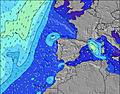 |  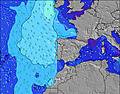 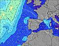 |  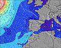 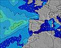 |  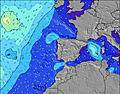 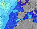 |  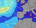 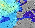 |  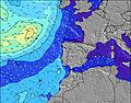 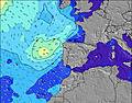 |  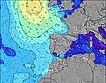  |    |    | |||||||||||||||||||||||||||||||||||||||||||||||||||
| Wave Height (m) & direction (?) | ||||||||||||||||||||||||||||||||||||||||||||||||||||||||||||
| Period(s) (?) | 11 | 11 | 12 | 11 | 11 | 11 | 11 | 10 | 10 | 10 | 10 | 10 | 10 | 9 | 9 | 12 | 11 | 11 | 10 | 10 | 10 | 10 | 12 | 12 | 11 | 11 | 11 | 11 | 10 | 10 | 9 | 9 | 9 | 9 | 9 | 17 | 16 | 15 | 14 | 14 | 13 | 9 | 13 | 12 | 12 | 11 | 11 | 11 | 11 | 11 | 10 | 10 | 10 | 10 | 10 | 10 | 10 | 9 | 9 | 9 |
Wave (?)Graph | ||||||||||||||||||||||||||||||||||||||||||||||||||||||||||||
| Energy (?) | 389 | 512 | 558 | 411 | 396 | 359 | 346 | 265 | 250 | 223 | 218 | 175 | 159 | 146 | 106 | 210 | 477 | 515 | 460 | 410 | 455 | 240 | 605 | 518 | 492 | 411 | 403 | 297 | 301 | 295 | 277 | 232 | 242 | 207 | 172 | 222 | 261 | 318 | 407 | 368 | 386 | 281 | 424 | 265 | 211 | 197 | 170 | 167 | 167 | 167 | 155 | 152 | 104 | 102 | 100 | 100 | 107 | 94 | 94 | 59 |
Wind (km/h) | ||||||||||||||||||||||||||||||||||||||||||||||||||||||||||||
| Wind State (?) onshore cross-onshore cross-shore cross-offshore offshore glassy | cross- off | off | off | off | off | cross- off | cross- on | cross- on | cross- off | off | cross- off | off | cross- off | cross- off | cross- off | cross- off | cross | cross- off | cross- off | cross- on | glass | cross- off | cross- on | cross- on | cross- off | off | off | off | off | glass | cross- on | cross | cross | off | cross- off | off | cross- off | cross- off | cross | cross | cross- off | cross- off | cross- off | cross- off | cross- off | cross | cross- on | cross- on | cross- on | cross- on | cross- on | on | on | on | on | cross- on | cross | cross- on | cross- off | glass |
High Tide / height (m) | 3:36AM 3.24 | 3:59PM 3.20 | 4:23AM 3.17 | 4:43PM 3.17 | 5:10AM 3.01 | 5:29PM 3.05 | 6:00AM 2.77 | 6:19PM 2.87 | 6:55AM 2.51 | 7:15PM 2.66 | 7:58AM 2.26 | 8:21PM 2.46 | 9:14AM 2.10 | 9:40PM 2.34 | ||||||||||||||||||||||||||||||||||||||||||||||
Low Tide / height (m) | 9:23PM -0.10 | 9:46AM -0.14 | 10:08PM -0.14 | 10:29AM -0.04 | 10:55PM -0.07 | 11:13AM 0.14 | 11:44PM 0.09 | 12:00PM 0.36 | 12:38AM 0.31 | 12:51PM 0.60 | 1:40AM 0.55 | 1:52PM 0.82 | 2:55AM 0.74 | 3:09PM 0.96 | 4:20AM 0.81 | |||||||||||||||||||||||||||||||||||||||||||||
Monday 28 | Tuesday 29 | Wednesday 30 | Thursday 01 | Friday 02 | Saturday 03 | Sunday 04 | Monday 05 | |||||||||||||||||||||||||||||||||||||||||||||||||||||
| Sunrise | - | - | - | 6:39 | - | - | - | - | - | - | - | 6:39 | - | - | - | - | - | - | - | 6:37 | - | - | - | - | - | - | - | 6:35 | - | - | - | - | - | - | - | 6:35 | - | - | - | - | - | - | - | 6:33 | - | - | - | - | - | - | - | 6:33 | - | - | - | - | - | - | - | 6:31 |
| Sunset | - | - | - | - | - | - | - | 8:25 | - | - | - | - | - | - | - | 8:27 | - | - | - | - | - | - | - | 8:28 | - | - | - | - | - | - | - | 8:29 | - | - | - | - | - | - | - | 8:30 | - | - | - | - | - | - | - | 8:30 | - | - | - | - | - | - | - | 8:31 | - | - | - | - |
Rain (mm) | - | - | - | - | - | - | - | - | - | - | - | - | - | - | - | - | - | - | - | 3 | 9 | 1 | 2 | - | - | - | - | - | - | - | - | - | - | - | - | - | - | - | - | 1 | - | - | - | - | - | 1 | 1 | - | - | - | - | - | - | - | - | - | - | - | - | - |
| Temp. °C | 20 | 20 | 18 | 17 | 20 | 24 | 22 | 18 | 17 | 17 | 16 | 16 | 19 | 22 | 24 | 22 | 16 | 15 | 15 | 14 | 13 | 16 | 16 | 16 | 15 | 13 | 13 | 12 | 16 | 19 | 18 | 17 | 16 | 15 | 15 | 14 | 19 | 21 | 20 | 19 | 17 | 15 | 15 | 15 | 16 | 17 | 16 | 15 | 15 | 14 | 14 | 14 | 15 | 15 | 15 | 15 | 14 | 14 | 13 | 12 |
| Feels °C (?) | 17 | 18 | 15 | 13 | 15 | 21 | 20 | 17 | 15 | 16 | 14 | 13 | 14 | 17 | 19 | 18 | 14 | 13 | 14 | 13 | 13 | 12 | 13 | 13 | 14 | 11 | 10 | 9 | 13 | 18 | 16 | 14 | 14 | 14 | 13 | 11 | 16 | 17 | 17 | 14 | 13 | 12 | 11 | 11 | 12 | 13 | 13 | 12 | 14 | 13 | 13 | 13 | 14 | 13 | 12 | 13 | 13 | 13 | 12 | 11 |
- Map Icons:
 Break
Break Live Wave Height (m)
 Live Wind Speed (km/h)
 Surf Rating (10 Max)
 Ocean Swells (m)
- Wind Speed (km/h)
FREE! Surf-Forecast.com widget for your website
The surf report / weather widget below is available to embed on third party websites free of charge and provides a summary of our Pedrogao surf forecast. Simply grab the html code snippet that we provide and paste it into your own site. You can choose your preferred language and metric/imperial units for the surf forecast feed to suit users of your site. Click here to get the code.


 Nearest