

- Forecast
- Maps
- Live
- Weather State
- Spot Information

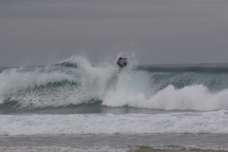
Playa de Baldayo - La Laguna surfForecast / Galicia / Spain
How big are the waves at Playa de Baldayo - La Laguna today?
The current surf forecast for Playa de Baldayo - La Laguna at 8PM is: 1.3m 10s primary swell from a Northwest direction and 0.2m 7s secondary swell from a North-northeast direction (forecast issued at 01:00pm April 17). An open ocean swell of 1.5m 7s is not directed at the surf break. The wind direction is predicted to be cross-offshore and the swell rating is 2.
| Time (CEST) & Date | Wave Height | Wave Period |
|---|---|---|
| Morning (17 Apr) | 7ft (2.1m) | 10s |
| Afternoon (17 Apr) | 5ft (1.5m) | 10s |
| Evening (17 Apr) | 4ft (1.2m) | 10s |
Table - waves today at Playa de Baldayo - La Laguna. (Swell directed towards the surf break)
Thursday 17 | Friday 18 | Saturday 19 | Sunday 20 | Monday 21 | Tuesday 22 | Wednesday 23 | Thursday 24 | |||||||||||||||||||||||||||||||||||||||||||||||||||||
| 11 AM | 2 PM | 5 PM | 8 PM | 11 PM | 2 AM | 5 AM | 8 AM | 11 AM | 2 PM | 5 PM | 8 PM | 11 PM | 2 AM | 5 AM | 8 AM | 11 AM | 2 PM | 5 PM | 8 PM | 11 PM | 2 AM | 5 AM | 8 AM | 11 AM | 2 PM | 5 PM | 8 PM | 11 PM | 2 AM | 5 AM | 8 AM | 11 AM | 2 PM | 5 PM | 8 PM | 11 PM | 2 AM | 5 AM | 8 AM | 11 AM | 2 PM | 5 PM | 8 PM | 11 PM | 2 AM | 5 AM | 8 AM | 11 AM | 2 PM | 5 PM | 8 PM | 11 PM | 2 AM | 5 AM | 8 AM | 11 AM | 2 PM | 5 PM | 8 PM | |
Rating (10 max) | ||||||||||||||||||||||||||||||||||||||||||||||||||||||||||||
Swell Height Map |    |    |   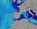 |  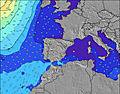 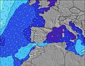 | 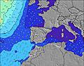   |    |    | 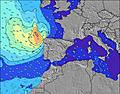 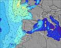 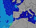 | ||||||||||||||||||||||||||||||||||||||||||||||||||||
| Wave Height (m) & direction (?) | ||||||||||||||||||||||||||||||||||||||||||||||||||||||||||||
| Period(s) (?) | 10 | 10 | 10 | 10 | 8 | 8 | 8 | 8 | 8 | 8 | 8 | 8 | 9 | 11 | 11 | 11 | 12 | 12 | 13 | 13 | 13 | 12 | 12 | 12 | 11 | 11 | 11 | 10 | 10 | 10 | 9 | 9 | 8 | 8 | 10 | 10 | 11 | 10 | 10 | 10 | 13 | 13 | 12 | 12 | 11 | 11 | 11 | 11 | 10 | 10 | 10 | 10 | 11 | 11 | 11 | 11 | 13 | 12 | 14 | 14 |
Wave (?)Graph | ||||||||||||||||||||||||||||||||||||||||||||||||||||||||||||
| Energy (?) | 716 | 469 | 356 | 309 | 346 | 441 | 527 | 606 | 574 | 644 | 914 | 1071 | 1611 | 3791 | 4104 | 4393 | 8646 | 15530 | 18081 | 14789 | 12837 | 9684 | 5043 | 3313 | 2128 | 1465 | 1150 | 746 | 550 | 351 | 582 | 320 | 291 | 243 | 284 | 734 | 815 | 763 | 634 | 578 | 1471 | 917 | 833 | 736 | 563 | 437 | 466 | 716 | 469 | 674 | 674 | 666 | 672 | 608 | 619 | 571 | 734 | 737 | 1010 | 2136 |
Wind (km/h) | ||||||||||||||||||||||||||||||||||||||||||||||||||||||||||||
| Wind State (?) onshore cross-onshore cross-shore cross-offshore offshore glassy | cross- off | cross- off | cross- off | cross- off | cross- off | cross- off | cross- off | cross- off | cross- off | cross- off | cross- off | cross- on | cross- on | cross- on | cross | cross- on | cross | cross | cross- on | on | on | on | on | cross- on | cross | cross- on | cross | cross- off | cross- off | cross- off | cross- on | cross- on | cross | cross- on | on | cross- on | glass | off | cross- off | glass | glass | on | on | cross- on | cross | glass | glass | glass | glass | cross- on | cross- on | cross- on | glass | cross- off | cross- off | cross- off | cross | cross- on | cross- on | cross- on |
High Tide / height (m) | 7:32PM 3.27 | 7:43AM 2.89 | 8:13PM 3.09 | 8:24AM 2.72 | 9:06PM 2.91 | 9:23AM 2.57 | 10:22PM 2.79 | 10:51AM 2.51 | 11:53PM 2.81 | 12:25PM 2.63 | 1:10AM 2.96 | 1:35PM 2.90 | 2:09AM 3.17 | 2:30PM 3.24 | ||||||||||||||||||||||||||||||||||||||||||||||
Low Tide / height (m) | 1:17PM 0.83 | 1:50AM 1.03 | 1:54PM 0.98 | 2:32AM 1.22 | 2:39PM 1.14 | 3:28AM 1.40 | 3:40PM 1.28 | 4:46AM 1.50 | 5:05PM 1.33 | 6:15AM 1.43 | 6:36PM 1.22 | 7:27AM 1.22 | 7:47PM 0.98 | 8:21AM 0.94 | ||||||||||||||||||||||||||||||||||||||||||||||
Thursday 17 | Friday 18 | Saturday 19 | Sunday 20 | Monday 21 | Tuesday 22 | Wednesday 23 | Thursday 24 | |||||||||||||||||||||||||||||||||||||||||||||||||||||
| Sunrise | - | - | - | - | - | - | - | 7:48 | - | - | - | - | - | - | - | 7:46 | - | - | - | - | - | - | - | 7:45 | - | - | - | - | - | - | - | 7:43 | - | - | - | - | - | - | - | 7:41 | - | - | - | - | - | - | - | 7:39 | - | - | - | - | - | - | - | 7:39 | - | - | - | - |
| Sunset | - | - | - | 9:19 | - | - | - | - | - | - | - | 9:20 | - | - | - | - | - | - | - | 9:21 | - | - | - | - | - | - | - | 9:22 | - | - | - | - | - | - | - | 9:22 | - | - | - | - | - | - | - | 9:24 | - | - | - | - | - | - | - | 9:25 | - | - | - | - | - | - | - | 9:27 |
Rain (mm) | - | - | - | - | 3 | 3 | 2 | 8 | 8 | 1 | 1 | 5 | 1 | 1 | 2 | 5 | 3 | 5 | 7 | 2 | 3 | 1 | - | - | - | 1 | 1 | 1 | 1 | 1 | 4 | - | - | - | - | - | - | - | - | - | - | - | - | - | - | - | - | - | - | - | - | - | - | - | - | - | - | - | - | - |
| Temp. °C | 13 | 14 | 16 | 15 | 14 | 14 | 14 | 13 | 14 | 15 | 15 | 10 | 9 | 8 | 8 | 9 | 9 | 10 | 11 | 11 | 11 | 11 | 10 | 10 | 13 | 13 | 13 | 10 | 11 | 11 | 12 | 12 | 13 | 15 | 15 | 13 | 11 | 10 | 10 | 9 | 13 | 15 | 15 | 14 | 11 | 11 | 10 | 9 | 14 | 17 | 16 | 14 | 11 | 12 | 12 | 11 | 16 | 18 | 17 | 16 |
| Feels °C (?) | 8 | 9 | 12 | 12 | 12 | 11 | 10 | 11 | 11 | 11 | 10 | 6 | 5 | 4 | 3 | 3 | 2 | 3 | 5 | 6 | 6 | 7 | 7 | 8 | 11 | 11 | 10 | 7 | 8 | 7 | 11 | 11 | 12 | 13 | 12 | 11 | 10 | 8 | 8 | 8 | 12 | 13 | 12 | 12 | 10 | 10 | 9 | 8 | 12 | 14 | 13 | 12 | 10 | 10 | 10 | 9 | 14 | 15 | 15 | 15 |
- Map Icons:
 Break
Break Live Wave Height (m)
 Live Wind Speed (km/h)
 Surf Rating (10 Max)
 Ocean Swells (m)
- Wind Speed (km/h)
FREE! Surf-Forecast.com widget for your website
The surf report / weather widget below is available to embed on third party websites free of charge and provides a summary of our Playa de Baldayo - La Laguna surf forecast. Simply grab the html code snippet that we provide and paste it into your own site. You can choose your preferred language and metric/imperial units for the surf forecast feed to suit users of your site. Click here to get the code.


 Nearest