

- Forecast
- Maps
- Live
- Weather State
- Spot Information

Playa de Rio Sieira / As Furnas surfForecast / Galicia / Spain
How big are the waves at Playa de Rio Sieira / As Furnas today?
The current surf forecast for Playa de Rio Sieira / As Furnas at 4PM is: 1.5m 12s primary swell from a West-northwest direction and 0.5m 16s secondary swell from a West direction (forecast issued at 01:00pm April 24). The wind direction is predicted to be onshore and the swell rating is 2.
| Time (CEST) & Date | Wave Height | Wave Period |
|---|---|---|
| Morning (24 Apr) | 4.5ft (1.4m) | 11s |
| Afternoon (24 Apr) | 5ft (1.5m) | 12s |
| Evening (24 Apr) | 5ft (1.6m) | 12s |
Table - waves today at Playa de Rio Sieira / As Furnas. (Swell directed towards the surf break)
Thursday 24 | Friday 25 | Saturday 26 | Sunday 27 | Monday 28 | Tuesday 29 | Wednesday 30 | Thursday 01 | |||||||||||||||||||||||||||||||||||||||||||||||||||||
| 11 AM | 2 PM | 5 PM | 8 PM | 11 PM | 2 AM | 5 AM | 8 AM | 11 AM | 2 PM | 5 PM | 8 PM | 11 PM | 2 AM | 5 AM | 8 AM | 11 AM | 2 PM | 5 PM | 8 PM | 11 PM | 2 AM | 5 AM | 8 AM | 11 AM | 2 PM | 5 PM | 8 PM | 11 PM | 2 AM | 5 AM | 8 AM | 11 AM | 2 PM | 5 PM | 8 PM | 11 PM | 2 AM | 5 AM | 8 AM | 11 AM | 2 PM | 5 PM | 8 PM | 11 PM | 2 AM | 5 AM | 8 AM | 11 AM | 2 PM | 5 PM | 8 PM | 11 PM | 2 AM | 5 AM | 8 AM | 11 AM | 2 PM | 5 PM | 8 PM | |
Rating (10 max) | ||||||||||||||||||||||||||||||||||||||||||||||||||||||||||||
Swell Height Map |    |    |   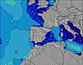 |  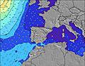 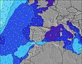 | 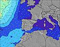 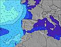 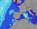 | 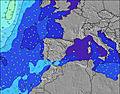 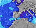 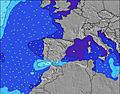 | 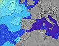 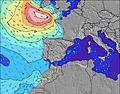 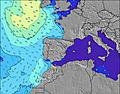 | 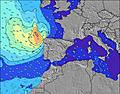 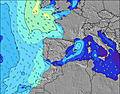 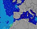 | ||||||||||||||||||||||||||||||||||||||||||||||||||||
| Wave Height (m) & direction (?) | ||||||||||||||||||||||||||||||||||||||||||||||||||||||||||||
| Period(s) (?) | 11 | 13 | 12 | 12 | 12 | 14 | 14 | 14 | 14 | 14 | 14 | 14 | 13 | 13 | 13 | 13 | 13 | 12 | 12 | 12 | 12 | 12 | 11 | 11 | 11 | 11 | 11 | 11 | 11 | 11 | 11 | 11 | 10 | 10 | 10 | 10 | 10 | 10 | 10 | 10 | 10 | 10 | 10 | 10 | 10 | 10 | 9 | 12 | 12 | 11 | 9 | 11 | 11 | 11 | 8 | 7 | 8 | 9 | 10 | 10 |
Wave (?)Graph | ||||||||||||||||||||||||||||||||||||||||||||||||||||||||||||
| Energy (?) | 469 | 699 | 634 | 694 | 980 | 1868 | 2190 | 2160 | 2308 | 2275 | 2211 | 2362 | 2116 | 1893 | 1713 | 1544 | 1365 | 1127 | 1140 | 985 | 1036 | 805 | 604 | 524 | 478 | 478 | 478 | 486 | 486 | 419 | 419 | 281 | 365 | 274 | 227 | 205 | 205 | 250 | 255 | 235 | 225 | 183 | 314 | 182 | 230 | 235 | 136 | 129 | 353 | 360 | 530 | 323 | 323 | 273 | 219 | 248 | 438 | 834 | 1354 | 1573 |
Wind (km/h) | ||||||||||||||||||||||||||||||||||||||||||||||||||||||||||||
| Wind State (?) onshore cross-onshore cross-shore cross-offshore offshore glassy | glass | cross- on | on | on | cross | cross- on | cross- on | cross- on | on | on | on | on | cross- on | cross | cross | cross | cross- on | on | on | cross- on | cross | cross | cross | cross | cross- off | glass | cross- on | on | cross | cross- off | cross- off | cross- off | off | cross | glass | glass | cross | cross- off | cross- off | cross- off | cross- off | cross- off | cross- off | off | off | cross- off | cross- off | cross- off | cross- off | cross- off | cross | cross- off | cross- off | off | off | off | off | cross- off | cross- off | cross- off |
High Tide / height (m) | 2:21PM 2.65 | 2:35AM 2.98 | 3:08PM 2.92 | 3:22AM 3.20 | 3:51PM 3.15 | 4:08AM 3.35 | 4:34PM 3.31 | 4:54AM 3.40 | 5:17PM 3.38 | 5:40AM 3.34 | 6:00PM 3.35 | 6:27AM 3.17 | 6:46PM 3.23 | 7:16AM 2.93 | 7:35PM 3.04 | |||||||||||||||||||||||||||||||||||||||||||||
Low Tide / height (m) | 8:07AM 0.43 | 8:22PM 0.51 | 8:54AM 0.17 | 9:09PM 0.25 | 9:38AM -0.04 | 9:55PM 0.03 | 10:21AM -0.15 | 10:40PM -0.11 | 11:03AM -0.16 | 11:25PM -0.16 | 11:46AM -0.06 | 12:12AM -0.09 | 12:30PM 0.12 | 1:01AM 0.07 | 1:16PM 0.36 | |||||||||||||||||||||||||||||||||||||||||||||
Thursday 24 | Friday 25 | Saturday 26 | Sunday 27 | Monday 28 | Tuesday 29 | Wednesday 30 | Thursday 01 | |||||||||||||||||||||||||||||||||||||||||||||||||||||
| Sunrise | - | - | - | - | - | - | - | 7:39 | - | - | - | - | - | - | - | 7:37 | - | - | - | - | - | - | - | 7:37 | - | - | - | - | - | - | - | 7:35 | - | - | - | - | - | - | - | 7:33 | - | - | - | - | - | - | - | 7:33 | - | - | - | - | - | - | - | 7:31 | - | - | - | - |
| Sunset | - | - | - | 9:27 | - | - | - | - | - | - | - | 9:28 | - | - | - | - | - | - | - | 9:30 | - | - | - | - | - | - | - | 9:30 | - | - | - | - | - | - | - | 9:31 | - | - | - | - | - | - | - | 9:32 | - | - | - | - | - | - | - | 9:34 | - | - | - | - | - | - | - | 9:35 |
Rain (mm) | - | - | - | - | - | - | - | - | - | - | - | - | - | - | - | - | - | - | - | - | - | - | - | - | - | - | - | - | - | - | - | - | - | - | - | - | - | - | - | - | - | - | - | - | - | 1 | 1 | - | - | 3 | 11 | 9 | - | - | - | - | - | - | 1 | 1 |
| Temp. °C | 15 | 17 | 17 | 17 | 16 | 14 | 13 | 12 | 14 | 15 | 15 | 14 | 13 | 12 | 12 | 12 | 13 | 16 | 18 | 16 | 12 | 11 | 10 | 9 | 12 | 17 | 17 | 18 | 18 | 17 | 16 | 15 | 18 | 20 | 19 | 19 | 19 | 17 | 16 | 16 | 18 | 17 | 17 | 18 | 17 | 15 | 14 | 14 | 14 | 12 | 12 | 11 | 12 | 12 | 11 | 11 | 14 | 17 | 15 | 16 |
| Feels °C (?) | 14 | 16 | 15 | 16 | 15 | 13 | 11 | 10 | 11 | 11 | 10 | 9 | 10 | 10 | 10 | 9 | 10 | 12 | 12 | 11 | 8 | 7 | 6 | 5 | 9 | 15 | 14 | 16 | 15 | 14 | 13 | 12 | 15 | 17 | 17 | 18 | 18 | 16 | 14 | 14 | 16 | 14 | 16 | 17 | 15 | 12 | 10 | 12 | 12 | 11 | 9 | 10 | 9 | 9 | 8 | 7 | 9 | 10 | 7 | 10 |
- Map Icons:
 Break
Break Live Wave Height (m)
 Live Wind Speed (km/h)
 Surf Rating (10 Max)
 Ocean Swells (m)
- Wind Speed (km/h)
FREE! Surf-Forecast.com widget for your website
The surf report / weather widget below is available to embed on third party websites free of charge and provides a summary of our Playa de Rio Sieira / As Furnas surf forecast. Simply grab the html code snippet that we provide and paste it into your own site. You can choose your preferred language and metric/imperial units for the surf forecast feed to suit users of your site. Click here to get the code.


 Nearest