

- Forecast
- Maps
- Live
- Weather State
- Spot Information

Playa de la Atalaya y Cazanera surfForecast / Asturias / Spain
How big are the waves at Playa de la Atalaya y Cazanera today?
The current surf forecast for Playa de la Atalaya y Cazanera at 2AM is: 1.1m 12s primary swell from a West-northwest direction and 0.6m 8s secondary swell from a North-northwest direction, 0.8m 4s secondary swell from a East direction (forecast issued at 07:00pm April 24). The wind direction is predicted to be cross-shore.
| Time (CEST) & Date | Wave Height | Wave Period |
|---|---|---|
| Morning (25 Apr) | 4ft (1.2m) | 14s |
| Afternoon (25 Apr) | 4.5ft (1.4m) | 14s |
| Evening (25 Apr) | 5ft (1.5m) | 14s |
Table - waves today at Playa de la Atalaya y Cazanera. (Swell directed towards the surf break)
Thursday 24 | Friday 25 | Saturday 26 | Sunday 27 | Monday 28 | Tuesday 29 | Wednesday 30 | Thursday 01 | Fri 02 | ||||||||||||||||||||||||||||||||||||||||||||||||||||
| 5 PM | 8 PM | 11 PM | 2 AM | 5 AM | 8 AM | 11 AM | 2 PM | 5 PM | 8 PM | 11 PM | 2 AM | 5 AM | 8 AM | 11 AM | 2 PM | 5 PM | 8 PM | 11 PM | 2 AM | 5 AM | 8 AM | 11 AM | 2 PM | 5 PM | 8 PM | 11 PM | 2 AM | 5 AM | 8 AM | 11 AM | 2 PM | 5 PM | 8 PM | 11 PM | 2 AM | 5 AM | 8 AM | 11 AM | 2 PM | 5 PM | 8 PM | 11 PM | 2 AM | 5 AM | 8 AM | 11 AM | 2 PM | 5 PM | 8 PM | 11 PM | 2 AM | 5 AM | 8 AM | 11 AM | 2 PM | 5 PM | 8 PM | 11 PM | 2 AM | |
Rating (10 max) | ||||||||||||||||||||||||||||||||||||||||||||||||||||||||||||
Swell Height Map |   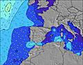 |  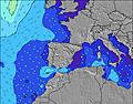 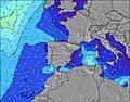 |  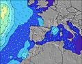 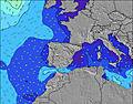 |  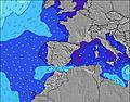 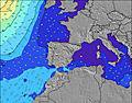 |  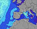 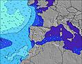 |  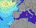 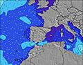 |  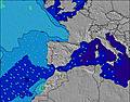 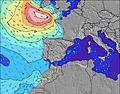 |  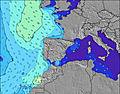 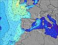 | 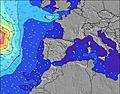   | |||||||||||||||||||||||||||||||||||||||||||||||||||
| Wave Height (m) & direction (?) | ||||||||||||||||||||||||||||||||||||||||||||||||||||||||||||
| Period(s) (?) | 11 | 12 | 12 | 12 | 14 | 14 | 14 | 14 | 14 | 14 | 14 | 13 | 13 | 13 | 13 | 13 | 13 | 12 | 12 | 12 | 12 | 12 | 11 | 11 | 11 | 11 | 11 | 11 | 11 | 11 | 11 | 10 | 10 | 10 | 10 | 9 | 10 | 10 | 10 | 10 | 10 | 5 | 11 | 11 | 11 | 10 | 10 | 12 | 12 | 12 | 11 | 11 | 11 | 10 | 10 | 10 | 10 | 10 | 10 | 9 |
Wave (?)Graph | ||||||||||||||||||||||||||||||||||||||||||||||||||||||||||||
| Energy (?) | 281 | 336 | 378 | 347 | 612 | 384 | 690 | 731 | 838 | 802 | 779 | 1169 | 659 | 640 | 587 | 512 | 569 | 563 | 508 | 545 | 500 | 421 | 393 | 379 | 366 | 455 | 411 | 360 | 347 | 268 | 263 | 185 | 178 | 127 | 77 | 68 | 109 | 107 | 77 | 75 | 48 | 78 | 104 | 197 | 200 | 182 | 127 | 122 | 336 | 314 | 242 | 233 | 166 | 124 | 122 | 120 | 98 | 76 | 74 | 68 |
Wind (km/h) | ||||||||||||||||||||||||||||||||||||||||||||||||||||||||||||
| Wind State (?) onshore cross-onshore cross-shore cross-offshore offshore glassy | on | cross- on | cross- on | cross | cross | glass | glass | cross | cross- off | cross- off | cross- off | cross- off | cross- off | cross- off | cross- off | cross | cross | cross | glass | glass | cross- off | cross- off | cross- on | on | cross- on | cross- on | cross- on | cross | cross | cross | cross- on | on | on | cross- on | cross | cross- off | cross- off | cross- off | cross | cross- on | on | cross- on | cross- off | off | off | glass | glass | cross- on | cross- on | cross- off | cross- off | cross- off | cross- off | cross- off | cross | cross- on | cross- on | cross- on | glass | cross- off |
High Tide / height (m) | 2:50PM 3.08 | 3:04AM 3.43 | 3:37PM 3.38 | 3:52AM 3.70 | 4:20PM 3.65 | 4:38AM 3.88 | 5:03PM 3.83 | 5:23AM 3.95 | 5:46PM 3.91 | 6:09AM 3.89 | 6:29PM 3.88 | 6:56AM 3.71 | 7:15PM 3.74 | 7:45AM 3.44 | 8:04PM 3.51 | |||||||||||||||||||||||||||||||||||||||||||||
Low Tide / height (m) | 8:49PM 0.60 | 9:20AM 0.22 | 9:37PM 0.29 | 10:05AM -0.03 | 10:22PM 0.03 | 10:48AM -0.17 | 11:07PM -0.14 | 11:30AM -0.19 | 11:52PM -0.19 | 12:14PM -0.08 | 12:38AM -0.12 | 12:58PM 0.12 | 1:27AM 0.07 | 1:45PM 0.38 | ||||||||||||||||||||||||||||||||||||||||||||||
Thursday 24 | Friday 25 | Saturday 26 | Sunday 27 | Monday 28 | Tuesday 29 | Wednesday 30 | Thursday 01 | Fri 02 | ||||||||||||||||||||||||||||||||||||||||||||||||||||
| Sunrise | - | - | - | - | - | 7:26 | - | - | - | - | - | - | - | 7:24 | - | - | - | - | - | - | - | 7:22 | - | - | - | - | - | - | - | 7:22 | - | - | - | - | - | - | - | 7:20 | - | - | - | - | - | - | - | 7:18 | - | - | - | - | - | - | - | 7:18 | - | - | - | - | - | - |
| Sunset | - | 9:16 | - | - | - | - | - | - | - | 9:17 | - | - | - | - | - | - | - | 9:20 | - | - | - | - | - | - | - | 9:21 | - | - | - | - | - | - | - | 9:22 | - | - | - | - | - | - | - | 9:22 | - | - | - | - | - | - | - | 9:23 | - | - | - | - | - | - | - | 9:25 | - | - |
Rain (mm) | - | - | - | - | - | - | 1 | 2 | 5 | 1 | - | 1 | - | - | - | - | - | - | - | - | - | - | - | - | - | - | - | - | - | - | - | - | - | - | - | - | - | - | - | - | - | - | - | - | - | - | - | - | - | 1 | 4 | 7 | - | - | - | - | - | - | - | - |
| Temp. °C | 17 | 15 | 12 | 11 | 12 | 12 | 15 | 15 | 14 | 14 | 13 | 13 | 10 | 11 | 14 | 15 | 15 | 13 | 10 | 9 | 8 | 8 | 13 | 16 | 16 | 14 | 11 | 10 | 10 | 10 | 18 | 21 | 20 | 19 | 15 | 14 | 14 | 15 | 22 | 25 | 24 | 21 | 16 | 15 | 15 | 15 | 19 | 20 | 18 | 15 | 12 | 11 | 11 | 10 | 16 | 20 | 21 | 20 | 14 | 13 |
| Feels °C (?) | 15 | 13 | 11 | 10 | 11 | 12 | 16 | 15 | 13 | 12 | 11 | 10 | 7 | 9 | 11 | 12 | 12 | 12 | 9 | 8 | 6 | 6 | 10 | 12 | 13 | 12 | 9 | 8 | 8 | 8 | 16 | 19 | 18 | 18 | 14 | 13 | 12 | 13 | 21 | 22 | 21 | 21 | 15 | 14 | 14 | 14 | 19 | 19 | 17 | 14 | 8 | 9 | 10 | 8 | 14 | 16 | 18 | 19 | 14 | 11 |
- Map Icons:
 Break
Break Live Wave Height (m)
 Live Wind Speed (km/h)
 Surf Rating (10 Max)
 Ocean Swells (m)
- Wind Speed (km/h)
FREE! Surf-Forecast.com widget for your website
The surf report / weather widget below is available to embed on third party websites free of charge and provides a summary of our Playa de la Atalaya y Cazanera surf forecast. Simply grab the html code snippet that we provide and paste it into your own site. You can choose your preferred language and metric/imperial units for the surf forecast feed to suit users of your site. Click here to get the code.


 Nearest