

- Forecast
- Maps
- Live
- Weather State
- Spot Information
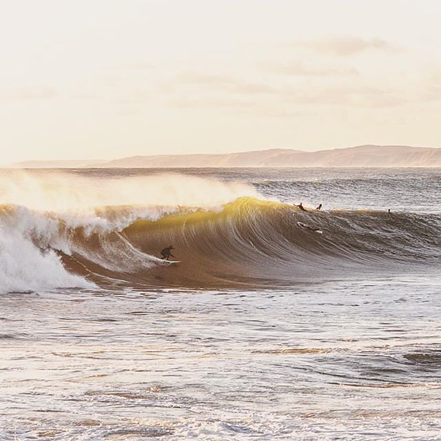
Raglan-Manu Bay Surf Forecast
/ Raglan and West Waikato (8 surf breaks) /
Raglan-Manu Bay surfForecast / Raglan and West Waikato / New Zealand
How big are the waves at Raglan-Manu Bay today?
The current surf forecast for Raglan-Manu Bay at 3AM is: 1.9m 11s primary swell from a West-northwest direction and 0.7m 17s secondary swell from a West direction, 0.4m 3s secondary swell from a Northeast direction (forecast issued at 11:00pm April 19). The wind direction is predicted to be cross-shore.
| Time (NZST) & Date | Wave Height | Wave Period |
|---|---|---|
| Morning (20 Apr) | 6ft (1.9m) | 11s |
| Afternoon (20 Apr) | 5ft (1.5m) | 10s |
| Evening (20 Apr) | 5ft (1.6m) | 12s |
Table - waves today at Raglan-Manu Bay. (Swell directed towards the surf break)
Sunday 20 | Monday 21 | Tuesday 22 | Wednesday 23 | Thursday 24 | Friday 25 | Saturday 26 | Sunday 27 | |||||||||||||||||||||||||||||||||||||||||||||||||||||
| 9 PM | 0 AM | 3 AM | 6 AM | 9 AM | 12 PM | 3 PM | 6 PM | 9 PM | 0 AM | 3 AM | 6 AM | 9 AM | 12 PM | 3 PM | 6 PM | 9 PM | 0 AM | 3 AM | 6 AM | 9 AM | 12 PM | 3 PM | 6 PM | 9 PM | 0 AM | 3 AM | 6 AM | 9 AM | 12 PM | 3 PM | 6 PM | 9 PM | 0 AM | 3 AM | 6 AM | 9 AM | 12 PM | 3 PM | 6 PM | 9 PM | 0 AM | 3 AM | 6 AM | 9 AM | 12 PM | 3 PM | 6 PM | 9 PM | 0 AM | 3 AM | 6 AM | 9 AM | 12 PM | 3 PM | 6 PM | 9 PM | 0 AM | 3 AM | 6 AM | |
Rating (10 max) | ||||||||||||||||||||||||||||||||||||||||||||||||||||||||||||
Swell Height Map |  |    |    |    |  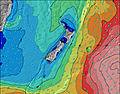 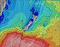 |  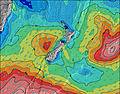 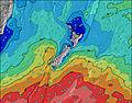 |  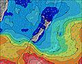 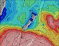 |  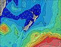 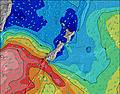 | 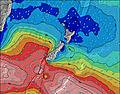 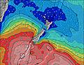 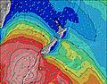 | |||||||||||||||||||||||||||||||||||||||||||||||||||
| Wave Height (m) & direction (?) | ||||||||||||||||||||||||||||||||||||||||||||||||||||||||||||
| Period(s) (?) | 9 | 9 | 11 | 12 | 11 | 11 | 10 | 14 | 12 | 12 | 11 | 10 | 10 | 10 | 10 | 9 | 9 | 9 | 8 | 13 | 13 | 13 | 12 | 12 | 12 | 12 | 12 | 12 | 12 | 12 | 12 | 18 | 18 | 18 | 17 | 17 | 16 | 16 | 16 | 16 | 16 | 16 | 15 | 15 | 15 | 15 | 15 | 14 | 14 | 14 | 14 | 14 | 14 | 14 | 14 | 14 | 17 | 17 | 16 | 16 |
Wave (?)Graph | ||||||||||||||||||||||||||||||||||||||||||||||||||||||||||||
| Energy (?) | 513 | 446 | 838 | 1320 | 927 | 655 | 437 | 1304 | 723 | 800 | 676 | 625 | 580 | 563 | 480 | 380 | 318 | 225 | 169 | 133 | 149 | 147 | 136 | 169 | 187 | 131 | 169 | 169 | 167 | 222 | 215 | 160 | 318 | 408 | 528 | 711 | 834 | 1123 | 1096 | 950 | 938 | 914 | 776 | 746 | 716 | 610 | 610 | 472 | 452 | 357 | 290 | 290 | 265 | 210 | 213 | 213 | 220 | 227 | 269 | 481 |
Wind (km/h) | ||||||||||||||||||||||||||||||||||||||||||||||||||||||||||||
| Wind State (?) onshore cross-onshore cross-shore cross-offshore offshore glassy | cross | cross | cross | cross | cross | cross- on | on | cross- on | cross | cross- off | cross | cross- on | glass | on | on | glass | cross | cross | cross | cross- off | cross | on | on | cross- on | glass | off | cross- off | cross- off | cross- off | cross- off | cross- off | cross- off | cross- off | cross- off | off | cross- off | cross- off | cross- off | cross- off | cross- off | cross- off | cross- off | cross- off | cross- off | cross- off | cross- off | cross- off | cross | cross- off | cross- off | cross- off | cross- off | cross- off | cross- off | cross | cross- off | cross- off | cross- off | cross- off | cross- off |
High Tide / height (m) | 2:25AM 2.40 | 3:02PM 2.23 | 3:35AM 2.31 | 4:18PM 2.19 | 4:51AM 2.32 | 5:27PM 2.25 | 5:57AM 2.44 | 6:30PM 2.38 | 6:54AM 2.61 | 7:29PM 2.56 | 7:46AM 2.80 | 8:22PM 2.78 | 8:36AM 2.98 | 9:10PM 2.98 | ||||||||||||||||||||||||||||||||||||||||||||||
Low Tide / height (m) | 8:13PM 0.81 | 8:52AM 0.94 | 9:14PM 0.90 | 10:00AM 0.96 | 10:27PM 0.91 | 11:12AM 0.87 | 11:40PM 0.81 | 12:20PM 0.68 | 12:45AM 0.61 | 1:19PM 0.43 | 1:41AM 0.38 | 2:10PM 0.18 | 2:32AM 0.16 | 2:57PM -0.02 | 3:20AM -0.01 | |||||||||||||||||||||||||||||||||||||||||||||
Sunday 20 | Monday 21 | Tuesday 22 | Wednesday 23 | Thursday 24 | Friday 25 | Saturday 26 | Sunday 27 | |||||||||||||||||||||||||||||||||||||||||||||||||||||
| Sunrise | - | - | - | - | 6:50 | - | - | - | - | - | - | - | 6:52 | - | - | - | - | - | - | - | 6:52 | - | - | - | - | - | - | - | 6:54 | - | - | - | - | - | - | - | 6:54 | - | - | - | - | - | - | - | 6:54 | - | - | - | - | - | - | - | 6:56 | - | - | - | - | - | - | - |
| Sunset | - | - | - | - | - | - | 5:46 | - | - | - | - | - | - | - | 5:45 | - | - | - | - | - | - | - | 5:44 | - | - | - | - | - | - | - | 5:43 | - | - | - | - | - | - | - | 5:42 | - | - | - | - | - | - | - | 5:40 | - | - | - | - | - | - | - | 5:38 | - | - | - | - | - |
Rain (mm) | 1 | 1 | - | - | - | 1 | 3 | 2 | 1 | - | - | 1 | - | 1 | 1 | - | - | - | - | - | - | - | - | - | - | - | - | - | - | - | 1 | - | - | - | 1 | 1 | - | - | - | - | - | - | - | - | - | - | - | - | - | - | - | - | - | - | - | - | - | - | - | - |
| Temp. °C | 20 | 20 | 20 | 19 | 20 | 22 | 20 | 19 | 18 | 17 | 17 | 17 | 18 | 19 | 19 | 18 | 18 | 17 | 16 | 16 | 18 | 19 | 19 | 17 | 16 | 16 | 16 | 16 | 17 | 18 | 18 | 16 | 15 | 13 | 12 | 11 | 11 | 12 | 14 | 14 | 14 | 13 | 13 | 12 | 13 | 17 | 19 | 17 | 14 | 13 | 13 | 13 | 13 | 17 | 20 | 18 | 14 | 14 | 14 | 14 |
| Feels °C (?) | 18 | 19 | 18 | 18 | 19 | 21 | 20 | 20 | 18 | 17 | 17 | 18 | 20 | 20 | 19 | 19 | 18 | 17 | 16 | 15 | 18 | 19 | 19 | 17 | 17 | 16 | 16 | 15 | 16 | 17 | 17 | 13 | 11 | 9 | 9 | 8 | 7 | 9 | 11 | 11 | 12 | 10 | 11 | 9 | 10 | 14 | 17 | 15 | 11 | 10 | 11 | 11 | 11 | 14 | 18 | 16 | 12 | 12 | 12 | 12 |
- Map Icons:
 Break
Break Live Wave Height (m)
 Live Wind Speed (km/h)
 Surf Rating (10 Max)
 Ocean Swells (m)
- Wind Speed (km/h)
FREE! Surf-Forecast.com widget for your website
The surf report / weather widget below is available to embed on third party websites free of charge and provides a summary of our Raglan-Manu Bay surf forecast. Simply grab the html code snippet that we provide and paste it into your own site. You can choose your preferred language and metric/imperial units for the surf forecast feed to suit users of your site. Click here to get the code.


 Nearest