

- Forecast
- Maps
- Live
- Weather State
- Spot Information
Rock Point/Pohakuloa Surf Forecast
/ HAW – Molokai (14 breaks) / Hawaii (267 breaks) /
Rock Point/Pohakuloa surfForecast / HAW – Molokai / USA
How big are the waves at Rock Point/Pohakuloa today?
The current surf forecast for Rock Point/Pohakuloa at 6AM is: 0.9m 12s primary swell from a Northwest direction and 1.1m 8s secondary swell from a East direction, 1.2m 8s secondary swell from a East direction (forecast issued at 01:00am April 28). The wind direction is predicted to be glassy and the swell rating is 2.
| Time (HST) & Date | Wave Height | Wave Period |
|---|---|---|
| Morning (28 Apr) | 3.5ft (1.0m) | 12s |
| Afternoon (28 Apr) | 2.5ft (0.8m) | 11s |
| Evening (28 Apr) | 2.5ft (0.8m) | 11s |
Table - waves today at Rock Point/Pohakuloa. (Swell directed towards the surf break)
Monday 28 | Tuesday 29 | Wednesday 30 | Thursday 01 | Friday 02 | Saturday 03 | Sunday 04 | Monday 05 | |||||||||||||||||||||||||||||||||||||||||||||||||||||
| 11 PM | 2 AM | 5 AM | 8 AM | 11 AM | 2 PM | 5 PM | 8 PM | 11 PM | 2 AM | 5 AM | 8 AM | 11 AM | 2 PM | 5 PM | 8 PM | 11 PM | 2 AM | 5 AM | 8 AM | 11 AM | 2 PM | 5 PM | 8 PM | 11 PM | 2 AM | 5 AM | 8 AM | 11 AM | 2 PM | 5 PM | 8 PM | 11 PM | 2 AM | 5 AM | 8 AM | 11 AM | 2 PM | 5 PM | 8 PM | 11 PM | 2 AM | 5 AM | 8 AM | 11 AM | 2 PM | 5 PM | 8 PM | 11 PM | 2 AM | 5 AM | 8 AM | 11 AM | 2 PM | 5 PM | 8 PM | 11 PM | 2 AM | 5 AM | 8 AM | |
Rating (10 max) | ||||||||||||||||||||||||||||||||||||||||||||||||||||||||||||
Swell Height Map |  |    |    |    |  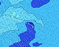 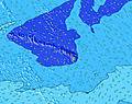 |  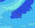 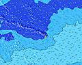 |  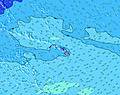  |   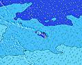 | 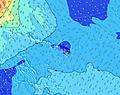 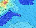 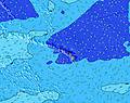 | |||||||||||||||||||||||||||||||||||||||||||||||||||
| Wave Height (m) & direction (?) | ||||||||||||||||||||||||||||||||||||||||||||||||||||||||||||
| Period(s) (?) | 12 | 12 | 12 | 12 | 12 | 11 | 11 | 11 | 12 | 12 | 11 | 11 | 11 | 11 | 11 | 8 | 8 | 8 | 8 | 8 | 8 | 8 | 8 | 8 | 8 | 18 | 18 | 16 | 16 | 15 | 15 | 14 | 14 | 13 | 13 | 13 | 12 | 12 | 12 | 7 | 7 | 7 | 7 | 7 | 7 | 7 | 7 | 7 | 7 | 7 | 7 | 7 | 7 | 7 | 7 | 7 | 7 | 7 | 7 | 7 |
Wave (?)Graph | ||||||||||||||||||||||||||||||||||||||||||||||||||||||||||||
| Energy (?) | 244 | 240 | 240 | 277 | 200 | 180 | 119 | 183 | 187 | 190 | 155 | 150 | 147 | 145 | 142 | 122 | 124 | 127 | 165 | 161 | 161 | 165 | 111 | 228 | 265 | 323 | 395 | 464 | 532 | 530 | 568 | 606 | 617 | 581 | 563 | 529 | 390 | 325 | 325 | 430 | 481 | 364 | 303 | 271 | 271 | 295 | 263 | 278 | 278 | 294 | 320 | 294 | 324 | 303 | 320 | 321 | 289 | 257 | 303 | 404 |
Wind (km/h) | ||||||||||||||||||||||||||||||||||||||||||||||||||||||||||||
| Wind State (?) onshore cross-onshore cross-shore cross-offshore offshore glassy | cross- on | cross- on | glass | glass | glass | cross- off | cross | cross | glass | on | on | on | cross- on | cross- on | cross | cross- on | cross- on | cross- on | cross- on | cross | cross | cross | cross | cross | cross | cross | cross | cross | cross | cross | cross | cross | cross | cross | cross | cross | cross | cross | cross | cross | cross | cross | cross- on | cross | cross | cross | cross | cross | cross | cross- on | cross | cross- on | cross | cross | cross | cross | cross | cross- on | cross | cross- on |
High Tide / height (m) | 1:52AM 0.61 | 3:42PM 0.97 | 2:18AM 0.56 | 4:30PM 0.96 | 2:39AM 0.51 | 5:24PM 0.91 | 2:46AM 0.47 | 6:25PM 0.86 | 7:36PM 0.81 | 8:50PM 0.77 | 8:47AM 0.35 | 9:51PM 0.74 | ||||||||||||||||||||||||||||||||||||||||||||||||
Low Tide / height (m) | 9:13PM 0.36 | 8:20AM -0.03 | 10:10PM 0.40 | 8:53AM -0.03 | 11:14PM 0.44 | 9:28AM 0.01 | 12:44AM 0.46 | 10:05AM 0.06 | 10:46AM 0.14 | 11:37AM 0.23 | 6:10AM 0.34 | 1:11PM 0.31 | 5:46AM 0.31 | |||||||||||||||||||||||||||||||||||||||||||||||
Monday 28 | Tuesday 29 | Wednesday 30 | Thursday 01 | Friday 02 | Saturday 03 | Sunday 04 | Monday 05 | |||||||||||||||||||||||||||||||||||||||||||||||||||||
| Sunrise | - | - | - | 5:58 | - | - | - | - | - | - | - | 5:56 | - | - | - | - | - | - | - | 5:56 | - | - | - | - | - | - | - | 5:56 | - | - | - | - | - | - | - | 5:54 | - | - | - | - | - | - | - | 5:54 | - | - | - | - | - | - | - | 5:54 | - | - | - | - | - | - | - | 5:54 |
| Sunset | - | - | - | - | - | - | 6:50 | - | - | - | - | - | - | - | 6:51 | - | - | - | - | - | - | - | 6:51 | - | - | - | - | - | - | - | 6:51 | - | - | - | - | - | - | - | 6:52 | - | - | - | - | - | - | - | 6:52 | - | - | - | - | - | - | - | 6:52 | - | - | - | - | - |
Rain (mm) | - | - | - | 1 | - | 1 | 2 | 1 | - | 1 | 3 | 3 | - | 1 | 1 | 1 | - | - | - | - | - | - | - | - | - | - | - | - | - | - | - | - | - | - | - | - | - | - | - | - | - | - | - | - | - | - | - | - | - | - | - | - | - | - | - | - | - | - | - | - |
| Temp. °C | 24 | 24 | 24 | 24 | 24 | 24 | 24 | 24 | 24 | 24 | 23 | 23 | 24 | 25 | 24 | 24 | 24 | 24 | 23 | 23 | 24 | 24 | 24 | 24 | 24 | 23 | 23 | 24 | 24 | 24 | 24 | 24 | 23 | 23 | 23 | 23 | 24 | 24 | 24 | 23 | 23 | 23 | 23 | 23 | 24 | 24 | 24 | 24 | 23 | 23 | 23 | 23 | 24 | 24 | 24 | 24 | 23 | 23 | 23 | 24 |
| Feels °C (?) | 25 | 26 | 27 | 27 | 26 | 26 | 26 | 26 | 26 | 25 | 24 | 24 | 25 | 26 | 24 | 24 | 25 | 25 | 23 | 22 | 23 | 24 | 24 | 23 | 23 | 22 | 22 | 22 | 22 | 22 | 23 | 23 | 21 | 21 | 21 | 20 | 21 | 20 | 20 | 19 | 19 | 19 | 20 | 20 | 21 | 20 | 21 | 21 | 20 | 19 | 20 | 21 | 20 | 20 | 19 | 21 | 20 | 20 | 20 | 21 |
- Map Icons:
 Break
Break Live Wave Height (m)
 Live Wind Speed (km/h)
 Surf Rating (10 Max)
 Ocean Swells (m)
- Wind Speed (km/h)
FREE! Surf-Forecast.com widget for your website
The surf report / weather widget below is available to embed on third party websites free of charge and provides a summary of our Rock Point/Pohakuloa surf forecast. Simply grab the html code snippet that we provide and paste it into your own site. You can choose your preferred language and metric/imperial units for the surf forecast feed to suit users of your site. Click here to get the code.


 Nearest