

- Forecast
- Maps
- Live
- Weather State
- Spot Information

Surf Forecasts

Salani surfForecast / Upolu / Samoa
Forecast update in hr min s Forecast update imminent
Salani surf forecast is for near shore open water. Breaking waves will often be smaller at less exposed spots.
Today's Salani sea temperature is
29.7° C
(Which is slightly warmer than usual)How big are the waves at Salani today?
The current surf forecast for Salani at 12AM is: 1.1m 15s primary swell from a Southwest direction and 1.2m 8s secondary swell from a Southeast direction, 1.2m 8s secondary swell from a Southeast direction (forecast issued at 06:00pm April 16). The wind direction is predicted to be cross-shore.
| Time (+13) & Date | Wave Height | Wave Period |
|---|---|---|
| Morning (17 Apr) | - | - |
| Afternoon (17 Apr) | 3.5ft (1.0m) | 15s |
| Evening (17 Apr) | 3.5ft (1.0m) | 15s |
Table - waves today at Salani. (Swell directed towards the surf break)
Updates in hr min s Forecast update imminent
Wednesday 16 | Thursday 17 | Friday 18 | Saturday 19 | Sunday 20 | Monday 21 | Tuesday 22 | Wednesday 23 | Thu 24 | ||||||||||||||||||||||||||||||||||||||||||||||||||||
| 4 PM | 7 PM | 10 PM | 1 AM | 4 AM | 7 AM | 10 AM | 1 PM | 4 PM | 7 PM | 10 PM | 1 AM | 4 AM | 7 AM | 10 AM | 1 PM | 4 PM | 7 PM | 10 PM | 1 AM | 4 AM | 7 AM | 10 AM | 1 PM | 4 PM | 7 PM | 10 PM | 1 AM | 4 AM | 7 AM | 10 AM | 1 PM | 4 PM | 7 PM | 10 PM | 1 AM | 4 AM | 7 AM | 10 AM | 1 PM | 4 PM | 7 PM | 10 PM | 1 AM | 4 AM | 7 AM | 10 AM | 1 PM | 4 PM | 7 PM | 10 PM | 1 AM | 4 AM | 7 AM | 10 AM | 1 PM | 4 PM | 7 PM | 10 PM | 1 AM | |
Rating (10 max) | ||||||||||||||||||||||||||||||||||||||||||||||||||||||||||||
Swell Height Map |  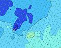 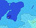 |  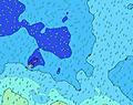  | 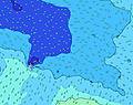 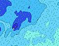 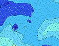 | 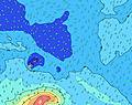  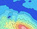 | 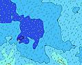 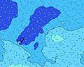 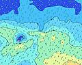 | 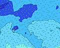 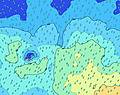 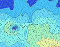 | 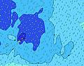 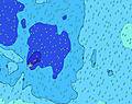 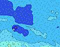 | 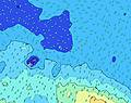 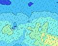 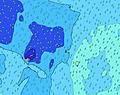 | 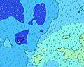 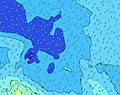 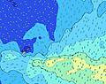 | |||||||||||||||||||||||||||||||||||||||||||||||||||
| Wave Height (m) & direction (?) | ||||||||||||||||||||||||||||||||||||||||||||||||||||||||||||
| Period(s) (?) | 15 | 15 | 15 | 15 | 15 | 15 | 15 | 15 | 15 | 15 | 15 | 15 | 15 | 15 | 8 | 8 | 8 | 8 | 8 | 8 | 8 | 19 | 18 | 18 | 18 | 17 | 16 | 8 | 16 | 15 | 15 | 9 | 9 | 9 | 9 | 9 | 9 | 9 | 10 | 10 | 10 | 10 | 10 | 10 | 10 | 10 | 10 | 10 | 10 | 10 | 10 | 10 | 10 | 10 | 10 | 13 | 13 | 13 | 10 | 10 |
Wave (?)Graph | ||||||||||||||||||||||||||||||||||||||||||||||||||||||||||||
| Energy (?) | 435 | 441 | 447 | 519 | 499 | 435 | 370 | 365 | 266 | 266 | 269 | 269 | 181 | 177 | 196 | 187 | 182 | 153 | 149 | 145 | 131 | 190 | 246 | 408 | 498 | 290 | 533 | 193 | 401 | 371 | 279 | 281 | 300 | 328 | 328 | 338 | 345 | 360 | 327 | 334 | 341 | 348 | 348 | 356 | 396 | 404 | 412 | 460 | 460 | 451 | 400 | 400 | 318 | 318 | 324 | 363 | 369 | 331 | 318 | 284 |
Wind (km/h) | ||||||||||||||||||||||||||||||||||||||||||||||||||||||||||||
| Wind State (?) onshore cross-onshore cross-shore cross-offshore offshore glassy | cross- on | cross- on | cross- on | cross- on | cross- on | cross- on | cross- on | cross- on | cross- on | cross | cross- on | cross | cross | cross | cross | cross | cross | cross | cross | cross | cross | cross | cross- off | cross- off | cross- off | cross- off | cross- off | off | off | off | cross- off | cross- off | cross- off | cross- off | cross- off | off | off | off | cross- off | cross- off | cross- off | cross- off | off | off | off | off | off | off | off | off | cross- off | glass | glass | glass | glass | glass | glass | glass | glass | cross- on |
High Tide / height (m) | 9:08PM 0.80 | 9:18AM 0.89 | 9:56PM 0.75 | 10:05AM 0.86 | 10:49PM 0.73 | 10:59AM 0.84 | 11:47PM 0.72 | 11:56AM 0.85 | 12:46AM 0.75 | 12:55PM 0.89 | 1:40AM 0.81 | 1:50PM 0.94 | 2:31AM 0.90 | 2:43PM 1.01 | ||||||||||||||||||||||||||||||||||||||||||||||
Low Tide / height (m) | 2:55AM 0.32 | 3:43PM 0.28 | 3:38AM 0.35 | 4:33PM 0.30 | 4:27AM 0.37 | 5:28PM 0.31 | 5:25AM 0.38 | 6:26PM 0.30 | 6:27AM 0.36 | 7:22PM 0.26 | 7:29AM 0.32 | 8:14PM 0.21 | 8:28AM 0.25 | 9:04PM 0.15 | ||||||||||||||||||||||||||||||||||||||||||||||
Wednesday 16 | Thursday 17 | Friday 18 | Saturday 19 | Sunday 20 | Monday 21 | Tuesday 22 | Wednesday 23 | Thu 24 | ||||||||||||||||||||||||||||||||||||||||||||||||||||
| Sunrise | - | - | - | - | - | 6:33 | - | - | - | - | - | - | - | 6:33 | - | - | - | - | - | - | - | 6:33 | - | - | - | - | - | - | - | 6:33 | - | - | - | - | - | - | - | 6:33 | - | - | - | - | - | - | - | 6:33 | - | - | - | - | - | - | - | 6:33 | - | - | - | - | - | - |
| Sunset | 6:19 | - | - | - | - | - | - | - | 6:19 | - | - | - | - | - | - | - | 6:17 | - | - | - | - | - | - | - | 6:16 | - | - | - | - | - | - | - | 6:16 | - | - | - | - | - | - | - | 6:15 | - | - | - | - | - | - | - | 6:15 | - | - | - | - | - | - | - | 6:15 | - | - | - |
Rain (mm) | - | - | - | - | - | - | - | - | - | - | - | - | - | 1 | - | 1 | - | - | 1 | 1 | 3 | 1 | - | - | 1 | 2 | 3 | 3 | 2 | 2 | 5 | 3 | 2 | 1 | - | - | 1 | 1 | 4 | 2 | 1 | - | - | 1 | 1 | 2 | 1 | - | - | - | - | - | - | - | - | - | - | - | - | - |
| Temp. °C | 28 | 28 | 28 | 28 | 28 | 28 | 28 | 28 | 28 | 28 | 29 | 28 | 28 | 28 | 28 | 28 | 28 | 28 | 28 | 27 | 27 | 28 | 28 | 28 | 28 | 28 | 28 | 28 | 28 | 28 | 27 | 27 | 27 | 28 | 28 | 28 | 28 | 28 | 28 | 28 | 28 | 28 | 28 | 28 | 28 | 28 | 28 | 28 | 29 | 29 | 28 | 28 | 28 | 28 | 28 | 28 | 28 | 28 | 28 | 28 |
| Feels °C (?) | 30 | 30 | 30 | 30 | 30 | 30 | 30 | 30 | 30 | 30 | 31 | 30 | 31 | 31 | 30 | 30 | 30 | 30 | 30 | 29 | 29 | 30 | 29 | 29 | 30 | 30 | 29 | 29 | 29 | 28 | 27 | 28 | 26 | 28 | 28 | 27 | 28 | 29 | 29 | 30 | 30 | 31 | 31 | 31 | 30 | 30 | 31 | 32 | 33 | 33 | 32 | 32 | 33 | 33 | 33 | 33 | 32 | 32 | 33 | 32 |
- Map Icons:
 Break
Break Live Wave Height (m)
 Live Wind Speed (km/h)
 Surf Rating (10 Max)
 Ocean Swells (m)
- Wind Speed (km/h)
FREE! Surf-Forecast.com widget for your website
The surf report / weather widget below is available to embed on third party websites free of charge and provides a summary of our Salani surf forecast. Simply grab the html code snippet that we provide and paste it into your own site. You can choose your preferred language and metric/imperial units for the surf forecast feed to suit users of your site. Click here to get the code.


 Nearest