

- Forecast
- Maps
- Live
- Weather State
- Spot Information

Surf Forecasts
Shabandar surfForecast / Borneo / Malaysia
Forecast update in hr min s Forecast update imminent
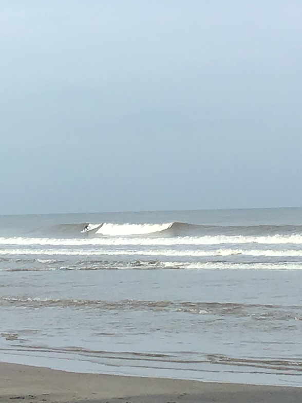
Shabandar surf forecast is for near shore open water. Breaking waves will often be smaller at less exposed spots.
Today's Shabandar sea temperature is
28.8° C
(Which is normal for this time of year)How big are the waves at Shabandar today?
The current surf forecast for Shabandar at 12PM is: 0.8m 10s primary swell from a North direction and 0.4m 7s secondary swell from a Northwest direction (forecast issued at 07:00am April 02). The wind direction is predicted to be glassy.
| Time (+08) & Date | Wave Height | Wave Period |
|---|---|---|
| Morning (02 Apr) | 2.5ft (0.8m) | 10s |
| Afternoon (02 Apr) | 2.5ft (0.8m) | 10s |
| Evening (02 Apr) | 3ft (0.9m) | 9s |
Table - waves today at Shabandar. (Swell directed towards the surf break)
Updates in hr min s Forecast update imminent
Wednesday 02 | Thursday 03 | Friday 04 | Saturday 05 | Sunday 06 | Monday 07 | Tuesday 08 | Wednesday 09 | |||||||||||||||||||||||||||||||||||||||||||||||||||||
| 5 AM | 8 AM | 11 AM | 2 PM | 5 PM | 8 PM | 11 PM | 2 AM | 5 AM | 8 AM | 11 AM | 2 PM | 5 PM | 8 PM | 11 PM | 2 AM | 5 AM | 8 AM | 11 AM | 2 PM | 5 PM | 8 PM | 11 PM | 2 AM | 5 AM | 8 AM | 11 AM | 2 PM | 5 PM | 8 PM | 11 PM | 2 AM | 5 AM | 8 AM | 11 AM | 2 PM | 5 PM | 8 PM | 11 PM | 2 AM | 5 AM | 8 AM | 11 AM | 2 PM | 5 PM | 8 PM | 11 PM | 2 AM | 5 AM | 8 AM | 11 AM | 2 PM | 5 PM | 8 PM | 11 PM | 2 AM | 5 AM | 8 AM | 11 AM | 2 PM | |
Rating (10 max) | ||||||||||||||||||||||||||||||||||||||||||||||||||||||||||||
Swell Height Map |    |    |  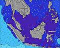 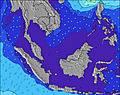 | 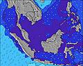 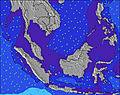 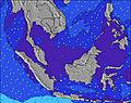 | 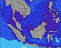 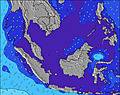 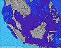 |    |  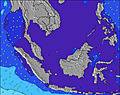 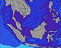 | 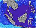 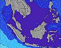  | ||||||||||||||||||||||||||||||||||||||||||||||||||||
| Wave Height (m) & direction (?) | ||||||||||||||||||||||||||||||||||||||||||||||||||||||||||||
| Period(s) (?) | 10 | 10 | 10 | 10 | 10 | 9 | 9 | 9 | 9 | 9 | 9 | 9 | 8 | 8 | 6 | 8 | 8 | 8 | 8 | 8 | 8 | 8 | 8 | 8 | 8 | 8 | 8 | 8 | 9 | 8 | 8 | 8 | 8 | 8 | 8 | 8 | 8 | 5 | 5 | 5 | 8 | 5 | 6 | 6 | 7 | 5 | 5 | 6 | 6 | 6 | 6 | 6 | 6 | 6 | 6 | 6 | 6 | 6 | 6 | 6 |
Wave (?)Graph | ||||||||||||||||||||||||||||||||||||||||||||||||||||||||||||
| Energy (?) | 154 | 154 | 120 | 118 | 116 | 129 | 162 | 170 | 142 | 169 | 162 | 154 | 173 | 90 | 86 | 187 | 129 | 130 | 100 | 93 | 114 | 137 | 138 | 119 | 97 | 78 | 82 | 91 | 93 | 89 | 113 | 35 | 51 | 66 | 65 | 63 | 63 | 24 | 34 | 27 | 20 | 20 | 24 | 10 | 10 | 9 | 8 | 12 | 20 | 20 | 19 | 11 | 10 | 10 | 11 | 13 | 13 | 13 | 12 | 12 |
Wind (km/h) | ||||||||||||||||||||||||||||||||||||||||||||||||||||||||||||
| Wind State (?) onshore cross-onshore cross-shore cross-offshore offshore glassy | cross- off | glass | glass | glass | glass | glass | off | cross- off | glass | glass | on | on | cross- on | cross- off | cross- off | glass | off | glass | on | on | cross- on | cross- off | cross- off | cross- off | glass | glass | cross- on | cross- on | glass | glass | glass | off | off | glass | on | on | cross- on | cross- off | off | off | glass | glass | cross- on | cross | glass | cross- off | cross- off | glass | glass | cross- off | cross | cross- on | cross- on | glass | glass | glass | cross- off | glass | cross | cross- on |
High Tide / height (m) | 3:04AM 1.06 | 12:28PM 1.75 | 12:59PM 1.81 | 1:35PM 1.79 | 2:18PM 1.72 | 3:17PM 1.60 | 4:53PM 1.48 | 6:54PM 1.40 | 11:33AM 1.11 | |||||||||||||||||||||||||||||||||||||||||||||||||||
Low Tide / height (m) | 5:33AM 1.02 | 8:49PM 0.14 | 10:01PM 0.16 | 11:26PM 0.21 | 12:57AM 0.25 | 2:11AM 0.29 | 3:02AM 0.33 | 3:38AM 0.40 | ||||||||||||||||||||||||||||||||||||||||||||||||||||
Wednesday 02 | Thursday 03 | Friday 04 | Saturday 05 | Sunday 06 | Monday 07 | Tuesday 08 | Wednesday 09 | |||||||||||||||||||||||||||||||||||||||||||||||||||||
| Sunrise | - | 6:13 | - | - | - | - | - | - | - | 6:13 | - | - | - | - | - | - | - | 6:11 | - | - | - | - | - | - | - | 6:11 | - | - | - | - | - | - | - | 6:11 | - | - | - | - | - | - | - | 6:11 | - | - | - | - | - | - | - | 6:11 | - | - | - | - | - | - | - | 6:09 | - | - |
| Sunset | - | - | - | - | 6:23 | - | - | - | - | - | - | - | 6:23 | - | - | - | - | - | - | - | 6:23 | - | - | - | - | - | - | - | 6:23 | - | - | - | - | - | - | - | 6:22 | - | - | - | - | - | - | - | 6:22 | - | - | - | - | - | - | - | 6:22 | - | - | - | - | - | - | - |
Rain (mm) | 1 | - | - | 1 | - | - | - | - | - | - | - | - | - | - | - | - | - | - | - | - | - | - | - | - | - | - | - | - | 2 | 1 | - | - | - | - | - | - | 1 | - | 1 | 1 | 1 | - | 1 | 1 | 4 | 7 | 7 | 1 | - | 1 | 1 | 2 | 2 | 2 | 3 | 2 | 1 | - | - | - |
| Temp. °C | 25 | 25 | 27 | 27 | 27 | 26 | 25 | 24 | 24 | 25 | 28 | 28 | 28 | 27 | 26 | 25 | 25 | 26 | 28 | 29 | 28 | 27 | 26 | 25 | 25 | 26 | 28 | 28 | 27 | 27 | 26 | 25 | 24 | 25 | 28 | 29 | 29 | 27 | 26 | 25 | 25 | 26 | 27 | 26 | 25 | 23 | 23 | 23 | 24 | 24 | 26 | 25 | 25 | 25 | 24 | 24 | 24 | 24 | 28 | 28 |
| Feels °C (?) | 28 | 29 | 31 | 31 | 32 | 31 | 29 | 27 | 27 | 28 | 31 | 30 | 31 | 30 | 30 | 29 | 28 | 29 | 31 | 32 | 32 | 31 | 29 | 28 | 28 | 29 | 31 | 31 | 31 | 32 | 30 | 29 | 27 | 29 | 31 | 32 | 33 | 31 | 30 | 29 | 29 | 30 | 30 | 30 | 29 | 26 | 27 | 27 | 28 | 27 | 29 | 28 | 29 | 29 | 28 | 28 | 27 | 28 | 31 | 31 |
- Map Icons:
 Break
Break Live Wave Height (m)
 Live Wind Speed (km/h)
 Surf Rating (10 Max)
 Ocean Swells (m)
- Wind Speed (km/h)
FREE! Surf-Forecast.com widget for your website
The surf report / weather widget below is available to embed on third party websites free of charge and provides a summary of our Shabandar surf forecast. Simply grab the html code snippet that we provide and paste it into your own site. You can choose your preferred language and metric/imperial units for the surf forecast feed to suit users of your site. Click here to get the code.


 Nearest