

- Forecast
- Maps
- Live
- Weather State
- Spot Information

Surf Forecasts
Souillac surfForecast / Mauritius / Mauritius
Forecast update in hr min s Forecast update imminent
Souillac surf forecast is for near shore open water. Breaking waves will often be smaller at less exposed spots.
Today's Souillac sea temperature is
28.3° C
(Which is 1.8°C warmer than normal for this time of year)How big are the waves at Souillac today?
The current surf forecast for Souillac at 4AM is: 1.4m 8s primary swell from a East-southeast direction and 0.7m 9s secondary swell from a Southwest direction (forecast issued at 03:00am April 24). The wind direction is predicted to be cross-shore.
| Time (+04) & Date | Wave Height | Wave Period |
|---|---|---|
| Morning (24 Apr) | 4.5ft (1.4m) | 8s |
| Afternoon (24 Apr) | 4.5ft (1.3m) | 8s |
| Evening (24 Apr) | 4.5ft (1.3m) | 9s |
Table - waves today at Souillac. (Swell directed towards the surf break)
Updates in hr min s Forecast update imminent
Thursday 24 | Friday 25 | Saturday 26 | Sunday 27 | Monday 28 | Tuesday 29 | Wednesday 30 | Thursday 01 | |||||||||||||||||||||||||||||||||||||||||||||||||||||
| 1 AM | 4 AM | 7 AM | 10 AM | 1 PM | 4 PM | 7 PM | 10 PM | 1 AM | 4 AM | 7 AM | 10 AM | 1 PM | 4 PM | 7 PM | 10 PM | 1 AM | 4 AM | 7 AM | 10 AM | 1 PM | 4 PM | 7 PM | 10 PM | 1 AM | 4 AM | 7 AM | 10 AM | 1 PM | 4 PM | 7 PM | 10 PM | 1 AM | 4 AM | 7 AM | 10 AM | 1 PM | 4 PM | 7 PM | 10 PM | 1 AM | 4 AM | 7 AM | 10 AM | 1 PM | 4 PM | 7 PM | 10 PM | 1 AM | 4 AM | 7 AM | 10 AM | 1 PM | 4 PM | 7 PM | 10 PM | 1 AM | 4 AM | 7 AM | 10 AM | |
Rating (10 max) | ||||||||||||||||||||||||||||||||||||||||||||||||||||||||||||
Swell Height Map |    |  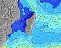 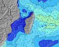 | 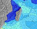 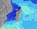 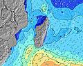 | 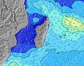 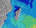 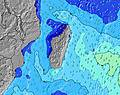 | 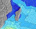 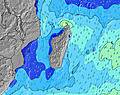 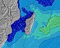 | 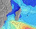 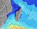 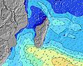 | 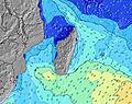 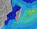 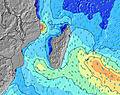 | 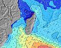 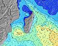 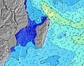 | ||||||||||||||||||||||||||||||||||||||||||||||||||||
| Wave Height (m) & direction (?) | ||||||||||||||||||||||||||||||||||||||||||||||||||||||||||||
| Period(s) (?) | 10 | 8 | 8 | 8 | 8 | 8 | 8 | 9 | 9 | 9 | 16 | 16 | 16 | 16 | 15 | 14 | 14 | 14 | 14 | 13 | 13 | 13 | 13 | 13 | 12 | 12 | 12 | 16 | 15 | 15 | 15 | 14 | 14 | 14 | 14 | 14 | 14 | 14 | 14 | 14 | 14 | 14 | 14 | 14 | 14 | 14 | 14 | 14 | 13 | 13 | 13 | 13 | 13 | 8 | 8 | 8 | 8 | 8 | 8 | 9 |
Wave (?)Graph | ||||||||||||||||||||||||||||||||||||||||||||||||||||||||||||
| Energy (?) | 160 | 268 | 268 | 268 | 234 | 234 | 239 | 245 | 251 | 288 | 525 | 604 | 859 | 1107 | 1305 | 1204 | 1321 | 1303 | 1267 | 1028 | 983 | 841 | 721 | 699 | 645 | 522 | 514 | 715 | 917 | 1602 | 1475 | 1396 | 1373 | 1353 | 1280 | 1226 | 1226 | 1106 | 943 | 957 | 1014 | 1042 | 982 | 969 | 955 | 838 | 814 | 653 | 634 | 624 | 536 | 491 | 414 | 371 | 401 | 476 | 497 | 522 | 589 | 708 |
Wind (km/h) | ||||||||||||||||||||||||||||||||||||||||||||||||||||||||||||
| Wind State (?) onshore cross-onshore cross-shore cross-offshore offshore glassy | cross | cross | cross | cross | cross | cross | cross | cross | cross | cross | cross | cross | cross | cross | cross | cross | cross | cross | cross- off | cross | cross | cross | cross | cross- off | cross- off | cross- off | cross- off | cross- off | cross- off | cross- off | cross- off | cross- off | cross- off | cross- off | cross- off | cross- off | cross- off | cross- off | cross- off | cross- off | cross- off | cross- off | cross- off | cross- off | cross- off | cross- off | cross- off | cross- off | cross- off | cross- off | cross- off | cross- off | cross- off | cross- off | cross- off | cross- off | cross- off | cross- off | cross- off | cross- off |
High Tide / height (m) | 10:22PM 0.69 | 10:18AM 0.71 | 10:55PM 0.78 | 11:02AM 0.78 | 11:27PM 0.85 | 11:43AM 0.82 | 12:00AM 0.89 | 12:23PM 0.83 | 12:32AM 0.90 | 1:02PM 0.80 | 1:05AM 0.88 | 1:42PM 0.75 | 1:37AM 0.84 | 2:21PM 0.67 | 2:09AM 0.77 | |||||||||||||||||||||||||||||||||||||||||||||
Low Tide / height (m) | 4:22AM 0.23 | 4:35PM 0.10 | 5:01AM 0.14 | 5:12PM 0.06 | 5:39AM 0.06 | 5:49PM 0.04 | 6:16AM 0.00 | 6:24PM 0.05 | 6:54AM -0.03 | 6:58PM 0.08 | 7:32AM -0.02 | 7:32PM 0.13 | 8:11AM 0.02 | 8:04PM 0.20 | 8:51AM 0.08 | |||||||||||||||||||||||||||||||||||||||||||||
Thursday 24 | Friday 25 | Saturday 26 | Sunday 27 | Monday 28 | Tuesday 29 | Wednesday 30 | Thursday 01 | |||||||||||||||||||||||||||||||||||||||||||||||||||||
| Sunrise | - | - | 6:22 | - | - | - | - | - | - | - | 6:24 | - | - | - | - | - | - | - | 6:24 | - | - | - | - | - | - | - | 6:24 | - | - | - | - | - | - | - | 6:24 | - | - | - | - | - | - | - | 6:24 | - | - | - | - | - | - | - | 6:24 | - | - | - | - | - | - | - | 6:26 | - |
| Sunset | - | - | - | - | - | 5:52 | - | - | - | - | - | - | - | 5:51 | - | - | - | - | - | - | - | 5:50 | - | - | - | - | - | - | - | 5:50 | - | - | - | - | - | - | - | 5:49 | - | - | - | - | - | - | - | 5:47 | - | - | - | - | - | - | - | 5:47 | - | - | - | - | - | - |
Rain (mm) | - | - | - | - | - | - | - | - | - | - | - | - | - | - | - | - | 1 | - | - | - | - | - | - | - | - | - | - | - | - | - | - | - | - | - | - | - | - | - | - | - | 1 | - | - | - | - | 1 | 1 | - | 1 | 1 | - | 1 | 1 | 2 | 2 | - | - | - | - | - |
| Temp. °C | 26 | 26 | 26 | 27 | 27 | 27 | 26 | 26 | 26 | 25 | 25 | 27 | 27 | 27 | 26 | 26 | 26 | 25 | 25 | 26 | 27 | 27 | 26 | 26 | 25 | 25 | 25 | 27 | 28 | 27 | 26 | 25 | 26 | 25 | 25 | 27 | 27 | 27 | 26 | 26 | 25 | 25 | 25 | 27 | 27 | 26 | 26 | 26 | 25 | 25 | 25 | 26 | 26 | 26 | 26 | 26 | 26 | 25 | 25 | 27 |
| Feels °C (?) | 28 | 28 | 27 | 27 | 27 | 28 | 27 | 26 | 26 | 26 | 26 | 27 | 27 | 28 | 27 | 27 | 28 | 27 | 27 | 27 | 28 | 28 | 28 | 28 | 27 | 27 | 27 | 28 | 29 | 28 | 28 | 26 | 28 | 27 | 27 | 28 | 27 | 26 | 26 | 27 | 26 | 26 | 26 | 27 | 27 | 26 | 27 | 26 | 25 | 25 | 25 | 25 | 25 | 26 | 25 | 24 | 24 | 23 | 23 | 25 |
- Map Icons:
 Break
Break Live Wave Height (m)
 Live Wind Speed (km/h)
 Surf Rating (10 Max)
 Ocean Swells (m)
- Wind Speed (km/h)
FREE! Surf-Forecast.com widget for your website
The surf report / weather widget below is available to embed on third party websites free of charge and provides a summary of our Souillac surf forecast. Simply grab the html code snippet that we provide and paste it into your own site. You can choose your preferred language and metric/imperial units for the surf forecast feed to suit users of your site. Click here to get the code.


 Nearest