

- Forecast
- Maps
- Live
- Weather State
- Spot Information

Surf Forecasts
St-Jean surfForecast / Saint Barthélemy / Saint Barthélemy
Forecast update in hr min s Forecast update imminent
St-Jean surf forecast is for near shore open water. Breaking waves will often be smaller at less exposed spots.
Today's St-Jean sea temperature is
27.3° C
(Which is normal for this time of year)How big are the waves at St-Jean today?
The current surf forecast for St-Jean at 12PM is: 1.3m 7s primary swell from a East direction and 0.7m 13s secondary swell from a North-northeast direction, 0.5m 7s secondary swell from a North direction (forecast issued at 07:00am April 27). The wind direction is predicted to be cross-shore.
| Time (AST) & Date | Wave Height | Wave Period |
|---|---|---|
| Morning (27 Apr) | 4.5ft (1.3m) | 8s |
| Afternoon (27 Apr) | 4.5ft (1.3m) | 7s |
| Evening (27 Apr) | 4.5ft (1.3m) | 8s |
Table - waves today at St-Jean. (Swell directed towards the surf break)
Updates in hr min s Forecast update imminent
Sunday 27 | Monday 28 | Tuesday 29 | Wednesday 30 | Thursday 01 | Friday 02 | Saturday 03 | Sunday 04 | |||||||||||||||||||||||||||||||||||||||||||||||||||||
| 5 AM | 8 AM | 11 AM | 2 PM | 5 PM | 8 PM | 11 PM | 2 AM | 5 AM | 8 AM | 11 AM | 2 PM | 5 PM | 8 PM | 11 PM | 2 AM | 5 AM | 8 AM | 11 AM | 2 PM | 5 PM | 8 PM | 11 PM | 2 AM | 5 AM | 8 AM | 11 AM | 2 PM | 5 PM | 8 PM | 11 PM | 2 AM | 5 AM | 8 AM | 11 AM | 2 PM | 5 PM | 8 PM | 11 PM | 2 AM | 5 AM | 8 AM | 11 AM | 2 PM | 5 PM | 8 PM | 11 PM | 2 AM | 5 AM | 8 AM | 11 AM | 2 PM | 5 PM | 8 PM | 11 PM | 2 AM | 5 AM | 8 AM | 11 AM | 2 PM | |
Rating (10 max) | ||||||||||||||||||||||||||||||||||||||||||||||||||||||||||||
Swell Height Map |    |    |    |  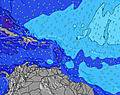 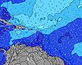 |  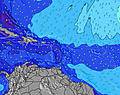 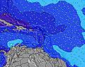 |  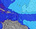 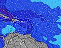 |  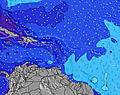 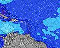 | 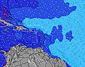 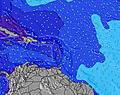 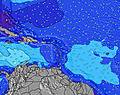 | ||||||||||||||||||||||||||||||||||||||||||||||||||||
| Wave Height (m) & direction (?) | ||||||||||||||||||||||||||||||||||||||||||||||||||||||||||||
| Period(s) (?) | 8 | 8 | 8 | 7 | 7 | 8 | 8 | 8 | 8 | 8 | 8 | 8 | 8 | 8 | 8 | 8 | 8 | 8 | 8 | 8 | 8 | 8 | 8 | 8 | 8 | 8 | 8 | 8 | 8 | 8 | 8 | 8 | 8 | 8 | 8 | 8 | 8 | 8 | 8 | 8 | 8 | 9 | 9 | 8 | 8 | 8 | 8 | 8 | 8 | 8 | 8 | 8 | 8 | 9 | 8 | 8 | 8 | 8 | 8 | 9 |
Wave (?)Graph | ||||||||||||||||||||||||||||||||||||||||||||||||||||||||||||
| Energy (?) | 163 | 193 | 198 | 159 | 178 | 207 | 246 | 212 | 212 | 181 | 182 | 182 | 177 | 176 | 208 | 203 | 203 | 208 | 177 | 177 | 149 | 149 | 149 | 146 | 124 | 127 | 131 | 131 | 127 | 124 | 107 | 131 | 109 | 109 | 109 | 109 | 105 | 107 | 87 | 92 | 147 | 158 | 150 | 140 | 136 | 133 | 109 | 116 | 122 | 119 | 119 | 116 | 120 | 151 | 184 | 90 | 120 | 120 | 90 | 101 |
Wind (km/h) | ||||||||||||||||||||||||||||||||||||||||||||||||||||||||||||
| Wind State (?) onshore cross-onshore cross-shore cross-offshore offshore glassy | cross | cross | cross | cross | cross | cross- on | cross | cross | cross | cross | cross | cross- off | cross | cross- on | cross- on | cross- on | cross- on | cross | cross | cross | cross- on | cross- on | cross- on | cross- on | cross- on | cross- on | cross | cross | cross- off | cross- off | glass | glass | glass | glass | on | on | on | on | on | on | on | cross- on | on | on | on | cross- on | cross- on | cross- on | cross- on | cross- on | cross- on | cross- on | cross- on | cross- on | cross- on | cross- on | cross- on | cross- on | cross- on | cross- on |
High Tide / height (m) | 4:00AM 0.41 | 7:40PM 0.56 | 4:02AM 0.44 | 8:52PM 0.57 | 3:43AM 0.46 | 10:08PM 0.56 | 11:29PM 0.54 | 12:49AM 0.52 | 1:49AM 0.49 | 2:25AM 0.45 | 10:22AM 0.36 | |||||||||||||||||||||||||||||||||||||||||||||||||
Low Tide / height (m) | 12:13PM -0.11 | 1:48AM 0.41 | 1:02PM -0.16 | 3:11AM 0.46 | 1:56PM -0.17 | 2:53PM -0.15 | 3:57PM -0.11 | 5:07PM -0.05 | 6:22PM 0.01 | 10:14AM 0.36 | ||||||||||||||||||||||||||||||||||||||||||||||||||
Sunday 27 | Monday 28 | Tuesday 29 | Wednesday 30 | Thursday 01 | Friday 02 | Saturday 03 | Sunday 04 | |||||||||||||||||||||||||||||||||||||||||||||||||||||
| Sunrise | - | 5:47 | - | - | - | - | - | - | - | 5:46 | - | - | - | - | - | - | - | 5:46 | - | - | - | - | - | - | - | 5:45 | - | - | - | - | - | - | - | 5:45 | - | - | - | - | - | - | - | 5:43 | - | - | - | - | - | - | - | 5:43 | - | - | - | - | - | - | - | 5:43 | - | - |
| Sunset | - | - | - | - | 6:30 | - | - | - | - | - | - | - | 6:30 | - | - | - | - | - | - | - | 6:30 | - | - | - | - | - | - | - | 6:30 | - | - | - | - | - | - | - | 6:31 | - | - | - | - | - | - | - | 6:31 | - | - | - | - | - | - | - | 6:31 | - | - | - | - | - | - | - |
Rain (mm) | - | 1 | - | 2 | 1 | 2 | - | - | - | - | - | - | - | 1 | 2 | 1 | - | - | - | - | - | - | - | - | - | - | - | 2 | 2 | - | - | - | - | - | - | - | - | - | 1 | 1 | - | - | - | - | 1 | - | - | - | - | - | - | - | - | - | - | - | - | - | - | - |
| Temp. °C | 25 | 26 | 26 | 26 | 26 | 26 | 26 | 26 | 26 | 26 | 26 | 26 | 26 | 26 | 25 | 26 | 25 | 26 | 26 | 26 | 26 | 26 | 26 | 26 | 26 | 26 | 26 | 25 | 25 | 25 | 25 | 25 | 25 | 25 | 25 | 26 | 26 | 26 | 25 | 25 | 25 | 25 | 25 | 25 | 26 | 26 | 25 | 25 | 25 | 25 | 25 | 25 | 25 | 25 | 25 | 25 | 25 | 25 | 25 | 25 |
| Feels °C (?) | 24 | 25 | 26 | 26 | 26 | 26 | 26 | 25 | 26 | 26 | 27 | 27 | 28 | 27 | 25 | 27 | 25 | 26 | 27 | 28 | 28 | 28 | 27 | 28 | 27 | 28 | 27 | 27 | 28 | 28 | 28 | 28 | 28 | 28 | 28 | 28 | 28 | 27 | 26 | 26 | 26 | 26 | 26 | 25 | 26 | 26 | 24 | 25 | 25 | 25 | 25 | 25 | 25 | 24 | 23 | 24 | 24 | 24 | 25 | 26 |
- Map Icons:
 Break
Break Live Wave Height (m)
 Live Wind Speed (km/h)
 Surf Rating (10 Max)
 Ocean Swells (m)
- Wind Speed (km/h)
FREE! Surf-Forecast.com widget for your website
The surf report / weather widget below is available to embed on third party websites free of charge and provides a summary of our St-Jean surf forecast. Simply grab the html code snippet that we provide and paste it into your own site. You can choose your preferred language and metric/imperial units for the surf forecast feed to suit users of your site. Click here to get the code.


 Nearest