

- Forecast
- Maps
- Live
- Weather State
- Spot Information
Tarantulas Surf Forecast
/ CAL – Santa Barbara (36 breaks) / California (404 breaks) /
Surf Forecasts
Tarantulas surfForecast / CAL – Santa Barbara / USA
Forecast update in hr min s Forecast update imminent
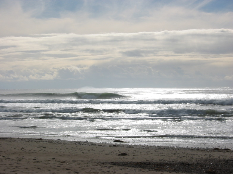
Tarantulas surf forecast is for near shore open water. Breaking waves will often be smaller at less exposed spots.
Today's Tarantulas sea temperature is
12.6° C
(Which is 1.0°C colder than average for this time of year)How big are the waves at Tarantulas today?
The current surf forecast for Tarantulas at 12AM is: 0.8m 16s primary swell from a South-southwest direction and 0.8m 12s secondary swell from a West-northwest direction (forecast issued at 10:00pm April 25). The wind direction is predicted to be glassy and the swell rating is 2.
| Time (PDT) & Date | Wave Height | Wave Period |
|---|---|---|
| Morning (26 Apr) | - | - |
| Afternoon (26 Apr) | - | - |
| Evening (26 Apr) | 2.5ft (0.7m) | 20s |
Table - waves today at Tarantulas. (Swell directed towards the surf break)
Updates in hr min s Forecast update imminent
Fri 25 | Saturday 26 | Sunday 27 | Monday 28 | Tuesday 29 | Wednesday 30 | Thursday 01 | Friday 02 | Sat 03 | ||||||||||||||||||||||||||||||||||||||||||||||||||||
| 8 PM | 11 PM | 2 AM | 5 AM | 8 AM | 11 AM | 2 PM | 5 PM | 8 PM | 11 PM | 2 AM | 5 AM | 8 AM | 11 AM | 2 PM | 5 PM | 8 PM | 11 PM | 2 AM | 5 AM | 8 AM | 11 AM | 2 PM | 5 PM | 8 PM | 11 PM | 2 AM | 5 AM | 8 AM | 11 AM | 2 PM | 5 PM | 8 PM | 11 PM | 2 AM | 5 AM | 8 AM | 11 AM | 2 PM | 5 PM | 8 PM | 11 PM | 2 AM | 5 AM | 8 AM | 11 AM | 2 PM | 5 PM | 8 PM | 11 PM | 2 AM | 5 AM | 8 AM | 11 AM | 2 PM | 5 PM | 8 PM | 11 PM | 2 AM | 5 AM | |
Rating (10 max) | ||||||||||||||||||||||||||||||||||||||||||||||||||||||||||||
Swell Height Map |    |    |    |    |    |    |  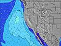 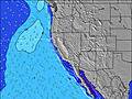 |  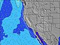 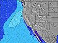 | 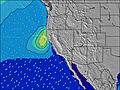 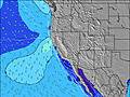 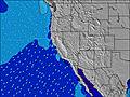 | |||||||||||||||||||||||||||||||||||||||||||||||||||
| Wave Height (m) & direction (?) | ||||||||||||||||||||||||||||||||||||||||||||||||||||||||||||
| Period(s) (?) | 20 | 16 | 16 | 16 | 18 | 18 | 18 | 18 | 18 | 18 | 10 | 10 | 16 | 10 | 9 | 9 | 9 | 9 | 9 | 19 | 18 | 18 | 18 | 18 | 18 | 17 | 17 | 16 | 16 | 16 | 16 | 16 | 16 | 16 | 9 | 16 | 8 | 15 | 15 | 15 | 14 | 8 | 8 | 8 | 8 | 14 | 14 | 14 | 8 | 8 | 8 | 7 | 7 | 19 | 19 | 19 | 8 | 8 | 7 | 7 |
Wave (?)Graph | ||||||||||||||||||||||||||||||||||||||||||||||||||||||||||||
| Energy (?) | 395 | 314 | 314 | 310 | 368 | 553 | 553 | 553 | 418 | 326 | 463 | 529 | 597 | 655 | 719 | 856 | 945 | 931 | 942 | 1060 | 808 | 768 | 768 | 646 | 929 | 879 | 809 | 797 | 787 | 787 | 778 | 653 | 620 | 612 | 503 | 496 | 545 | 453 | 441 | 363 | 350 | 350 | 350 | 311 | 297 | 269 | 198 | 189 | 184 | 173 | 164 | 151 | 148 | 332 | 332 | 332 | 776 | 1190 | 735 | 539 |
Wind (km/h) | ||||||||||||||||||||||||||||||||||||||||||||||||||||||||||||
| Wind State (?) onshore cross-onshore cross-shore cross-offshore offshore glassy | cross | glass | cross- off | cross | glass | cross | cross | cross | cross | cross | cross- off | cross- off | glass | cross- on | cross | cross | cross- off | cross- off | cross- off | cross- off | cross- off | cross | cross | cross- off | cross- off | cross- off | cross- off | cross- off | cross- off | cross- on | cross | cross | cross- off | cross- off | cross- off | cross- off | cross- off | cross- on | cross- on | cross | cross- off | cross- off | cross- off | cross- off | cross- off | cross | cross | cross | cross- off | cross- off | cross- off | cross- off | cross- off | cross | cross | cross | cross | cross- off | cross- off | cross- off |
High Tide / height (m) | 8:48PM 2.16 | 9:31AM 1.76 | 9:21PM 2.30 | 10:29AM 1.71 | 9:57PM 2.38 | 11:30AM 1.63 | 10:37PM 2.41 | 12:36PM 1.54 | 11:21PM 2.35 | 1:50PM 1.48 | 12:10AM 2.24 | 3:15PM 1.45 | 1:06AM 2.09 | 4:43PM 1.49 | 2:15AM 1.92 | |||||||||||||||||||||||||||||||||||||||||||||
Low Tide / height (m) | 3:23AM 0.33 | 3:04PM 0.67 | 4:12AM 0.13 | 3:41PM 0.81 | 5:03AM 0.01 | 4:20PM 0.95 | 5:57AM -0.03 | 5:01PM 1.08 | 6:54AM 0.02 | 5:47PM 1.20 | 7:57AM 0.11 | 6:46PM 1.30 | 9:05AM 0.21 | 8:14PM 1.36 | ||||||||||||||||||||||||||||||||||||||||||||||
Fri 25 | Saturday 26 | Sunday 27 | Monday 28 | Tuesday 29 | Wednesday 30 | Thursday 01 | Friday 02 | Sat 03 | ||||||||||||||||||||||||||||||||||||||||||||||||||||
| Sunrise | - | - | - | - | 6:16 | - | - | - | - | - | - | - | 6:16 | - | - | - | - | - | - | - | 6:15 | - | - | - | - | - | - | - | 6:13 | - | - | - | - | - | - | - | 6:13 | - | - | - | - | - | - | - | 6:11 | - | - | - | - | - | - | - | 6:11 | - | - | - | - | - | - | - |
| Sunset | - | - | - | - | - | - | - | 7:42 | - | - | - | - | - | - | - | 7:43 | - | - | - | - | - | - | - | 7:44 | - | - | - | - | - | - | - | 7:44 | - | - | - | - | - | - | - | 7:45 | - | - | - | - | - | - | - | 7:45 | - | - | - | - | - | - | - | 7:46 | - | - | - | - |
Rain (mm) | - | - | - | 6 | 8 | 1 | 1 | - | - | - | - | - | - | - | - | - | - | - | - | - | - | - | - | - | - | - | - | - | - | - | - | - | - | - | - | - | - | - | - | - | - | - | - | - | - | - | - | - | - | - | - | - | - | - | - | - | - | - | - | - |
| Temp. °C | 12 | 11 | 10 | 10 | 11 | 12 | 12 | 11 | 11 | 10 | 11 | 10 | 11 | 13 | 13 | 13 | 11 | 11 | 11 | 10 | 10 | 15 | 14 | 14 | 12 | 11 | 11 | 11 | 12 | 16 | 15 | 15 | 12 | 10 | 10 | 10 | 12 | 14 | 14 | 14 | 12 | 12 | 12 | 12 | 12 | 15 | 14 | 15 | 12 | 11 | 10 | 11 | 12 | 14 | 14 | 15 | 13 | 13 | 13 | 12 |
| Feels °C (?) | 9 | 10 | 8 | 7 | 9 | 9 | 7 | 5 | 8 | 8 | 9 | 8 | 10 | 10 | 7 | 7 | 5 | 4 | 4 | 5 | 6 | 11 | 8 | 8 | 7 | 6 | 7 | 8 | 10 | 14 | 11 | 10 | 9 | 6 | 7 | 8 | 11 | 13 | 12 | 10 | 8 | 8 | 9 | 9 | 9 | 11 | 8 | 10 | 8 | 8 | 7 | 8 | 8 | 9 | 8 | 10 | 8 | 8 | 8 | 6 |
- Map Icons:
 Break
Break Live Wave Height (m)
 Live Wind Speed (km/h)
 Surf Rating (10 Max)
 Ocean Swells (m)
- Wind Speed (km/h)
FREE! Surf-Forecast.com widget for your website
The surf report / weather widget below is available to embed on third party websites free of charge and provides a summary of our Tarantulas surf forecast. Simply grab the html code snippet that we provide and paste it into your own site. You can choose your preferred language and metric/imperial units for the surf forecast feed to suit users of your site. Click here to get the code.


 Nearest