

- Forecast
- Maps
- Live
- Weather State
- Spot Information

Surf Forecasts
Toroko surfForecast / Easter Island / Chile
Forecast update in hr min s Forecast update imminent
Toroko surf forecast is for near shore open water. Breaking waves will often be smaller at less exposed spots.
Today's Toroko sea temperature is
25.7° C
(Which is 1.8°C warmer than normal for this time of year)How big are the waves at Toroko today?
The current surf forecast for Toroko at 10AM is: 2.1m 16s primary swell from a Southwest direction and 1.3m 10s secondary swell from a South-southeast direction (forecast issued at 05:00am April 19). The wind direction is predicted to be offshore and the swell rating is 4.
| Time (-06) & Date | Wave Height | Wave Period |
|---|---|---|
| Morning (19 Apr) | 7ft (2.2m) | 16s |
| Afternoon (19 Apr) | 6.5ft (2.0m) | 15s |
| Evening (19 Apr) | 5ft (1.6m) | 14s |
Table - waves today at Toroko. (Swell directed towards the surf break)
Updates in hr min s Forecast update imminent
Saturday 19 | Sunday 20 | Monday 21 | Tuesday 22 | Wednesday 23 | Thursday 24 | Friday 25 | Saturday 26 | |||||||||||||||||||||||||||||||||||||||||||||||||||||
| 3 AM | 6 AM | 9 AM | 12 PM | 3 PM | 6 PM | 9 PM | 0 AM | 3 AM | 6 AM | 9 AM | 12 PM | 3 PM | 6 PM | 9 PM | 0 AM | 3 AM | 6 AM | 9 AM | 12 PM | 3 PM | 6 PM | 9 PM | 0 AM | 3 AM | 6 AM | 9 AM | 12 PM | 3 PM | 6 PM | 9 PM | 0 AM | 3 AM | 6 AM | 9 AM | 12 PM | 3 PM | 6 PM | 9 PM | 0 AM | 3 AM | 6 AM | 9 AM | 12 PM | 3 PM | 6 PM | 9 PM | 0 AM | 3 AM | 6 AM | 9 AM | 12 PM | 3 PM | 6 PM | 9 PM | 0 AM | 3 AM | 6 AM | 9 AM | 12 PM | |
Rating (10 max) | ||||||||||||||||||||||||||||||||||||||||||||||||||||||||||||
Swell Height Map |    |    |    |    |  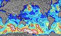 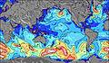 | 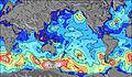 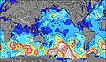 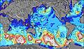 | 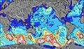 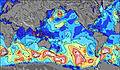 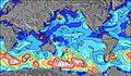 | 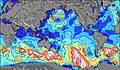 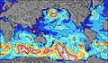 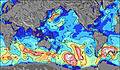 | ||||||||||||||||||||||||||||||||||||||||||||||||||||
| Wave Height (m) & direction (?) | ||||||||||||||||||||||||||||||||||||||||||||||||||||||||||||
| Period(s) (?) | 16 | 16 | 16 | 15 | 15 | 14 | 14 | 14 | 15 | 15 | 17 | 16 | 16 | 16 | 16 | 15 | 15 | 19 | 18 | 18 | 18 | 17 | 17 | 16 | 16 | 16 | 16 | 16 | 16 | 16 | 17 | 17 | 16 | 16 | 17 | 17 | 17 | 17 | 17 | 17 | 16 | 16 | 16 | 16 | 16 | 15 | 15 | 15 | 14 | 14 | 14 | 14 | 14 | 14 | 14 | 13 | 13 | 14 | 14 | 13 |
Wave (?)Graph | ||||||||||||||||||||||||||||||||||||||||||||||||||||||||||||
| Energy (?) | 2761 | 2545 | 2383 | 1987 | 1672 | 1220 | 1094 | 1196 | 1421 | 1581 | 1586 | 1571 | 1664 | 1643 | 1602 | 1262 | 1246 | 1402 | 1490 | 3594 | 3771 | 4144 | 3909 | 3592 | 3504 | 3740 | 3693 | 3647 | 3837 | 4152 | 5807 | 6486 | 6930 | 7372 | 8314 | 8104 | 8026 | 7159 | 7807 | 6592 | 7403 | 6786 | 6618 | 6211 | 5450 | 4511 | 3973 | 3645 | 3273 | 3127 | 2907 | 2483 | 2160 | 1840 | 1787 | 947 | 846 | 769 | 715 | 836 |
Wind (km/h) | ||||||||||||||||||||||||||||||||||||||||||||||||||||||||||||
| Wind State (?) onshore cross-onshore cross-shore cross-offshore offshore glassy | off | off | off | off | off | off | off | cross- off | glass | glass | glass | glass | cross- on | glass | glass | glass | glass | on | on | on | on | cross- on | cross- on | on | on | on | on | on | on | cross- on | cross- on | cross- off | cross- off | cross- off | cross- off | cross- off | cross- off | cross- off | off | off | off | off | off | off | off | off | cross- off | cross- off | cross- off | cross- off | cross- off | cross- off | cross- off | cross- off | cross- off | cross- off | cross- off | cross- off | cross- off | cross- off |
High Tide / height (m) | 10:18AM 0.60 | 11:06PM 0.49 | 11:22AM 0.63 | 12:06AM 0.55 | 12:22PM 0.67 | 12:59AM 0.62 | 1:17PM 0.73 | 1:48AM 0.71 | 2:08PM 0.78 | 2:36AM 0.79 | 2:58PM 0.81 | 3:23AM 0.85 | 3:47PM 0.83 | 4:10AM 0.90 | ||||||||||||||||||||||||||||||||||||||||||||||
Low Tide / height (m) | 3:46AM 0.45 | 4:56PM 0.35 | 4:58AM 0.41 | 5:52PM 0.31 | 6:00AM 0.35 | 6:42PM 0.25 | 6:55AM 0.28 | 7:28PM 0.20 | 7:46AM 0.20 | 8:12PM 0.14 | 8:35AM 0.12 | 8:57PM 0.10 | 9:24AM 0.07 | 9:42PM 0.08 | 10:14AM 0.05 | |||||||||||||||||||||||||||||||||||||||||||||
Saturday 19 | Sunday 20 | Monday 21 | Tuesday 22 | Wednesday 23 | Thursday 24 | Friday 25 | Saturday 26 | |||||||||||||||||||||||||||||||||||||||||||||||||||||
| Sunrise | - | - | 7:35 | - | - | - | - | - | - | - | 7:37 | - | - | - | - | - | - | - | 7:37 | - | - | - | - | - | - | - | 7:37 | - | - | - | - | - | - | - | 7:37 | - | - | - | - | - | - | - | 7:39 | - | - | - | - | - | - | - | 7:39 | - | - | - | - | - | - | - | 7:39 | - |
| Sunset | - | - | - | - | - | 6:55 | - | - | - | - | - | - | - | 6:54 | - | - | - | - | - | - | - | 6:53 | - | - | - | - | - | - | - | 6:52 | - | - | - | - | - | - | - | 6:52 | - | - | - | - | - | - | - | 6:52 | - | - | - | - | - | - | - | 6:51 | - | - | - | - | - | - |
Rain (mm) | - | - | - | - | - | - | - | - | - | - | - | - | - | - | - | - | - | - | - | - | - | - | - | - | - | - | - | - | - | - | - | 1 | 1 | - | - | - | - | - | - | - | - | 1 | 1 | - | - | - | - | - | - | - | 1 | - | - | - | - | - | - | - | - | - |
| Temp. °C | 21 | 21 | 21 | 21 | 21 | 21 | 21 | 21 | 21 | 21 | 21 | 21 | 22 | 22 | 22 | 22 | 22 | 21 | 21 | 22 | 22 | 22 | 22 | 22 | 22 | 22 | 22 | 22 | 22 | 23 | 23 | 23 | 22 | 22 | 22 | 22 | 22 | 21 | 22 | 22 | 22 | 21 | 21 | 21 | 21 | 22 | 22 | 22 | 22 | 22 | 22 | 23 | 22 | 22 | 22 | 22 | 23 | 22 | 22 | 23 |
| Feels °C (?) | 20 | 20 | 20 | 20 | 21 | 21 | 21 | 22 | 22 | 22 | 22 | 21 | 22 | 23 | 23 | 23 | 23 | 21 | 21 | 22 | 22 | 22 | 23 | 23 | 22 | 22 | 22 | 21 | 22 | 23 | 24 | 24 | 21 | 21 | 19 | 19 | 18 | 16 | 18 | 18 | 18 | 16 | 14 | 14 | 14 | 15 | 15 | 16 | 17 | 17 | 16 | 17 | 17 | 18 | 17 | 17 | 19 | 18 | 18 | 18 |
- Map Icons:
 Break
Break Live Wave Height (m)
 Live Wind Speed (km/h)
 Surf Rating (10 Max)
 Ocean Swells (m)
- Wind Speed (km/h)
FREE! Surf-Forecast.com widget for your website
The surf report / weather widget below is available to embed on third party websites free of charge and provides a summary of our Toroko surf forecast. Simply grab the html code snippet that we provide and paste it into your own site. You can choose your preferred language and metric/imperial units for the surf forecast feed to suit users of your site. Click here to get the code.


 Nearest